【Deep Dive Chronicle】Central Buttress of Ichinokura-sawa: A Day After the Exam, Onto the Wall
北村 智明
稜線ディープダイブ

In July, we headed to the Chinne Left Ridge of Mt. Tsurugi-dake. Our three-day expedition ascended Ikenotan Glacier to challenge the rock spires of the northern ridgeline—an experience filled with overwhelming scale and the solid feel of granite. After years of planning thwarted by weather and snow conditions, the time had finally come to climb this route. An alpine climbing chronicle of summer on Tsurugi.
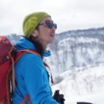
We departed Miyagi the night before. Our three-person team—T, Y, and myself—drove westward through the darkness. Our destination: the Chinne Left Ridge of Mt. Tsurugi-dake, a serious alpine route that has been a climbing objective since the 1930s. The northern ridgeline’s rock spires offer 13 pitches of climbing with an overall grade of 4 (based on Japanese Alpine Club standard) and crux sections at Grade V. For years, we had planned this climb only to be turned back by rain or poor snow conditions. Hoping this year would be different, I closed my eyes in the passenger seat.
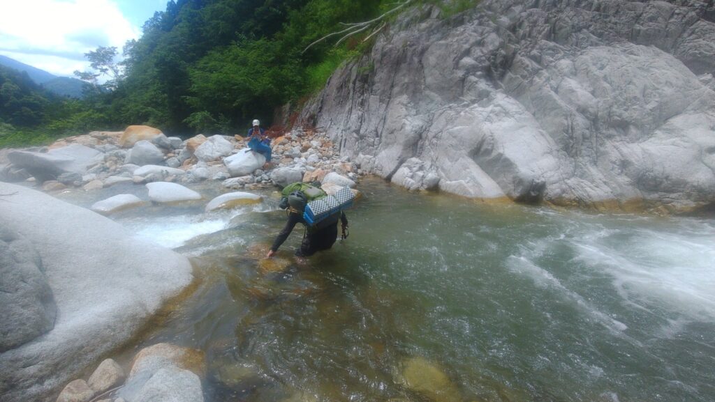
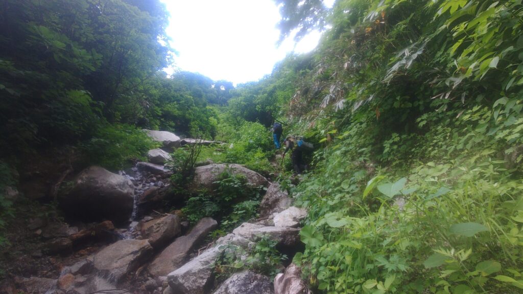
By the time we reached the trailhead the next morning, the heat was already oppressive. Shouldering our tent camping gear, we began walking just after 3 AM. We followed the forest road and eventually climbed over a debris control dam. The ascent with heavy packs was more draining than I had imagined. Sweat dripped steadily. By the time we reached the Shirahagi River crossing, over six hours had passed. The cold water, reaching above our knees, felt refreshing against our overheated bodies.
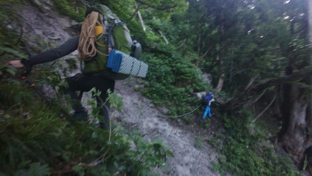
After the ford, we continued gaining elevation. Past Kaminari-iwa, the trail to Ikenotan junction became monotonous, with relentless sunshine beating down. No matter how much water we drank, the thirst wouldn’t subside. When the Ikenotan snowfield finally came into view, a breath of relief escaped.
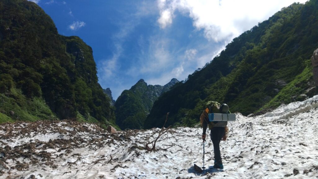
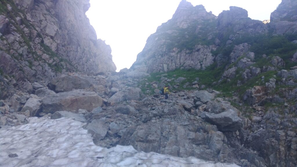
Stepping onto the snowfield, the air transformed. Cool air brushed against our cheeks. But the relief was short-lived. The snowfield’s gradient was considerable, and ascending with heavy gear was more exhausting than anticipated.
Ikenotan was academically recognized as a glacier in 2018—one of the few remaining glaciers in Japan. We climbed that white slope in silence.
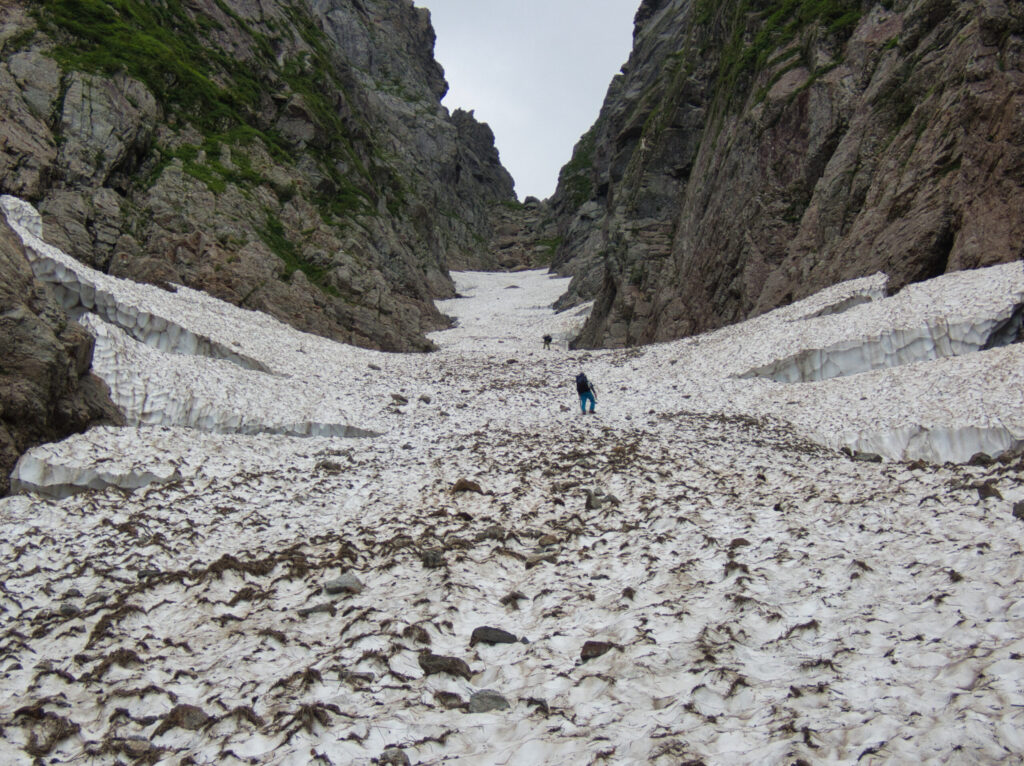
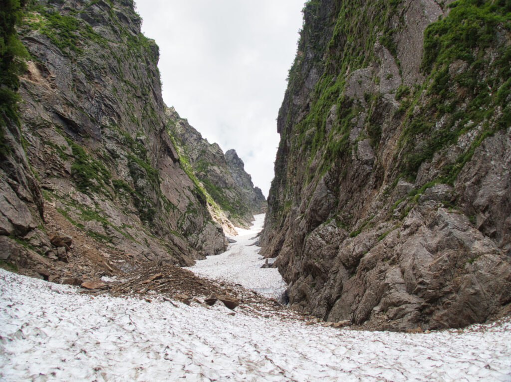
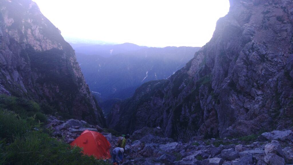
Eventually we reached a confluence and continued further to establish base camp beneath Ko-mado-no-O at approximately 2,600 meters elevation. It was already past 5 PM. A Toyama Prefectural Police training team had also pitched their tents nearby. Tomorrow, we would finally attempt Chinne.
On day two, we left base camp just after 5 AM. We headed up Ikenotan toward the approach to Chinne. The sky was brilliantly clear, the wind calm. We couldn’t have asked for better conditions.
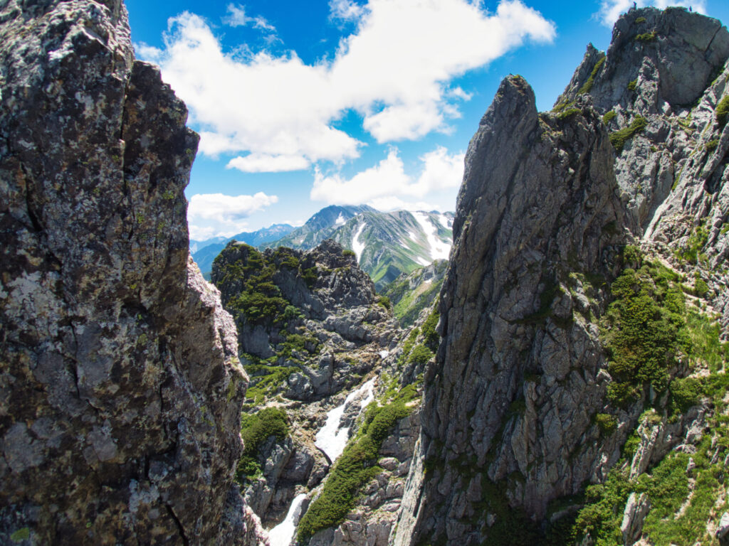
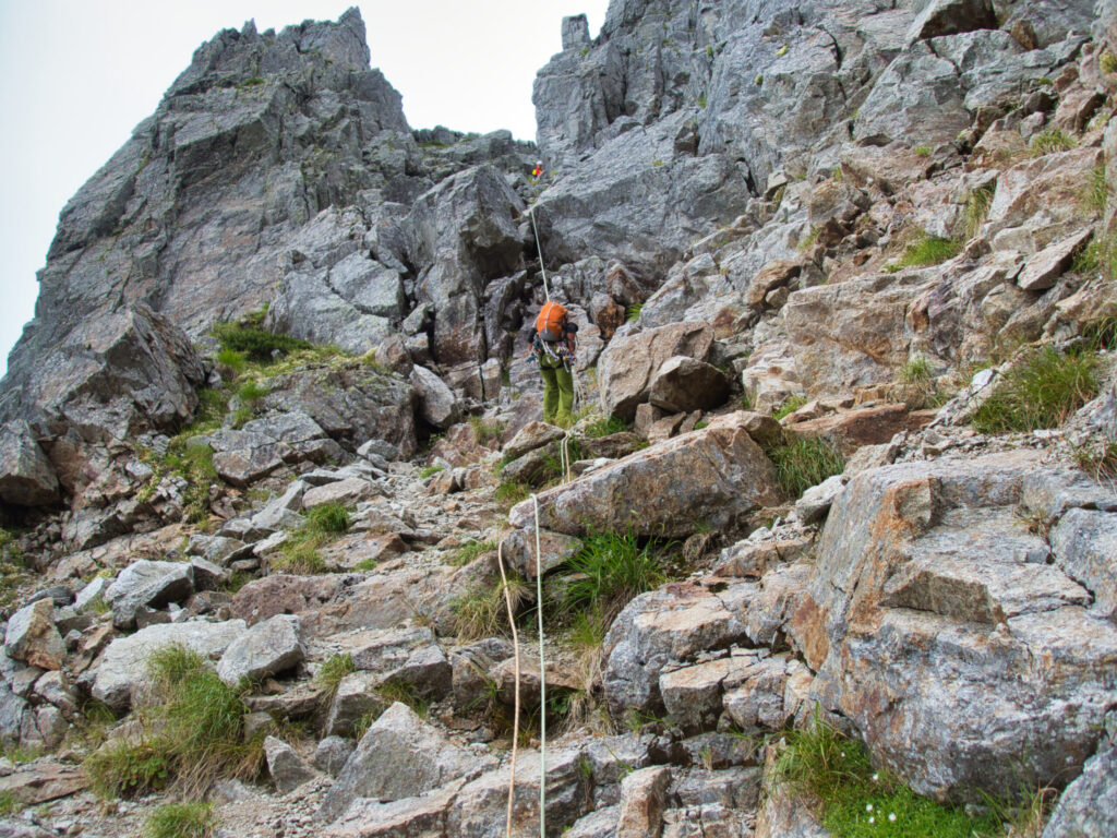
Reaching the base, we donned our harnesses. Tsurugi’s granite is solid, with reliable holds. As I began the first pitch, I felt reassured by that firm contact. We gained elevation, mixing in sections of ridge climbing. An overwhelming sense of scale spread below us. We could see considerable numbers of climbers on the Yatsumine walls. The entire Tsurugi area was welcoming many mountaineers today.
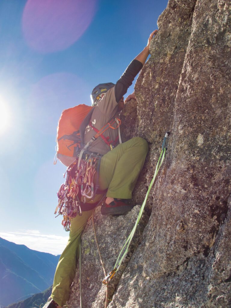
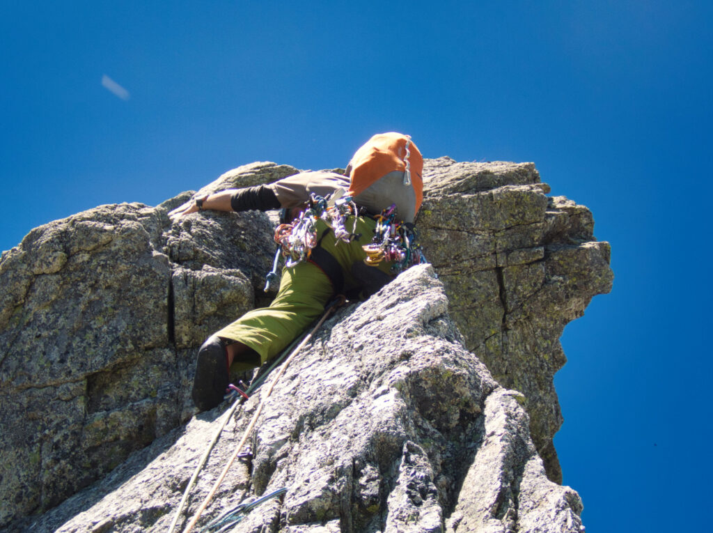
We approached the crux section known as “the nose.” Based on advance information, I had expected the nose itself to be the difficult part, but in reality, the face above the nose proved to be the crux. I carefully worked out the movements and placed protection reliably. Tension coursed through me, but not anxiety. Trusting my partners’ belay, I pulled myself up the rock face.
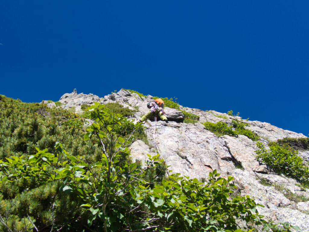
Beyond the nose, we returned to climbing that was mostly around Grade III. Overall, outside the crux sections, the difficulty wasn’t particularly high. Despite the 13-pitch designation, our climbing time was less than expected. We actually broke it into about 15 pitches due to intermediate stances, but even so, it was faster than anticipated.
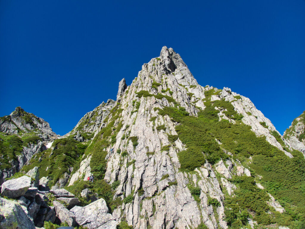
Rather, the true appeal of this ridgeline lies in its overwhelming location. We had clear views extending to Yari-ga-take and the Hotaka Range. Blue sky, white rock ridges, and peaks stretching into the distance. I came to understand firsthand why Tsurugi is called the “Palace of Rock and Snow.”
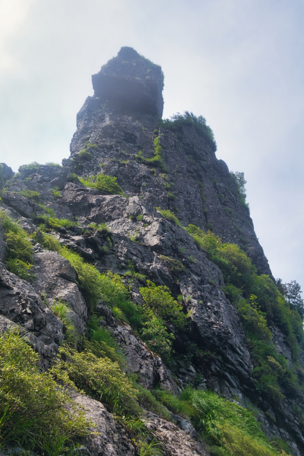
Cleopatra’s Needle loomed before us. That spire towered as if piercing the heavens. Beautiful, I thought sincerely. From the Toyama Prefectural Police Mountain Rescue team ahead of us, the command “○○ clear! Go!” carried on the wind to a team member. A warm feeling of mountain solidarity spread through my chest.
We completed all pitches and returned to base via Ikenotan Pass. The descent route through Ikenotan Gully was a continuous scree field with unstable footing. I felt more fear on the way down than during the ascent. Carefully, confirming each step, we made our way back to base camp.
Day three was descent day. We descended the Ikenotan snowfield, forded the Shirahagi River again, and walked the long forest road—retracing our approach route in reverse.
However, the descent proved unexpectedly harsh. The merciless heat attacked again. No matter how much water we drank, our condition didn’t improve. Even while sensing signs of dehydration, we couldn’t stop moving. T encouraged us: “Just a bit more.” Y pressed forward silently. I gritted my teeth and continued.
When we reached the forest road, my entire body was wrapped in fatigue. Yet strangely, my heart felt light. We had finally climbed the long-desired Chinne Left Ridge via the Ikenotani approach. Years of waiting had culminated in this achievement.
Returning to the parking area, we set down our gear. The sky remained blue, and Tsurugi’s rock spires were visible in the distance. We had walked that ridgeline—truly walked it.
The feel of Tsurugi’s granite, the beauty of Cleopatra’s Needle, the panorama of Yari and Hotaka, and the solid camaraderie with my partners—all were etched into memory during those three days.
LOG SUMMARY