【Deep Dive Chronicle】Kakkonda River Kitanomata-zawa: A Circuit Through the Celebrated Gorges of Hachimantai
北村 智明
稜線ディープダイブ
To the Shirane Sanzan (three peaks of Shirane) in the Southern Japan Alps. Over two days, I traced the ridge from Mt. Kitadake through Mt. Ainodake to Mt. Notoridake, my body exhausted from overnight travel. The traverse was filled with the colors of alpine flora and the beauty of white rock walls. This is a chronicle of midsummer ridge walking, written as a solo climber traversing the heart of the Southern Alps.
目次
I arrived at Hirogawara just after 6:00 AM. I’d gotten almost no sleep from the previous night’s travel. The bus’s swaying motion still lingered in my body, and a dull ache had already settled deep in my head.
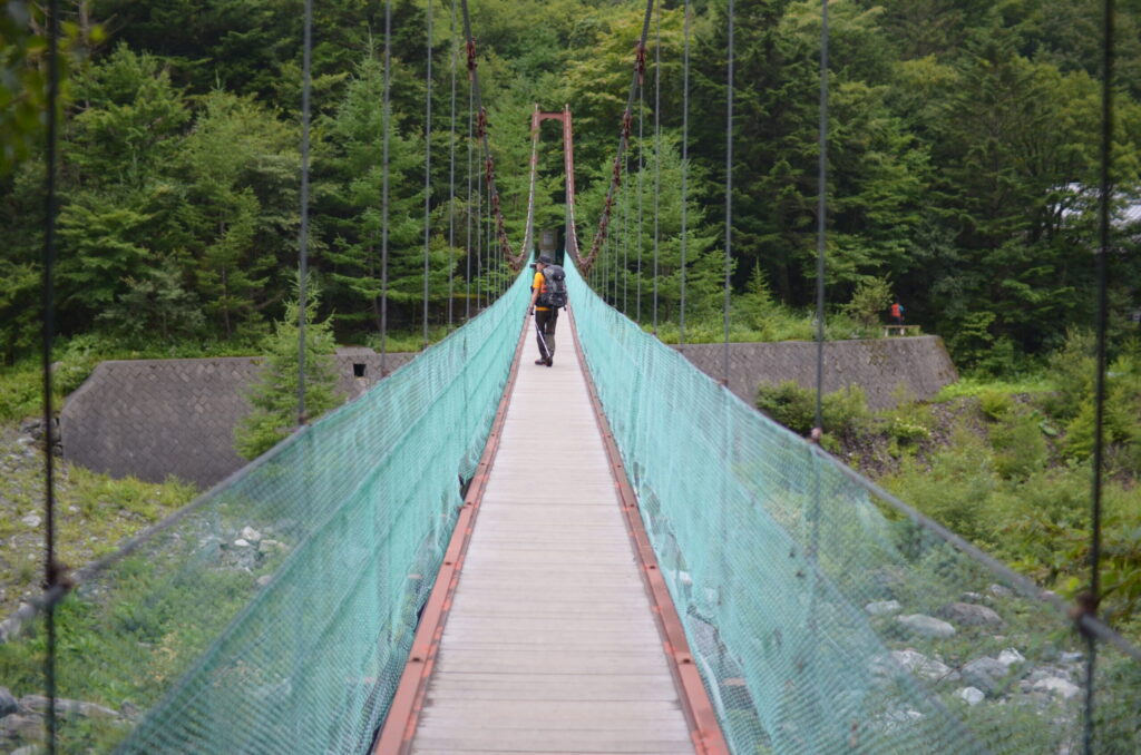
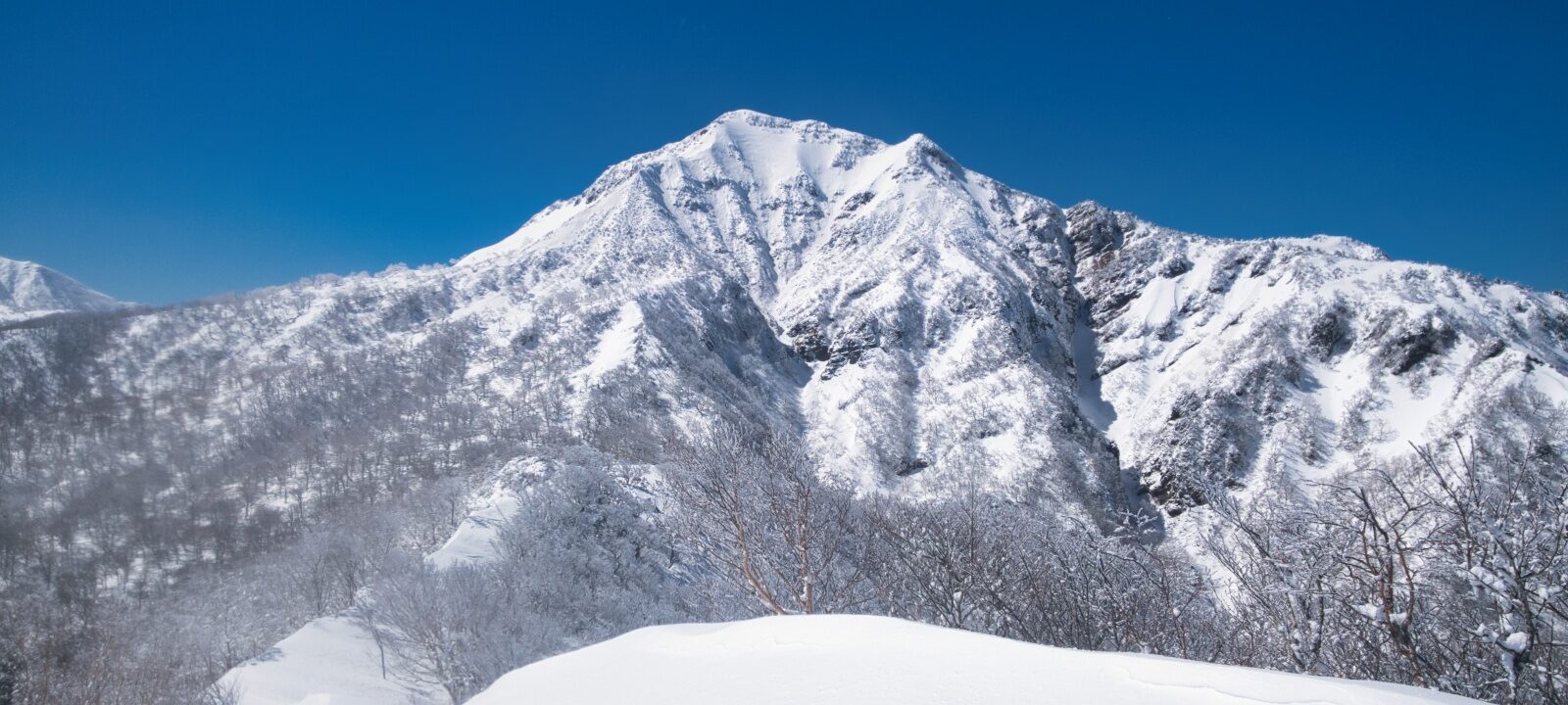
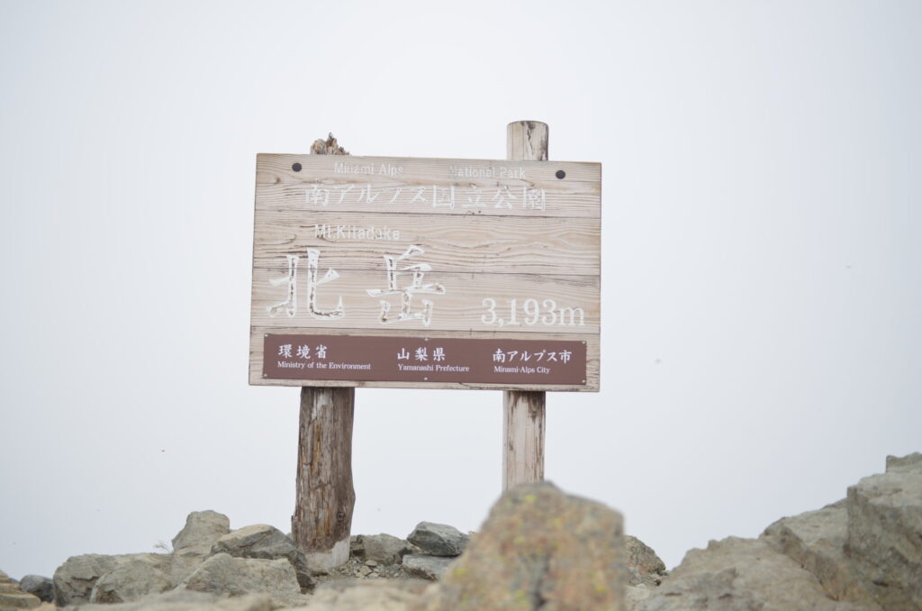
I crossed the suspension bridge and passed the Shiranemiike junction. The trail through the forest was cool, with dappled sunlight illuminating the path beneath my feet. The route toward Kitadake—at 3,193 meters, Japan’s second-highest peak after Mt. Fuji and the sovereign of the Southern Alps selected by Kyuya Fukada for his One Hundred Famous Mountains—stretched along the Okanbasawa valley.
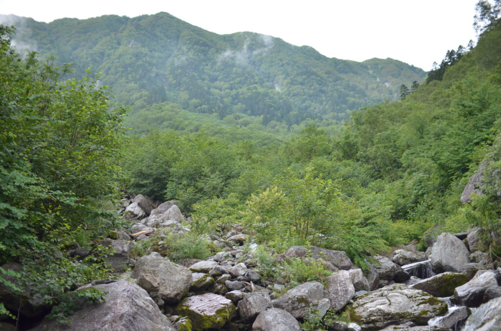
The sound of the stream grew closer. I reached the Okanbasawa confluence just before 9:00 AM and took a twenty-minute rest. I drank water and ate trail snacks, but the headache wouldn’t fade. Rather, as I gained elevation, the pain seemed to intensify.
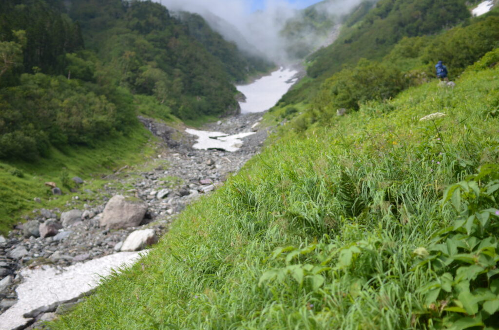
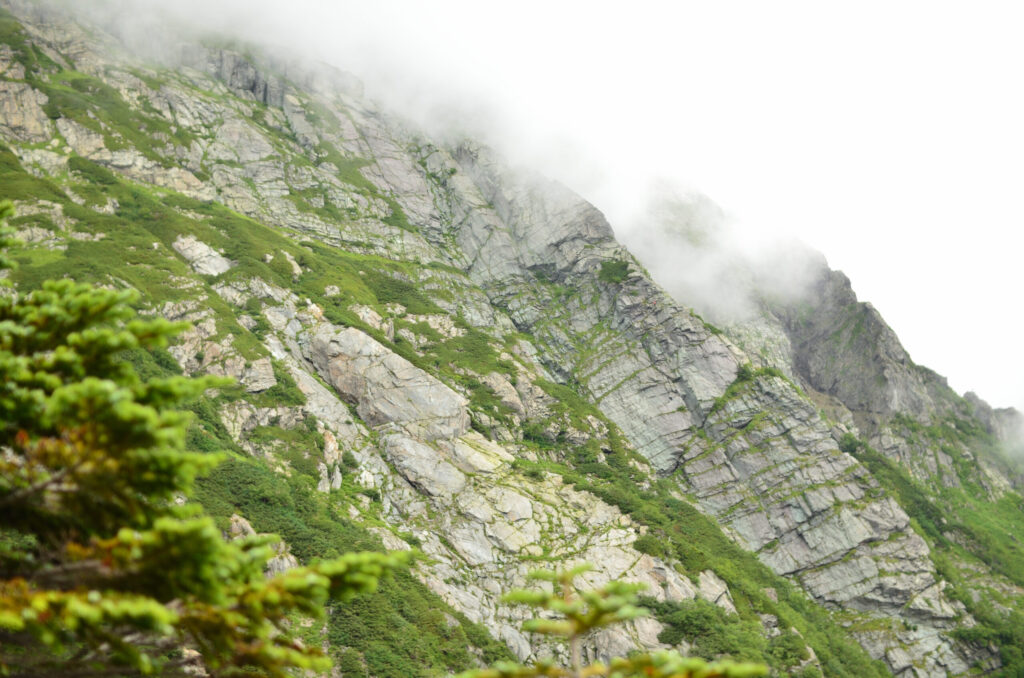
From the confluence to the col of Happon-ba, the trail climbs steeply alongside the snow field. I stopped repeatedly to catch my breath, then climbed again. Looking back, the white rock wall of the Buttress loomed before my eyes. The vertical granite face gleamed smooth as white porcelain under the summer sun. On its four ridges, I could see small human figures—climbers tackling that wall. From far above the rock face, the powerful cry of a Spotted Nutcracker echoed down into the valley.
I reached the col of Happon-ba around noon. I rested there for over twenty minutes, but the headache showed no signs of abating.
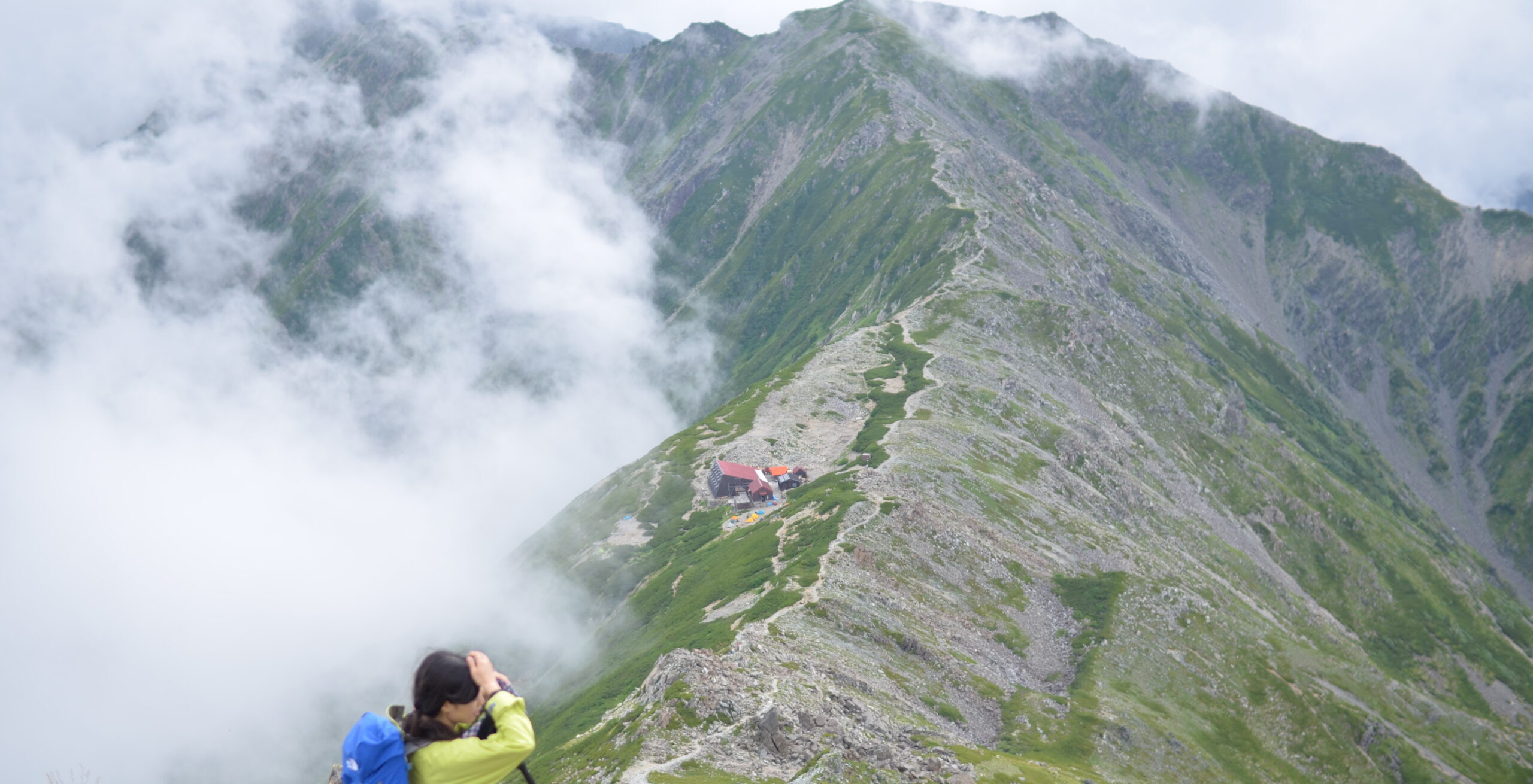
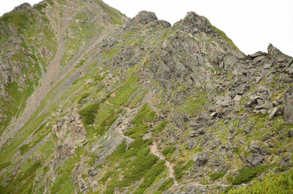
I followed the path toward the hanging ridge. After passing the junction with the traverse route, I emerged onto the ridge line. The wind felt pleasant. But the pain in my head was approaching its limit.
I reached the summit of Kitadake just after 1:30 PM. However, the peak was shrouded in clouds. The views I’d hoped for were denied. After lingering for about eight minutes, I immediately headed toward Kitadake Sanso.
I arrived at Kitadake Sanso just before 3:00 PM. I set up my tent and immediately lay down. The fatigue brought on by overnight travel and high altitude pressed heavily on my entire body, and consciousness seemed to drift away. When I awoke from about an hour of deep sleep, the headache had somewhat subsided. It felt as though the heavy lead that had accumulated in my body had begun, if only slightly, to dissolve.
In the evening, I emerged from the tent. The western sun was dyeing the ridge line.
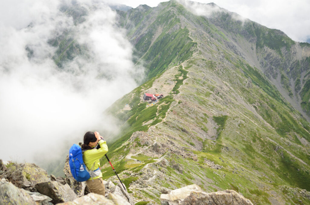
The next morning dawned clear. I broke camp just after 5:00 AM and headed toward Ainodake. The ridge trail was easy to walk, and I reached Ainodake via Naka-shironessan just before 7:30 AM. Here too I didn’t linger long, pushing forward toward Notori Hut.
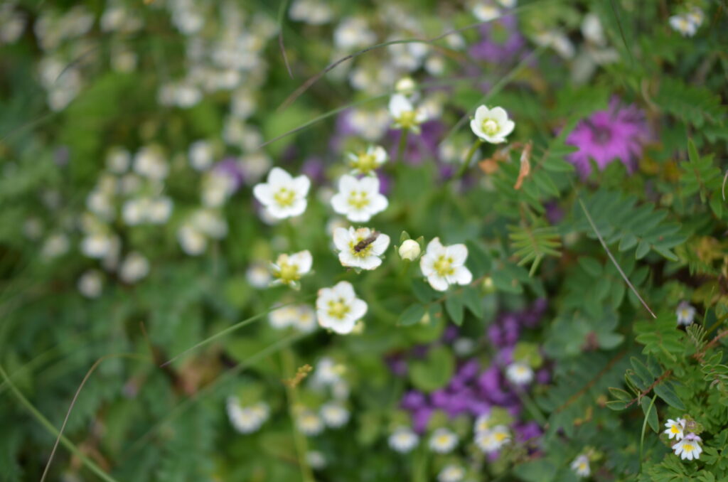
The comfort of walking the ridge line, combined with the sense of liberation from the previous day’s suffering, became something irreplaceable. Wind blew, and alpine plants added their colors. Takane-biranji (Southern Alps catchfly), endemic to the Southern Alps, spread its pale pink petals, while Iwatsumekusa (alpine stitchwort) filled the rocky areas. The yellow of Miyama-kinpouge (alpine buttercup), the blue-purple of Miyama-torikabuto (alpine monkshood)—they wove a brocade across the summer ridge line, quietly comforting my exhausted self. I passed through Nishi-notoridake and reached Notoridake just before 10:00 AM. From here, the descent to Daimonzawa would begin.
From the Daimonzawa descent point onward, the slope was steeper than expected. Entering the forest, the sunlight was blocked. But the trail was treacherous, and fatigue rapidly accumulated throughout my body. After hours of continuous movement, my entire body felt as though it carried heavy lead.
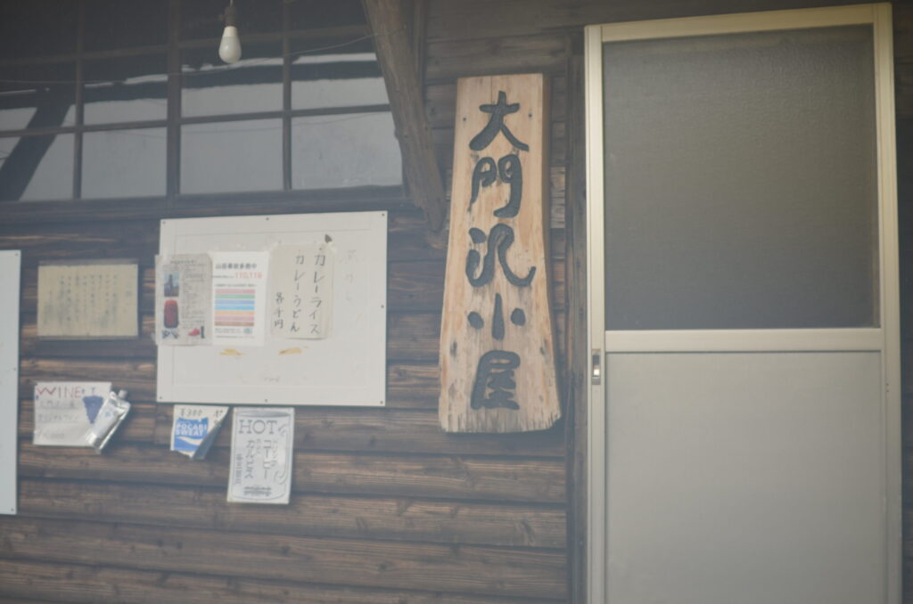
I arrived at Daimonzawa Hut just before 1:00 PM and took a thirty-minute break. I replenished my water and prepared for the remaining descent. But the fatigue that had reached its limit over two days of traverse was now impossible to hide.
I descended along the stream. I passed the Daikomorizawa confluence, the power plant intake, and Moriyama Bridge—markers appearing one after another. Just a little more to Narada. Telling myself this, I walked on in silence.
I arrived at the Narada bus stop near 3:30 PM. Having finished the two-day traverse, I finally felt relief.
Looking back, I could see the ridge line of Shirane Sanzan in the distance. Despite suffering from a headache brought on by overnight travel, I felt a quiet sense of fulfillment at having walked that entire ridge. The characteristic harshness and beauty of the Southern Alps—I had thoroughly enjoyed two days of midsummer traverse.
[LOG SUMMARY]