【Deep Dive Chronicle】Mt. Tsurugi-dake Chinne Left Ridge: Climbing the Northern Ridgeline via Ikenotan Glacie
北村 智明
稜線ディープダイブ
Golden Week in Hakkōda. Our ski mountaineering journey to the southeast face of Mt. Takadaodake (elevation 1,559m) became a day where fresh beech green, lingering snow, blizzards, and steep slopes intersected. This is the chronicle of our spring ascent with a party of seven, undertaken as a prelude to the following day’s ski tour in the Southern Hakkōda range.
目次
We departed Miyagi before dawn, heading north on the Tōhoku Expressway toward Aomori. Three years had passed since the Reiwa era began, and the world remained under the shadow of the COVID-19 pandemic. While people’s movements were restricted, we headed for the mountains.
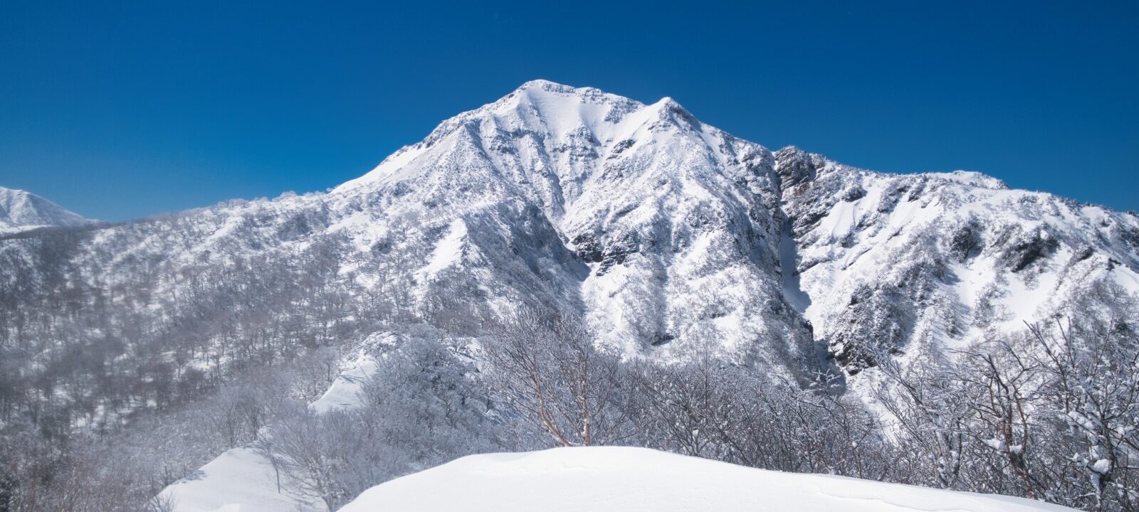
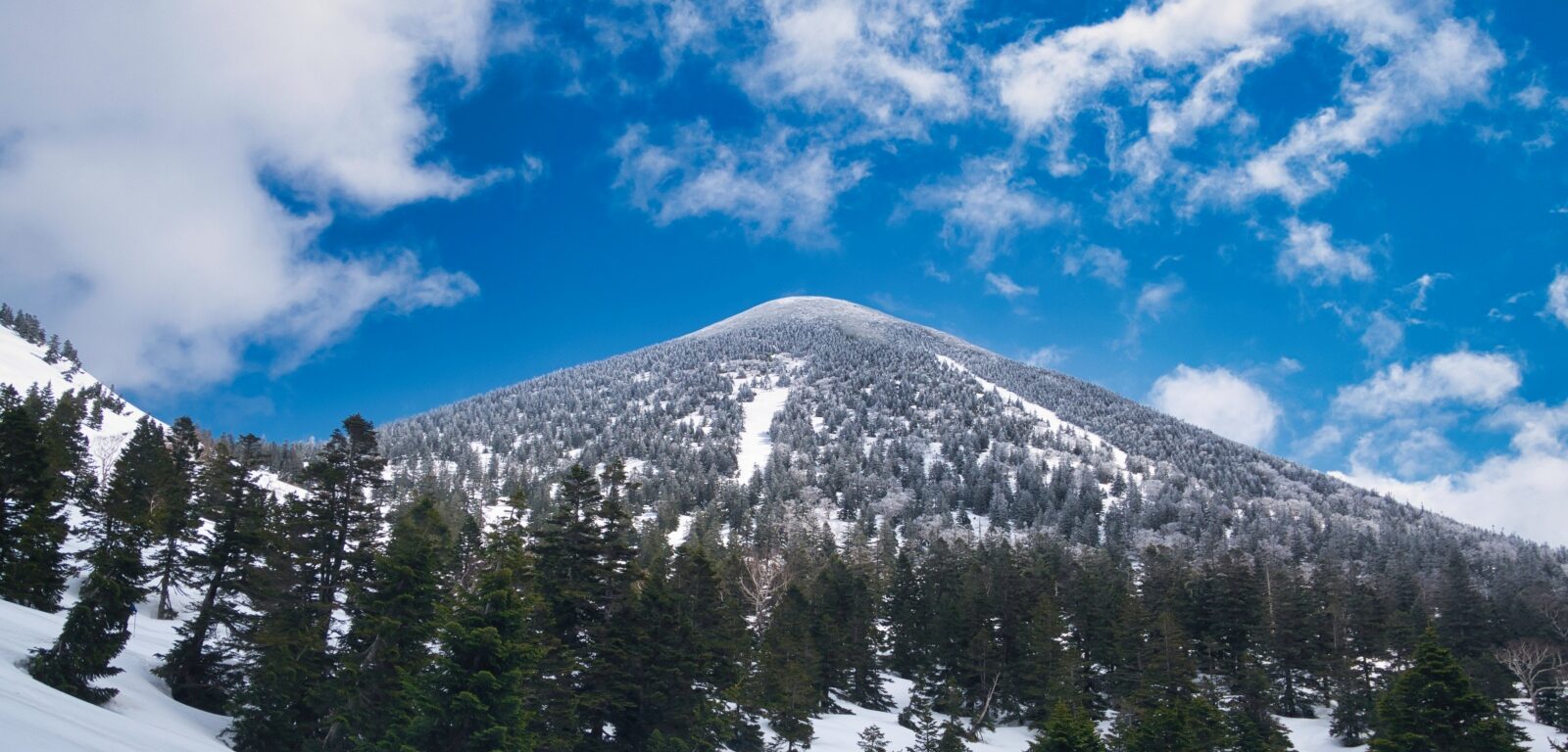
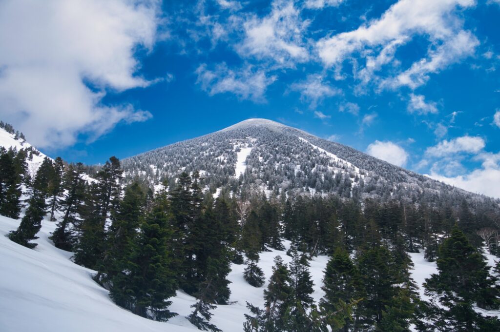
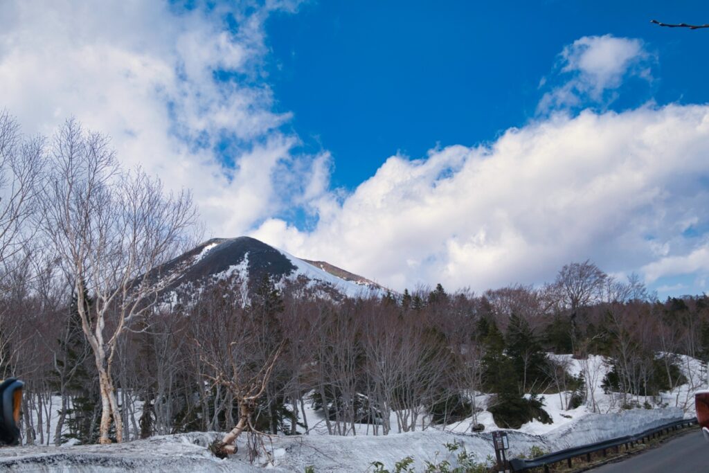
Our destination was Mt. Takadaodake. One of the peaks comprising the Hakkōda mountain system, it stands at 1,559 meters elevation. Listed among the 100 Famous Mountains of Tōhoku, this mountain possesses an imposing conical form and is known as a spring ski descent course. Among the Northern Hakkōda peaks, it offers a quieter mountain experience.
We parked along the roadside near Suiren Marsh. Roughly ten vehicles were already lined up, revealing the popularity of Hakkōda during this season. While guidebooks from decades ago describe routes from Kasamatsu Pass, this was the only place where parking was possible. Little did we know at this moment that this would later result in a warning.

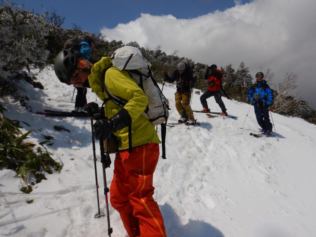
At 8:30 AM, we started. Aiming for the col connecting Mt. Takadaodake and Mt. Kodake, we proceeded across the remaining snow. Skis with climbing skins attached gripped the still-firm snow surface. Our party of seven formed a long line, each member ascending at their own pace.
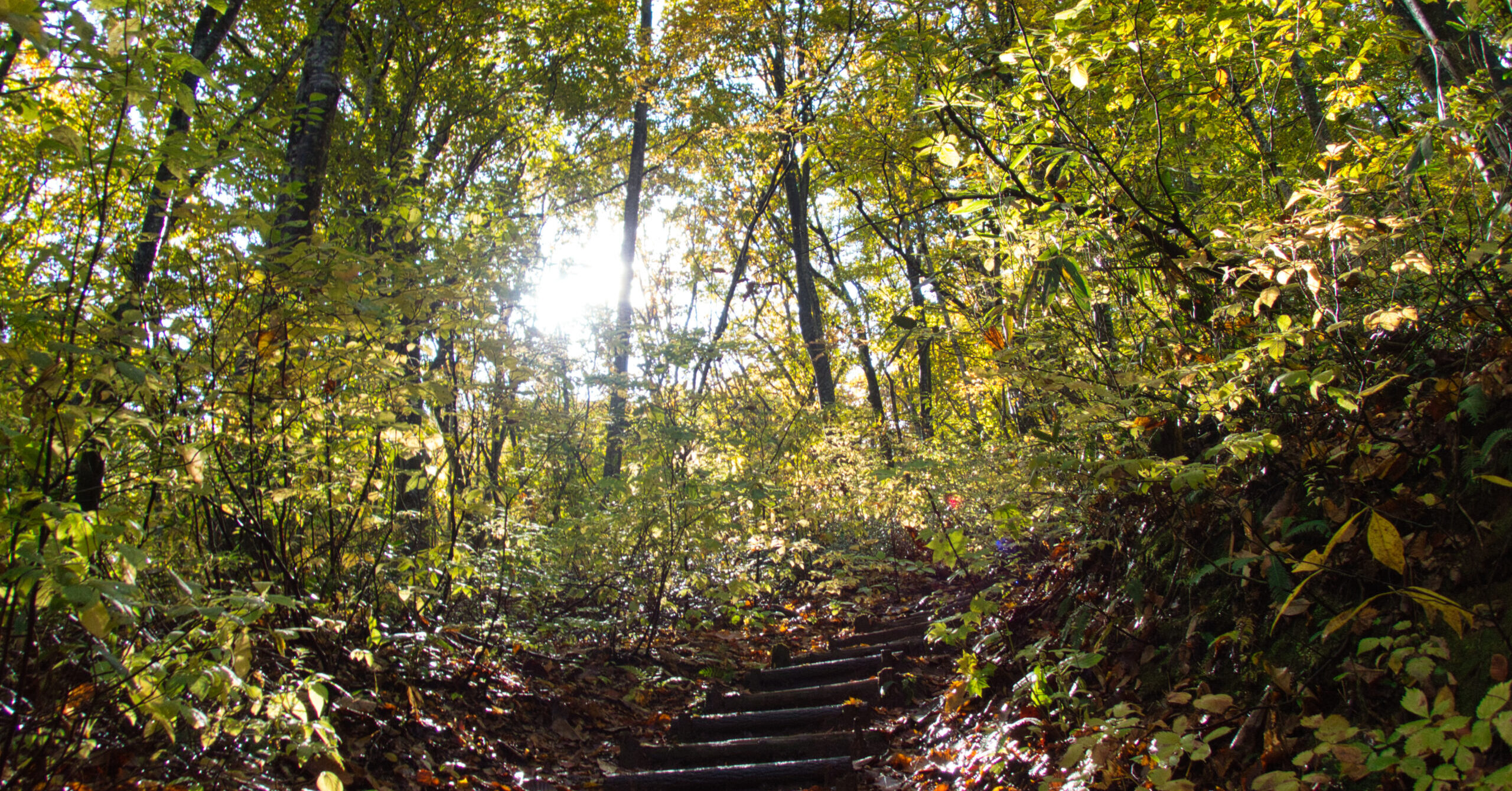
Beyond Suiren Marsh, a beech forest spread before us. Too early for fresh green foliage, snow clung to the branches. The white trunks created a tranquil world like an ink wash painting. Trees buried in snow cover poked their heads above the surface here and there. Sunlight filtered through gaps in the branches, casting complex shadows on the snow.
This stillness was comforting. Only the sound of skis compressing snow echoed through the forest. Conversation among companions was sparse—we simply progressed silently. Each person maintained their own pace, engaged with their own breathing.
As we gained elevation, the snow quality transformed. The snow surface, firm from morning cold, gradually softened. While our footing remained stable, we advanced cautiously, confirming the grip of our skins. Emerging from the tree line, our view opened. The form of Mt. Takadaodake loomed directly ahead.
Just after 11:00 AM, we reached the col. At that moment, the wind changed.
The blizzard began near the col. Though the sky remained clear, wind whipped up the snow. Ground blizzard. Snow clouds like torn white cloth raced along the ridgeline. Temperature dropped sharply, chilling us to the core. I regretted not bringing a balaclava. The cold seemed to freeze my face.
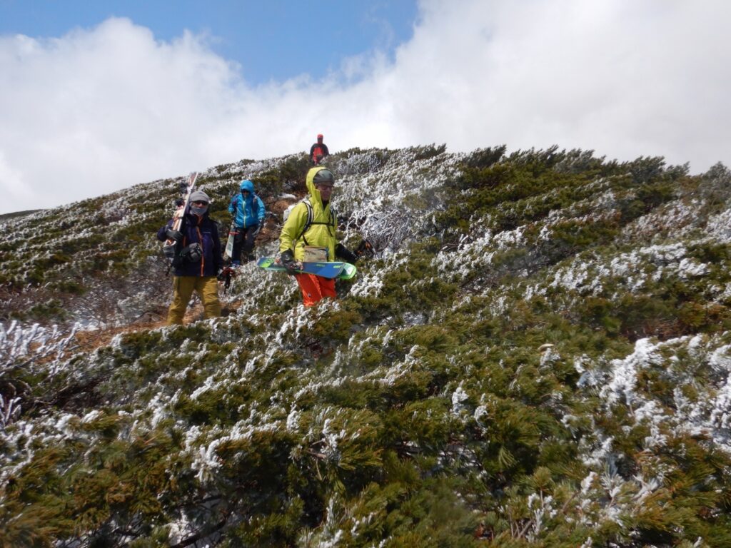
The snow surface had turned to ice. Low shrubs protruded from the snow, blocking our path. With skins still attached, brush entangled the skis, preventing progress. We removed our skis and carried them by hand. One hand holding skis, the other a pole. Maintaining balance, we carefully advanced across the frozen brush and snow surface.
Impeded by cold and brush, we gradually gained elevation.
The section from the col to the summit had deeper brush than anticipated. Not haimatsu (dwarf pine), but dense low shrubs. Not fully buried by snow, they stubbornly extended their branches. Removing and shouldering our skis, we followed what seemed to be a summer trail. Bodies weighted with skis made balance difficult. Wind remained strong, the blizzard unrelenting.
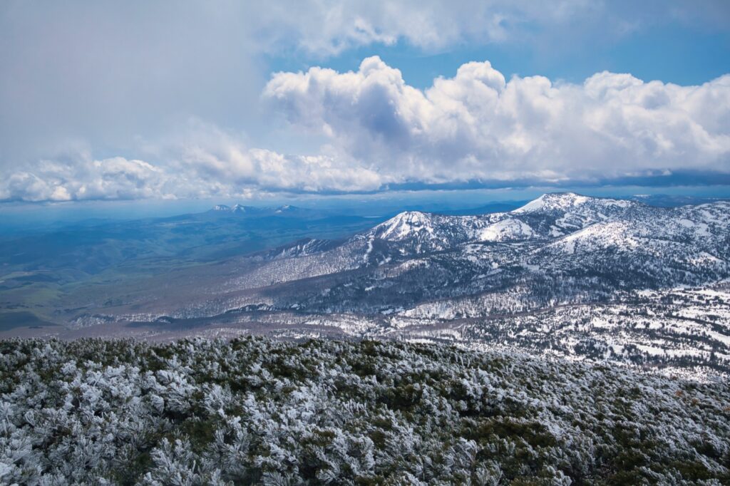
Still, visibility was not poor. Clear patches appeared, allowing views of surrounding mountains. The blue sea of Mutsu Bay gleamed in the distance. The graceful form of Mt. Kodake was also beautiful.

Just after noon, we stood on the summit of Mt. Takadaodake.
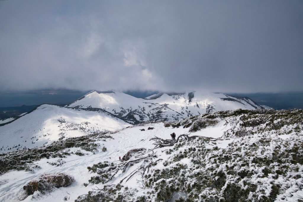
Though wind remained strong, weather conditions were stable. The mountains of Hakkōda stretched in succession, and the ridgeline of Southern Hakkōda—our target for the following day—was also visible. Visibility was good with 360-degree views spreading before us. However, we had no leisure to slowly enjoy the scenery. The cold was severe, and lingering was inadvisable.
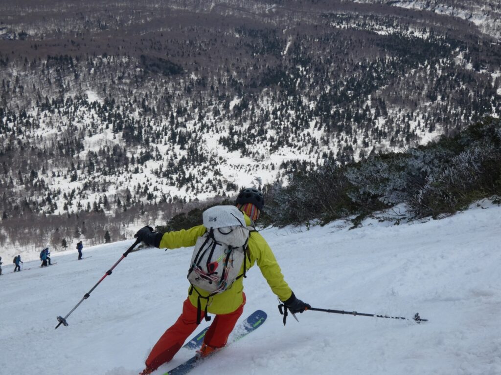
With only brief rest, we headed toward the southeast face.

Bushwhacking from the summit, we emerged at the entry to the great slope. What met our eyes was a steepness exceeding expectations. True to the topographic map with its densely packed contour lines, the slope exceeded an average of 35 degrees. The steepness was such that the bottom couldn’t be seen—I hesitated for a moment.
We removed our skins and mounted the skis. Retightening boot buckles, adjusting pole lengths. I checked the snow quality. The surface was slightly crusted, but edges should hold. Confirmed that snow wasn’t adhering to the running surface.
S led off. Carefully carving turns, he descended the slope. I followed, launching into my descent.
The slope was steep, but snow quality was not bad. With wind blowing upward like a wall, we were protected during the descent. With each turn, the skis carved the snow surface, white spray dancing in the air. My body naturally found rhythm. Elevation dropped rapidly.
That’s when it happened.
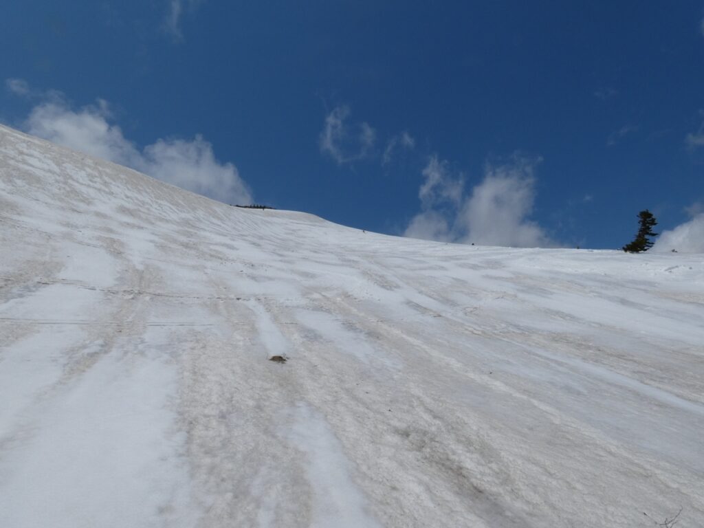
K fell ahead of us. The next instant, one of his skis released from the binding and began sliding down the slope.
“The ski!”
Before we could even shout, the ski accelerated. Straight down the steep slope at terrifying speed. We could only watch, dumbfounded. The ski descended several hundred meters down the slope before finally stopping. It appeared only as a small black dot.
Fortunately, there was no injury. K descended carefully with repeated sideslips on the remaining ski. Balance on one foot was difficult and time-consuming. We followed behind, supporting K as we descended.
The descent itself was comfortable. Though steep, the snow quality was good and turns connected smoothly. Elevation dropped rapidly. The slope, sheltered by wind, was quiet and calm.
We recovered the ski and descended together toward the Karesawa area.
Just after 3:00 PM, we arrived at the campground.
While setting up tents, we reflected on today’s climb. Blizzard, brush, and steep slopes. Though troubled by the ski loss, we descended without major injury. K’s ski binding would require adjustment. Perhaps the release value had been set too low.
In the evening, S decided to tempura the taranome (angelica tree shoots) he’d brought. Spring mountain vegetables. We assembled the stove and poured oil into the cooker. The frying oil heated, and battered taranome were dropped in.
However, the wind was strong. The stove flame bent sideways, heat output unstable. Even with a windscreen erected, wind mercilessly blew in. Oil temperature didn’t rise sufficiently.
After waiting several minutes, the tempura was finally ready. However, what emerged was somewhat undercooked with soggy batter. Far from ideal tempura.
“Well, this is mountain tempura.”
Someone said this with a laugh. Though the texture was limp, it remained a spring delicacy. The characteristic slight bitterness of taranome spread through our mouths. We consumed it without complaint. Food eaten in the mountains is always delicious.
Finishing dinner, we confirmed tomorrow’s plan for Southern Hakkōda. We’d planned the Hōkibatai Route, but weather forecasts predicted strong wind again the following day. Ridge action would require even greater vigilance than today.
That night in the tent, I reflected on Mt. Takadaodake. The beech forest viewed from Suiren Marsh, the blizzard at the col, the struggle through brush, and the southeast face descent. Many elements packed into a short time. The ski loss was unexpected, but this too was mountain experience.
Burrowing into my sleeping bag, I closed my eyes. Outside, wind howled. The tent shook, occasional strong gusts pounding the fabric. Tomorrow would also be a battle with wind.
The following morning, wind raged outside the tent. Checking the forecast, even stronger winds were predicted along the ridgeline. We exercised caution and modified our plan. Scaling back from the original objective, we would aim only for Mt. Yokodake.
The following morning, wind roared outside the tent as forecast.
We organized our gear and headed for the next mountain.
Spring in Hakkōda exists with the wind.
[LOG SUMMARY]