【Deep Dive Essays】Essential Gear for Hiking in Japan: Equipment Recommendations and Where to Buy/Rent
北村 智明
稜線ディープダイブ
Planning Your First Hike in Japan? This guide focuses on mountain selection and each peak’s unique appeal. For comprehensive preparation including transportation details, essential gear, cultural etiquette, and safety information, please read our [Complete Guide to Hiking in Japan for International Visitors] first. New to Japan’s mountains? That foundational guide will help you prepare properly for a successful and safe hiking experience.
目次
Best Hiking Season: April to November (avoid rainy season: mid-June to mid-July)
Estimated Day Trip Cost: ¥4,000-9,000 ($28-63 USD) per person including transportation, cable cars, lunch, and hot springs
Essential Gear: Hiking boots, 1-2L water, rain jacket, hat, sunscreen, basic first aid kit, mobile phone, cash
Emergency Contact: 110 (Police) / 119 (Fire/Ambulance) – English support available in major tourist areas
Getting There: All mountains accessible by public transportation from Tokyo (1-3 hours). Detailed access information provided for each mountain below.
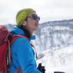
“I want to start hiking, but which mountain should I choose?” To answer this question, simply recommending “easy mountains” is insufficient. What beginners truly seek are mountains that offer not only safe climbs but also a sense of accomplishment and the full charm of mountain experiences. Based on my guiding experience, I present five carefully selected mountains accessible as day trips from Tokyo, covering their appeal, reasons for accessibility, and post-hike enjoyment.
Selecting mountains for beginners requires three essential perspectives.
First is safety: well-maintained trails, clear routes, and emergency evacuation options.
Second is a sense of accomplishment: not merely easy mountains, but those offering appropriate challenges where climbers can truly experience the joy of reaching the summit.
Third is comprehensive satisfaction: beyond the climb itself, added value such as history, culture, post-hike hot springs, and local cuisine nurtures beginners’ desire to “climb again.”
From these three perspectives, I have selected five mountains accessible as day trips from Tokyo. All are mountains I have guided numerous times, where beginners can reliably gain successful experiences.
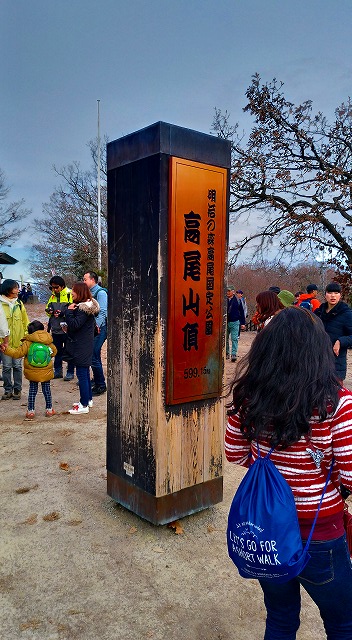
Mt. Takao, attracting 3 million visitors annually, is Japan’s most-climbed mountain. Yet its popularity stems not merely from accessibility.
Despite standing at only 599m, the summit offers panoramic views of Mt. Fuji, the Tanzawa Mountains, and the Okutama region. Its three-star Michelin rating validates this mountain’s international appeal.
Above all, its rich natural environment captivates visitors. With over 1,600 plant species, no other mountain offers such biodiversity just one hour from central Tokyo.
Mt. Takao also appears in the hiking anime Yama no Susume as the first mountain the protagonists climb in Episode 1, symbolizing its status as “the gateway to mountaineering.” Many young people who began hiking after watching the anime have made Mt. Takao a symbol of modern hiking culture.
Mt. Takao’s suitability for beginners lies in its diverse options.
A cable car (funicular railway) and chairlift operate from the base to mid-mountain (approximately 400m elevation), covering roughly half the ascent. Round-trip tickets cost about ¥1,000 (~$7 USD). If using the cable car, only 40-50 minutes of hiking remains to the summit.
Six hiking trails numbered 1 through 6 offer choices, with the most developed Route 1 being paved. For first-time hikers, Route 1 via cable car is recommended.
Elevation gain is approximately 400m from the trailhead, with about 90 minutes to the summit on foot. This distance and time are ideal for first-time hiking. Climbers can turn back if tired, reducing psychological pressure.
Multiple toilets, rest areas, and shops eliminate concerns about hydration and meals. Mobile phone coverage extends throughout the area.
Fitness Level Required: Suitable for complete beginners with basic fitness. Comparable to a 2-hour moderate walk with stairs.
Access from Tokyo:
Typical Day Trip Schedule:
Estimated Costs:
What to Bring: Water (1L sufficient due to many shops), light snacks, rain jacket, comfortable hiking shoes or sturdy sneakers acceptable for Route 1.
Mt. Takao’s history extends back 1,300 years. In 744 CE, during the Tempyo era, the monk Gyoki established the mountain under Emperor Shomu’s imperial order. Yakuo-in Temple on the mountain is one of the three major temples of the Shingon Buddhist Chizan sect, alongside Narita-san and Kawasaki Daishi.
The principal deity, Izuna Daigongen, is considered an incarnation of Fudo Myoo and is linked to Tengu (mountain goblin) worship. Numerous Tengu statues throughout the grounds convey the mountain’s history as a training ground for mountain ascetics (Shugendo practitioners).
During the Edo period, the mountain was revered as a spiritual protector of Edo Castle and received Tokugawa family patronage. Even after the Meiji-era separation of Buddhism and Shinto, it has maintained its traditions as an esoteric Buddhist temple.
At Takaosanguchi Station, the day-use hot spring “Keio Takaosan Onsen Gokurakuyu” opened in 2015, perfect for relieving post-climb fatigue. Entry fee: ¥1,000. Note: As with most Japanese hot springs (onsen), bathing is done nude in gender-separated facilities. Some establishments may restrict entry for visitors with tattoos—check policies in advance.
Around Takaosanguchi Station, local specialties include tororo soba (mountain yam noodles) and Tengu-yaki pastries. Vegetarian Buddhist cuisine (shojin ryori) can be experienced at Yakuo-in Temple.
If time permits after hiking, the free-admission Takao 599 Museum offers learning about Mt. Takao’s natural environment, enjoyable for all ages.
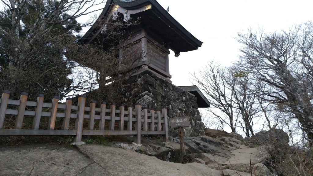
Known by the saying “Mt. Fuji in the west, Mt. Tsukuba in the east,” Mt. Tsukuba rises as an isolated peak on the Kanto Plain. Consisting of twin peaks—Nantai-san (871m) and Nyotai-san (877m)—its graceful form is affectionately called “Purple Peak.” It is also one of Kyuya Fukada’s 100 Famous Japanese Mountains.
The summit views are spectacular, overlooking the entire Kanto Plain with Mt. Fuji, the Nikko mountain range, and the Pacific Ocean visible on clear days. The evening and night views are particularly beautiful, with Mt. Tsukuba’s night scenery designated as part of Japan’s “Night View Heritage.”
The mountain has been beloved by cultural figures since ancient times, with 25 poems dedicated to it in the Man’yoshu poetry anthology.
Mt. Tsukuba features both cable car and ropeway (gondola) systems. A cable car operates to Nantai-san side and a ropeway to Nyotai-san side. Round-trip tickets cost about ¥1,100 ($8). Using either system leaves only 15-20 minutes of walking to reach each summit.
For hiking, the Miyukigahara Course (Nantai-san side) takes about 2 hours, while the Shirakumo-bashi Course (Nyotai-san side) takes about 2.5 hours. Both follow well-maintained trails with few hazardous sections.
The Shirakumo-bashi Course features distinctive rock formations like “Benkei Nanamodori” and “Takamagahara,” keeping the climb engaging. The Miyukigahara Course is relatively gentle, allowing beginners to reach the summit without difficulty.
At the Miyukigahara summit area, shops and restaurants provide opportunities to rest while enjoying the scenery.
Fitness Level Required: Requires ability to hike uphill continuously for 2-2.5 hours with breaks. Similar to hiking 4-5 miles with 800m elevation gain.
Access from Tokyo:
Typical Day Trip Schedule:
Estimated Costs:
What to Bring: Hiking boots recommended, 1.5L water, lunch (limited summit options), rain gear, warm layer (windy at summit).
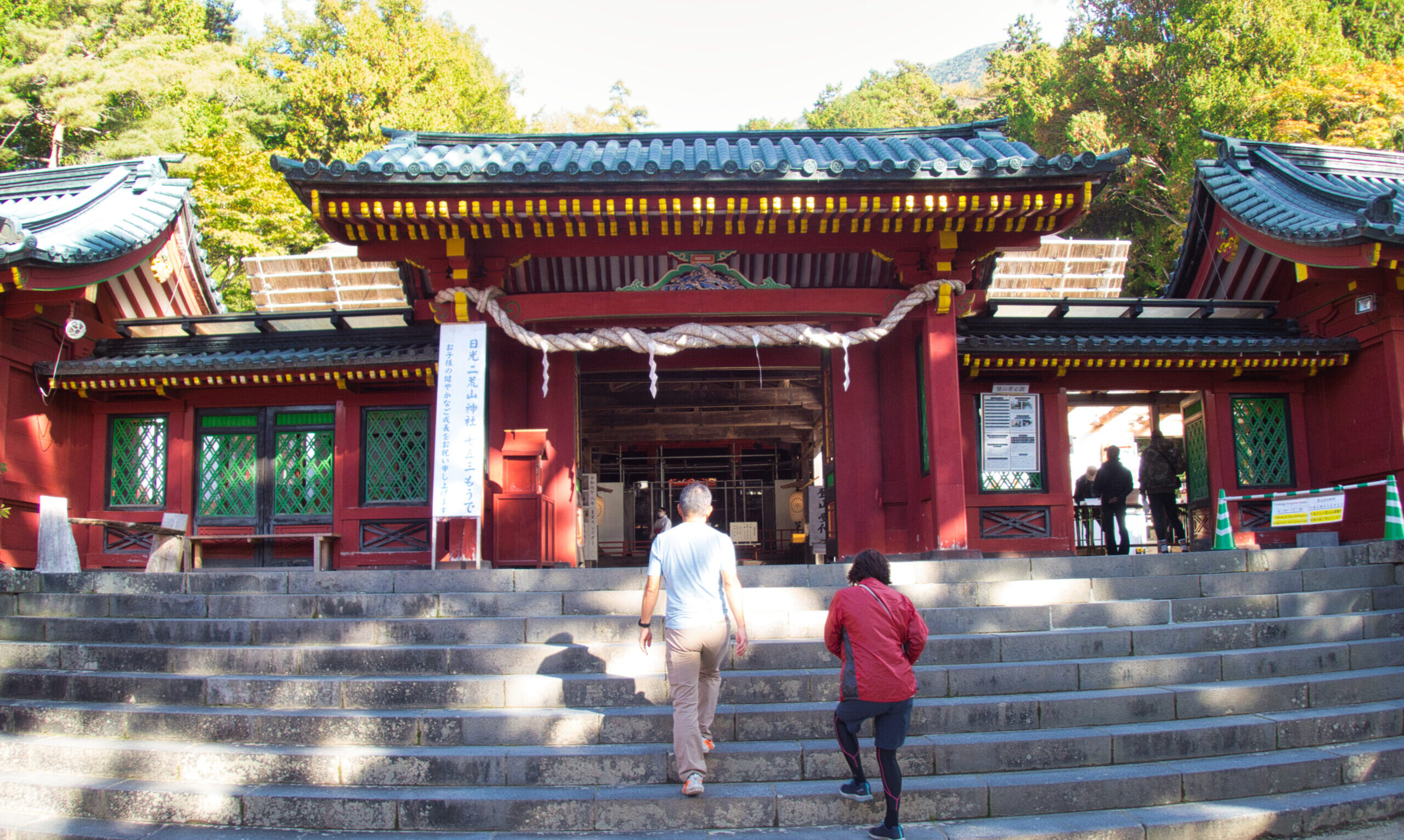
Tsukuba Shrine’s history spans approximately 3,000 years, enshrining the mythological deities Izanagi-no-Mikoto and Izanami-no-Mikoto. The mountain itself serves as the sacred object (goshintai), making it a holy site of ancient mountain worship.
During Emperor Sujin’s reign (approximately 2,000 years ago), Tsukuba Province was established, with a branch of the Mononobe clan serving in unified religious and political roles. Records indicate Prince Yamato Takeru climbed the mountain during his return from eastern expeditions.
Tokugawa Ieyasu revered Mt. Tsukuba as a spiritual protector of Edo Castle, donating 400 koku of rice in 1602. The mountain received shogunate patronage throughout the Edo period.
While many Buddhist facilities were lost during Meiji-era anti-Buddhist movements, Tsukuba Shrine’s grounds preserve Edo-period cultural properties.
At the shrine’s approach, the day-use hot spring “Tsukubasan Onsen Tsukubasan Keisei Hotel” offers outdoor baths with spectacular Kanto Plain views.
In Tsukuba City, JAXA’s Tsukuba Space Center welcomes visitors, satisfying intellectual curiosity beyond hiking.
Traditional Gama-no-abura (toad oil) salesmanship performances, an art form dating from the Edo period, are sometimes demonstrated around Tsukuba Shrine on weekends.
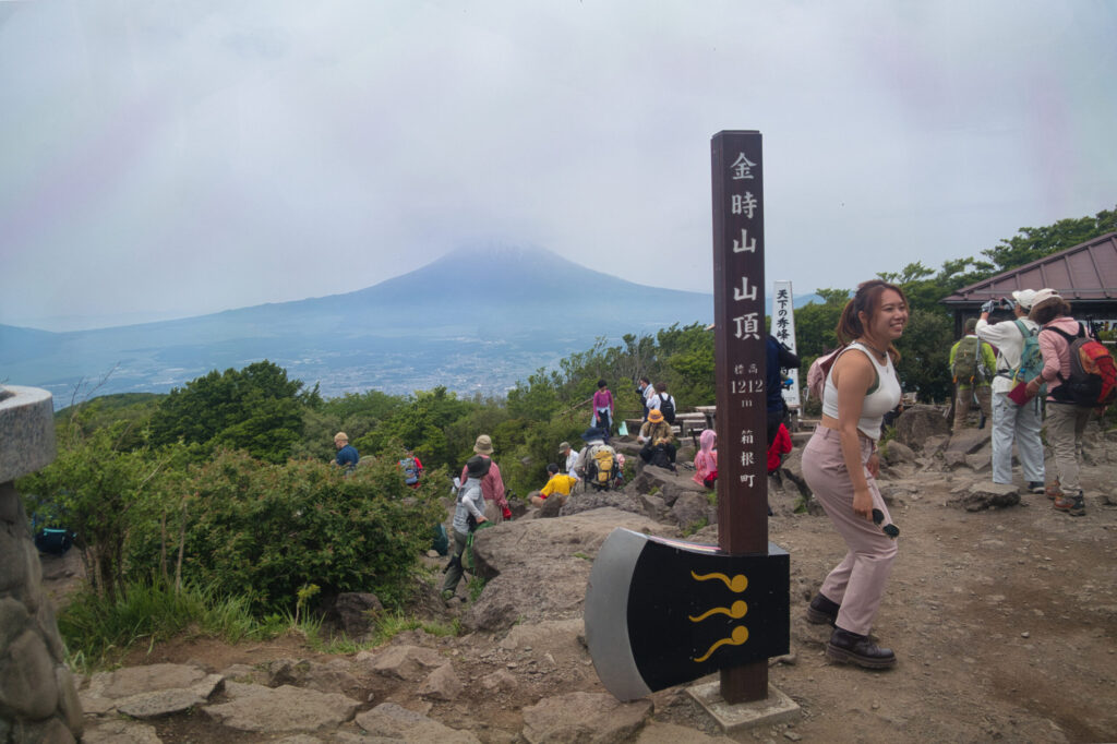
Mt. Kintoki, the highest peak of Hakone’s outer rim, is renowned as a viewing platform for Mt. Fuji. From the summit, Mt. Fuji appears in a picture-perfect composition with Lake Ashi and Hakone’s mountains in the foreground.
The mountain preserves legends of Sakata Kintoki, the model for “Kintaro” (Golden Boy) fairy tales. The summit features the inner shrine of Kintoki Shrine, dedicated to Kintaro.
Despite its elevation of 1,212m, the round-trip hiking time of approximately 3 hours makes it ideal for a first summit above 1,000m.
Mt. Kintoki has multiple trailheads, with the most popular route starting from Kintoki Shrine entrance. With an elevation gain of about 600m, the ascent takes approximately 90 minutes and descent about 70 minutes.
The trail is well-maintained, with some steep sections that are short. With attention to footing, no special skills are required.
The broad summit features two mountain huts (Kintoki Chaya and Kintaro Chaya) serving specialty dishes like “Masakari” curry and Kintoki sweet red bean soup (¥800-1,000). Dining at the summit while gazing at Mt. Fuji is an exceptional luxury.
When guiding, I introduce Mt. Kintoki as “a mountain where you can see Mt. Fuji.” On clear days, all participants are moved by Mt. Fuji appearing behind the ceremonial axe marker.
Fitness Level Required: First experience with sustained uphill sections. Comparable to Class 1 hiking in the US (Yosemite Decimal System). Requires steady cardiovascular fitness.
Access from Tokyo:
Typical Day Trip Schedule:
Estimated Costs:
What to Bring: Proper hiking boots essential (rocky trail), 1.5L water (no water sources), lunch or buy at summit, warm layer (exposed summit), trekking poles helpful for descent.
Mt. Kintoki’s name derives from the Heian-period warrior Sakata Kintoki (childhood name: Kintaro). Kintaro grew up in the Ashigara mountains, renowned for his superhuman strength. As an adult, he became one of Minamoto no Yorimitsu’s Four Guardian Kings, distinguishing himself in the subjugation of the demon Shuten-doji on Mt. Oe.
According to legend, Kintaro wrestled with bears on this mountain and played with animals. The Kintoki Shrine inner shrine at the summit enshrines this Kintaro.
During the Edo period, the area saw traffic as an alternative route to the Tokaido highway crossing Ashigara Pass. Mt. Kintoki served as a landmark for travelers.
In modern times, the mountain is also known as the namesake for protagonist “Sakata Gintoki” in the popular manga Gintama. The Kintaro legend continues to be cherished across generations.
After descending Mt. Kintoki, enjoy Hakone’s hot springs. Day-use hot spring facilities in Sengokuhara and Gora are abundant (¥1,000-1,500 entry).
Hakone offers numerous art museums and museums, including the Pola Museum of Art, Hakone Open-Air Museum, and Venetian Glass Museum, providing rich cultural experiences.
Lakeside restaurants at Lake Ashi offer dining with Mt. Fuji views. Hakone specialties include Hakone soba and yuba (tofu skin) dishes.
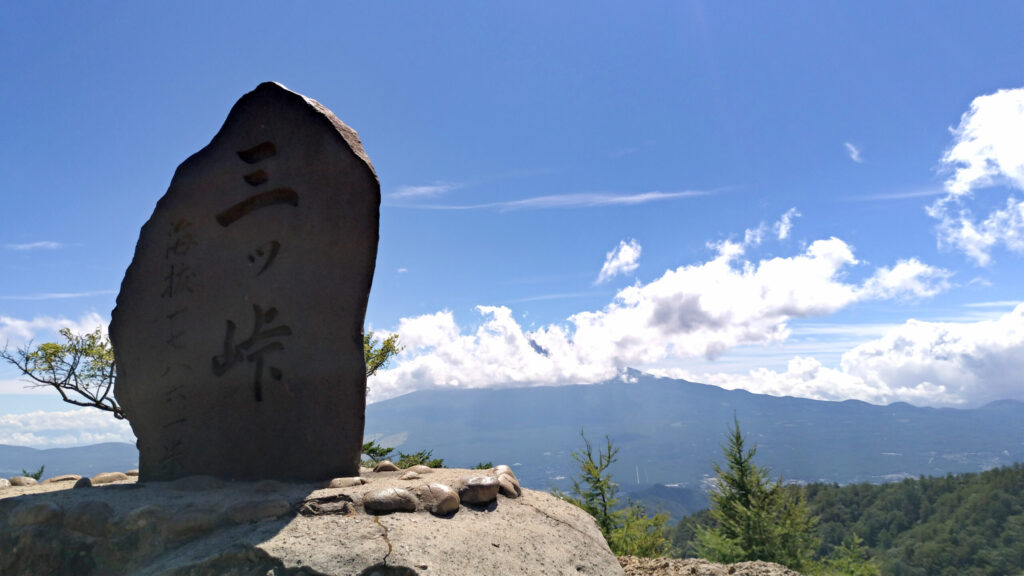
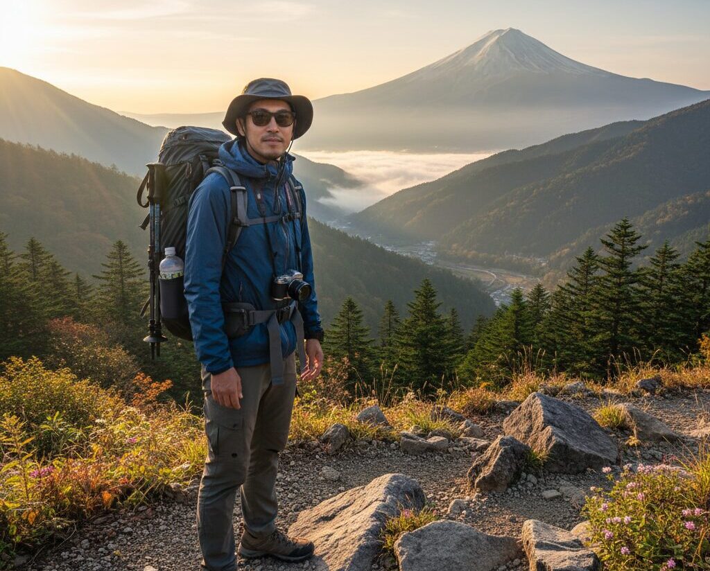
Mt. Mitsutōge ranks among the finest Mt. Fuji viewing locations near Tokyo. From the summit’s Kaiun-yama peak (1,786m), unobstructed views of Mt. Fuji spread before you.
Popular with photographers, the mountain offers spectacular sunrise and sunset views of Mt. Fuji. Views of the Southern Alps, Yatsugatake, and Okuchichibu ranges are also superb.
The rocky mountain terrain is also known as a climbing training ground. Byobu-iwa (Folding Screen Rock) near the summit is one of the Kanto region’s premier rock climbing areas.
The mountain has gained attention as a pilgrimage site for Yama no Susume fans. Featured as a mountain the protagonists challenge in the series, panels are installed at Mitsutōge Station, making it a fan destination. Many young hikers who began mountaineering after watching the anime symbolize a new generation of hiking culture, with this mountain representing that movement.
The most common route to Mt. Mitsutōge starts from the Mitsutōge trailhead (Daruma-ishi). With an elevation gain of about 1,200m, the ascent takes approximately 3 hours 30 minutes and descent about 2 hours 30 minutes.
While the elevation gain is substantial, the trail is well-maintained with few steep sections. The route winds through forest for the first half, making it more manageable. When you emerge from the forest, views open up and Mt. Fuji’s appearance is breathtaking.
Mitsutōge-sanso mountain hut stands near the summit, offering overnight stays (reservation required, ¥8,000 with meals). While day trips are sufficient, staying overnight to witness sunrise over Mt. Fuji is exceptional.
When guiding, I organize Mitsutōge as “Mt. Fuji photography hikes.” Watching participants with cameras capture Mt. Fuji from their chosen angles is heartwarming.
Fitness Level Required: Sustained uphill for 3+ hours. Equivalent to a moderate all-day hike in European Alps. Previous hiking experience recommended.
Access from Tokyo:
Typical Day Trip Schedule:
Estimated Costs:
What to Bring: Hiking boots essential, 2L water (limited water sources), full lunch and snacks, warm layers (temperature drops at 1,800m), headlamp (for safety), camera for Mt. Fuji photos.
Important: This is a longer, more demanding hike. Start early and allow buffer time. Turn back if weather deteriorates.
The name Mitsutōge derives from three peaks: Kaiun-yama, Gosudaka-yama, and Kinashi-yama. During the Edo period, practitioners of Fuji-ko (Fuji worship societies) visited as a training ground.
Mitsutōge Shrine at the summit functioned as a worship site linked to Mt. Fuji faith, serving as a place for distant veneration of Mt. Fuji.
After the Meiji era, Mitsutōge became known as a premier Mt. Fuji viewing location. During the Taisho period climbing boom, many literati and artists visited.
From the 1950s onward, rock climbing at Byobu-iwa flourished, making the mountain beloved for both hiking and climbing.
The Kawaguchiko Onsen area spreads around the Fuji Five Lakes region. Outdoor baths with Mt. Fuji views perfectly relieve post-hike fatigue.
Cultural facilities around Lake Kawaguchi include the Kawaguchiko Museum of Art and the Kawaguchiko Music Forest Museum. Regional specialties like houtou noodles (thick wheat noodles in miso soup) and Yoshida udon can be enjoyed.
If time permits, tourist attractions in the Fuji Five Lakes area include Fuji-Q Highland and the Fuji Subaru Line. Planning combined hiking and sightseeing trips is easy.
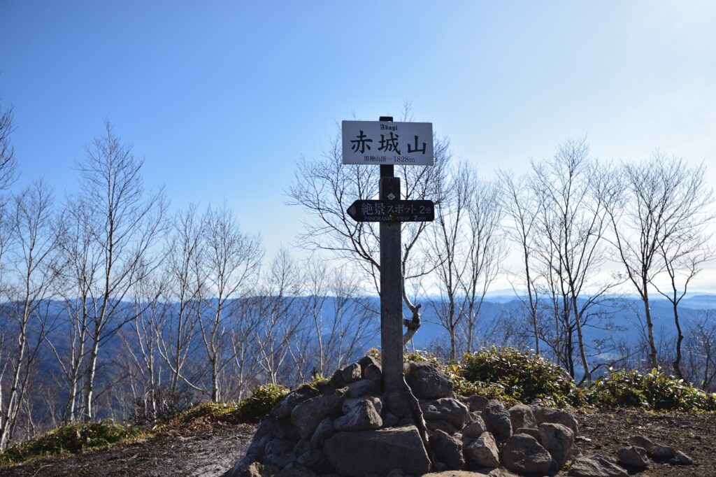
Mt. Akagi, one of the Jomo Sanzan (Three Mountains of Jomo) alongside Mt. Haruna and Mt. Myogi, is the only one of the three designated among Kyuya Fukada’s 100 Famous Japanese Mountains. Comprising multiple volcanic peaks, the highest, Kurohiyama, reaches 1,828m, offering panoramic Kanto Plain views.
From the summit, the Nikko mountain range, Oze, Tanigawa-dake, and Mt. Asama spread before you. On clear days, Mt. Fuji is visible.
Caldera lakes Onuma and Konuma, along with wetlands, showcase volcanic topography. The natural beauty changes through four seasons, with autumn colors being particularly spectacular.
The mountain is also known as the home base of the “Akagi RedSuns” in the racing manga Initial D. Battle scenes unfold on Akagi’s mountain passes in the series, attracting many fan pilgrims. Beyond the mountain itself, the surrounding driving routes offer enjoyment.
The standard route to Kurohiyama starts from Obora parking area. With an elevation gain of about 600m, the ascent takes approximately 90 minutes and descent about 70 minutes.
The trail is well-maintained with few hazardous sections. While some steep sections exist, appropriate rest breaks make them manageable.
The broad summit offers spectacular views with benches for leisurely rest. The descent route via Komagatake circling Onuma Lake is also popular (adds 1 hour, highly recommended for the lake views).
When guiding, I position Mt. Akagi as “a 100 Famous Mountain exceeding 1,800m.” The high elevation creates a strong sense of accomplishment.
Fitness Level Required: Highest elevation but gentle grade. Altitude may affect those unaccustomed to 1,800m+. Allow extra time for acclimatization. Similar difficulty to Mt. Tsukuba but at higher elevation.
Access from Tokyo:
Typical Day Trip Schedule:
Estimated Costs (by car):
What to Bring: Hiking boots, 1.5L water, lunch (limited options at Onuma), warm layers (can be windy and cool at 1,800m even in summer), sun protection.
Weather Note: Higher elevation means cooler temperatures (typically 5-10°C lower than Tokyo) and more unpredictable weather. Check forecast carefully.
Mt. Akagi has long been an object of mountain worship. Multiple Akagi Shrines exist at the mountain’s base—in Miyakozawa, Obora, and Ninomiya—all ancient establishments.
The Kozuke Province Fudoki records legends of Mt. Akagi and Nikko’s Mt. Nantai battling over Lake Chuzenji. According to legend, Akagi’s deity transformed into a giant centipede while Nantai’s deity became a giant serpent for their conflict.
During the Edo period, Akagi worship spread throughout the Kanto region with many ko (religious associations) organized. The mountain was revered as a deity of agriculture and fire.
After the Meiji era, development progressed as a summer resort, with hotels and villas built around Onuma Lake. It remains a thriving tourist destination.
Multiple day-use hot spring facilities exist at Mt. Akagi’s base, including “Akagi Onsen Hana no Yado Yunosawa-kan” and “Maebashi Akagi-no-Yu,” offering abundant choices (¥800-1,200).
Around Onuma Lake, Japanese smelt fishing and boating are available. Winter ice fishing for smelt (wakasagi) is a seasonal tradition (January-February).
In Maebashi City, Gunma specialties include yaki-manju (grilled steamed buns with sweet miso), himokawa udon (extremely wide flat noodles), and motsuni (stewed offal). Akagi beef is also famous, recommended as a post-hike reward.
These five mountains share common elements:
First, clear routes and well-maintained trails minimize the risk of beginners getting lost, allowing confident climbing.
Second, appropriate challenge and accomplishment: neither too easy nor too difficult, allowing climbers to experience the joy of self-powered summiting.
Third, multifaceted mountain appeal: views, history, nature, and culture offer enjoyment beyond climbing itself.
Fourth, post-hike fulfillment: hot springs, cuisine, and tourist spots allow experiencing hiking as a journey rather than just a destination.
The mountain a beginner first chooses influences their entire mountaineering life. Failure distances them from hiking; success propels them toward the next peak.
These five mountains promise successful experiences. Choose one from among them and take your first step. The mountains await you.
◆ Characteristics of the Five Mountains
| Mountain | Elevation | Hiking Time | Difficulty | Best Feature | Access |
|---|---|---|---|---|---|
| Mt. Takao | 599m | 3-4 hours | Easiest | Urban proximity, culture | Train: 50 min |
| Mt. Tsukuba | 877m | 4-5 hours | Easy | Twin peaks, views | Train+bus: 2 hrs |
| Mt. Kintoki | 1,212m | 3-4 hours | Moderate | Mt. Fuji views | Train+bus: 2.5 hrs |
| Mt. Mitsutōge | 1,785m | 6-7 hours | Moderate+ | Photography, Mt. Fuji | Train: 2 hrs |
| Mt. Akagi | 1,828m | 3-4 hours | Moderate | Volcanic landscape, 100 Famous | Car: 2.5 hrs |
◆ Three Perspectives for Beginner Mountain Selection
◆ Common Elements Across All Mountains
◆ Progression Recommendation
Start with: Mt. Takao (build basic hiking confidence)
↓
Progress to: Mt. Tsukuba or Mt. Kintoki (longer distance, higher elevation)
↓
Challenge yourself: Mt. Mitsutōge or Mt. Akagi (full-day hikes, 1,700m+ elevation)
◆ Seasonal Recommendations
Spring (April-May): All mountains excellent. Cherry blossoms at Mt. Takao (early April). Lingering snow possible at Mt. Akagi.
Summer (June-August): Best for high elevations (Mt. Mitsutōge, Mt. Akagi). Avoid Mt. Takao and Mt. Tsukuba on hot, humid days. Watch for afternoon thunderstorms.
Autumn (September-November): Peak season for all mountains. Fall colors spectacular at Mt. Akagi (mid-October) and Mt. Tsukuba (late October-early November).
Winter (December-March): Mt. Takao and Mt. Tsukuba accessible year-round but may have ice. Mt. Kintoki, Mt. Mitsutōge, and Mt. Akagi require winter gear and experience—not recommended for beginners.
◆ Next Steps
After climbing these five mountains, you’ll have built a foundation for more advanced hiking. Consider:
Your first step determines your mountaineering life. Choose your mountain, prepare properly, and begin your journey into Japan’s remarkable mountain landscapes.
Essential Reading:
Useful Websites:
Emergency Preparedness:
Language Tips:
Basic Japanese phrases for hiking:
Author’s Note: This guide is based on my experience guiding hundreds of first-time hikers on these mountains. Every mountain listed has been personally tested with beginners of varying fitness levels. While I’ve provided cost estimates and schedules, please verify current transportation timetables and facility fees before your trip, as these may change seasonally.
For those planning to hike in Japan, remember that proper preparation transforms a potentially stressful experience into a joyful adventure. Take time to read our comprehensive preparation guides, check weather forecasts, and don’t hesitate to turn back if conditions deteriorate. The mountains will always be there for your next attempt.
Happy hiking, and welcome to Japan’s magnificent mountain world.
Note: This article contains affiliate links. If purchases are made through links, the site receives referral fees without affecting prices. Article content is based on actual guiding experience and objective evaluation.