【Deep Dive Chronicle】Shirakami-Sanchi — The Golden World Heritage Forest
北村 智明
稜線ディープダイブ
On the second day of our training course, we headed to Usuigawa Honryu in Western Joshu. In contrast to the previous day’s Yakyusawa in Ura-Myogi, a bright and open stream greeted us. A gentle ascent with continuous name (smooth slabs) and small waterfalls, followed by a historic descent along the old Nakasendo trail. A fulfilling day learning safety management techniques.
目次
The morning of the second day of our training course arrived. After completing the previous day’s ascent of Yakyusawa Right Fork, we had spent the night at Hishiya Ryokan. Fatigue lingered in our bodies, but we had grown accustomed to the mountain rhythm.
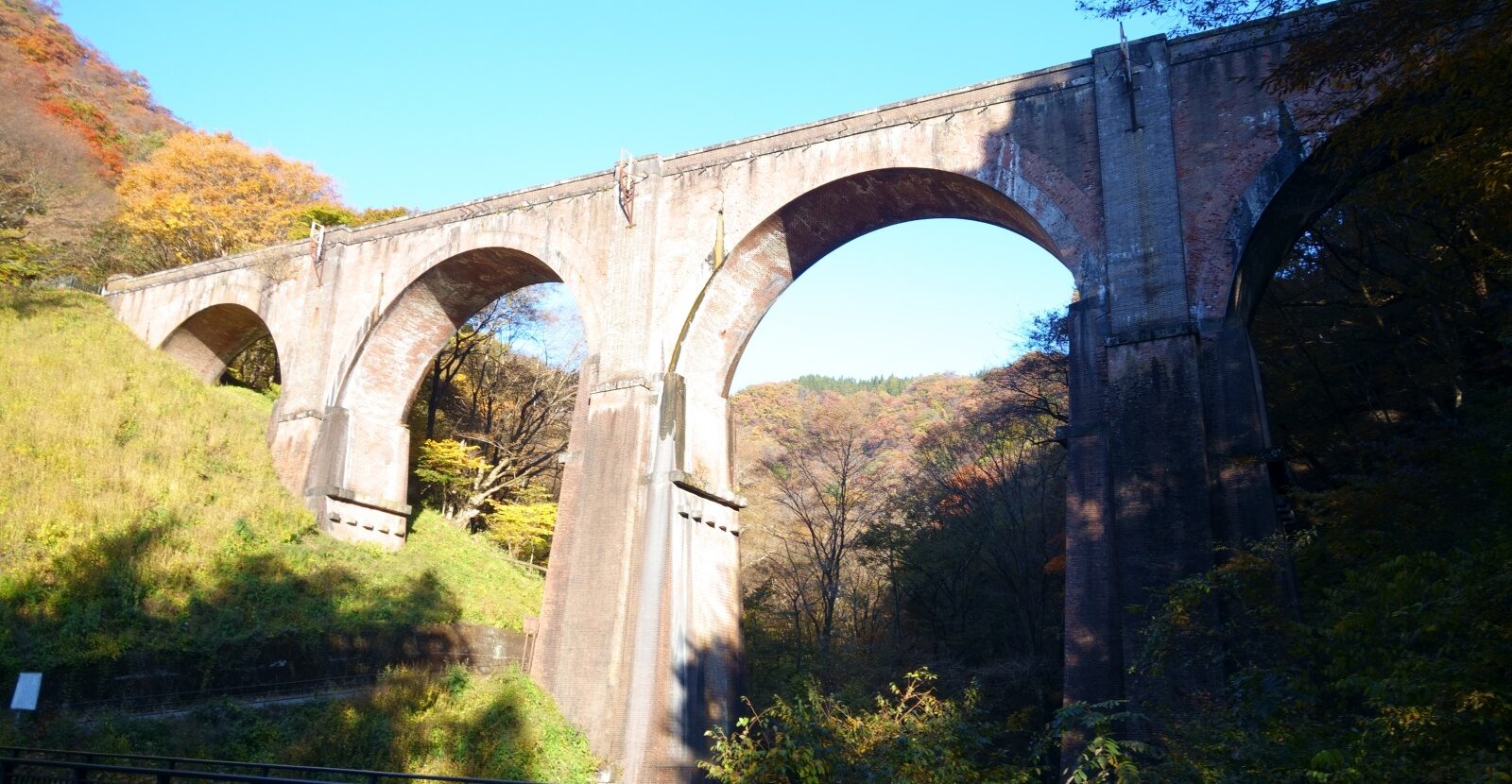
We departed once more in the morning. Our destination: Usuigawa Honryu Right Fork in Western Joshu. As we drove, the Usui Third Bridge—commonly known as “Megane Bridge”—came into view.
The four-arched brick structure glowed in reddish-brown hues under the morning sun. Completed in 1892 during the Meiji era, this bridge had once supported the Shin-etsu Main Line over Usui Pass. Standing thirty-one meters high and ninety-one meters long, its imposing presence exudes the dignity of a modernization heritage site.
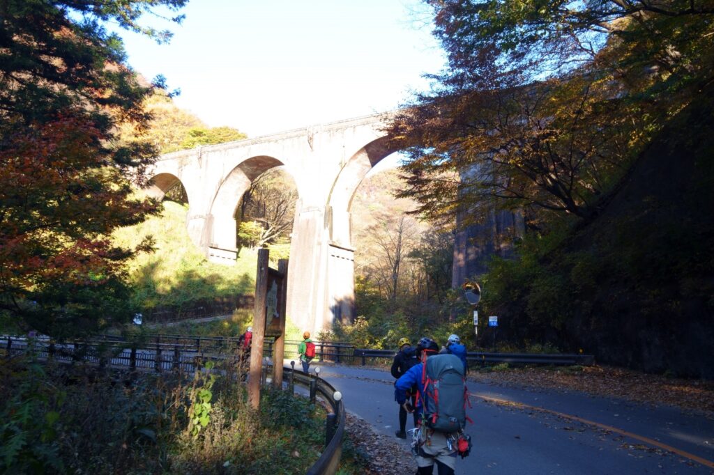
Flowing beneath the bridge is the Usuigawa, the stream we would ascend today. After walking along the ravine path for about five minutes from Megane Bridge, we reached our entry point.
Usuigawa Honryu Right Fork—Grade 1 for stream climbing, Grade III- for climbing difficulty (based on Japanese Alpine Club standards). This stream was even easier than yesterday’s Yakyusawa. Today’s theme focused on safety management techniques. Under our instructor’s guidance, we would learn practical skills.
As we stepped into the water, November’s stream proved colder than expected. While yesterday’s Yakyusawa had been surprisingly warm, this was different. Cold crept up from our feet. Our bodies reminded us that in this season, we must be prepared to get wet.
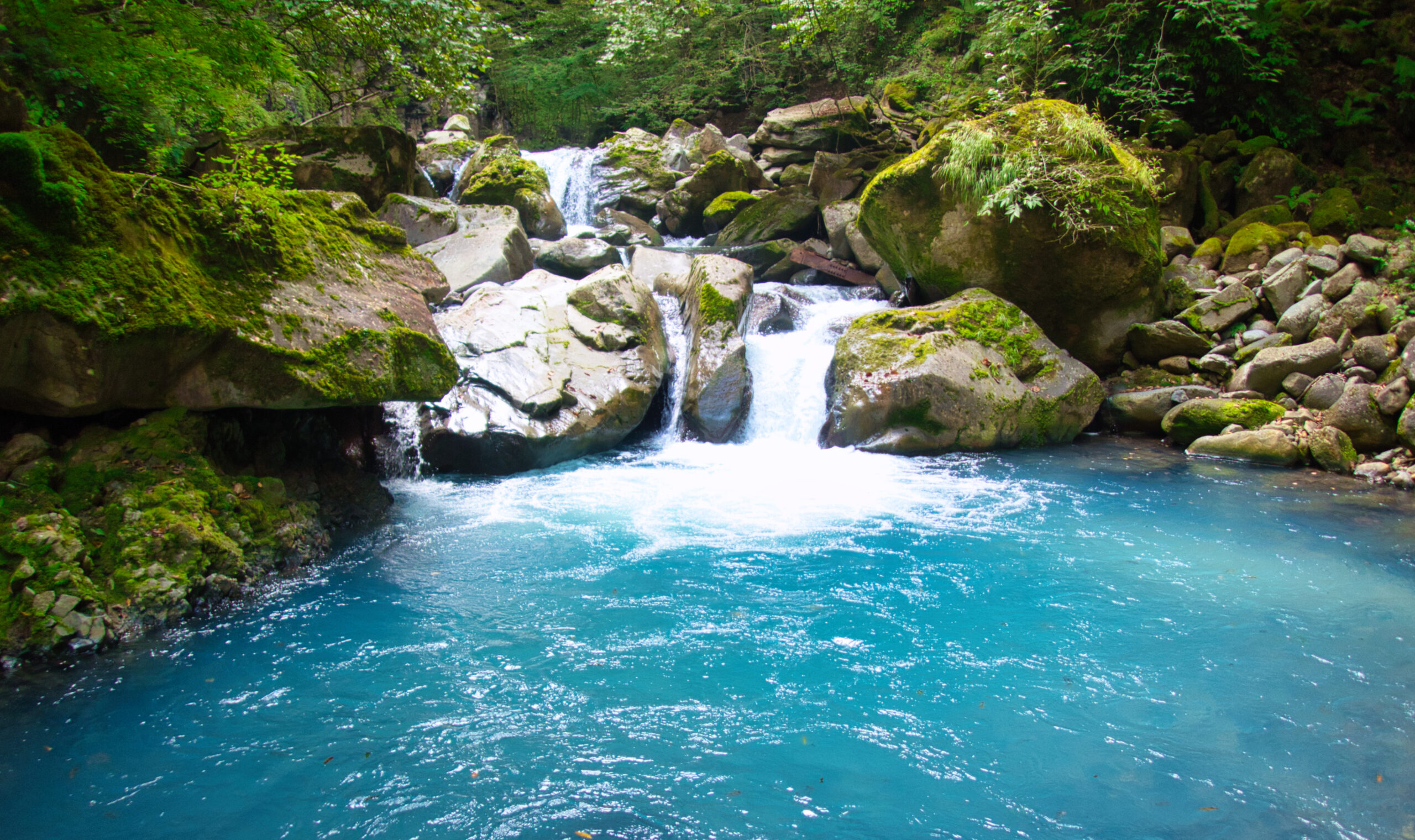
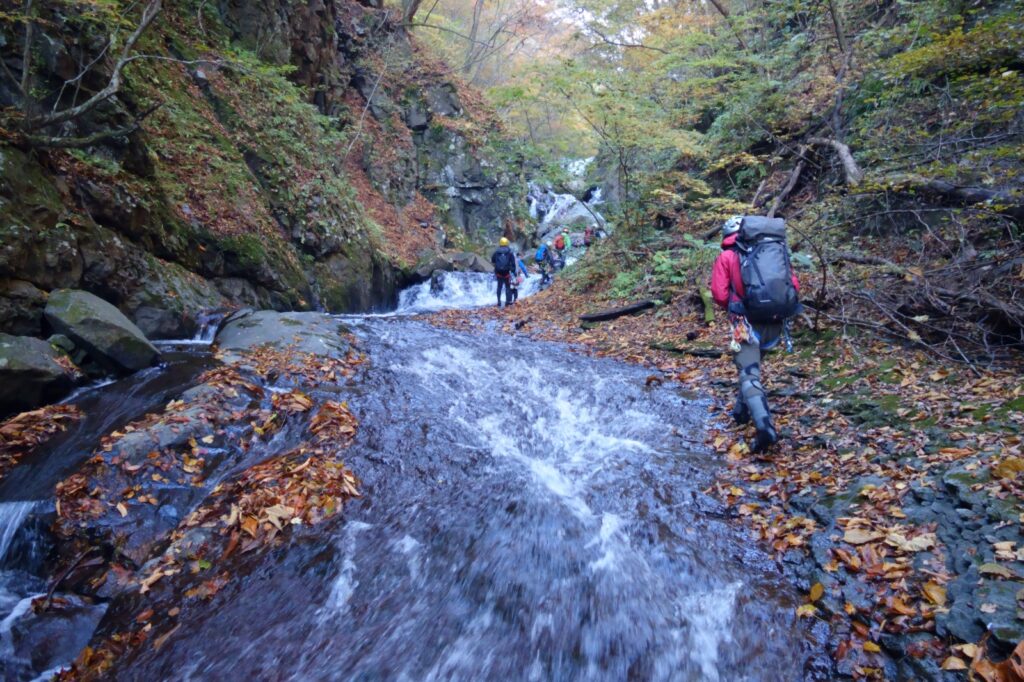
My first impression of Usuigawa Right Fork was its brightness. While yesterday’s Yakyusawa had been a deeply cut V-shaped valley, this stream opened wide. Sunlight reached deep into the gorge, making both rocks and water appear luminous.
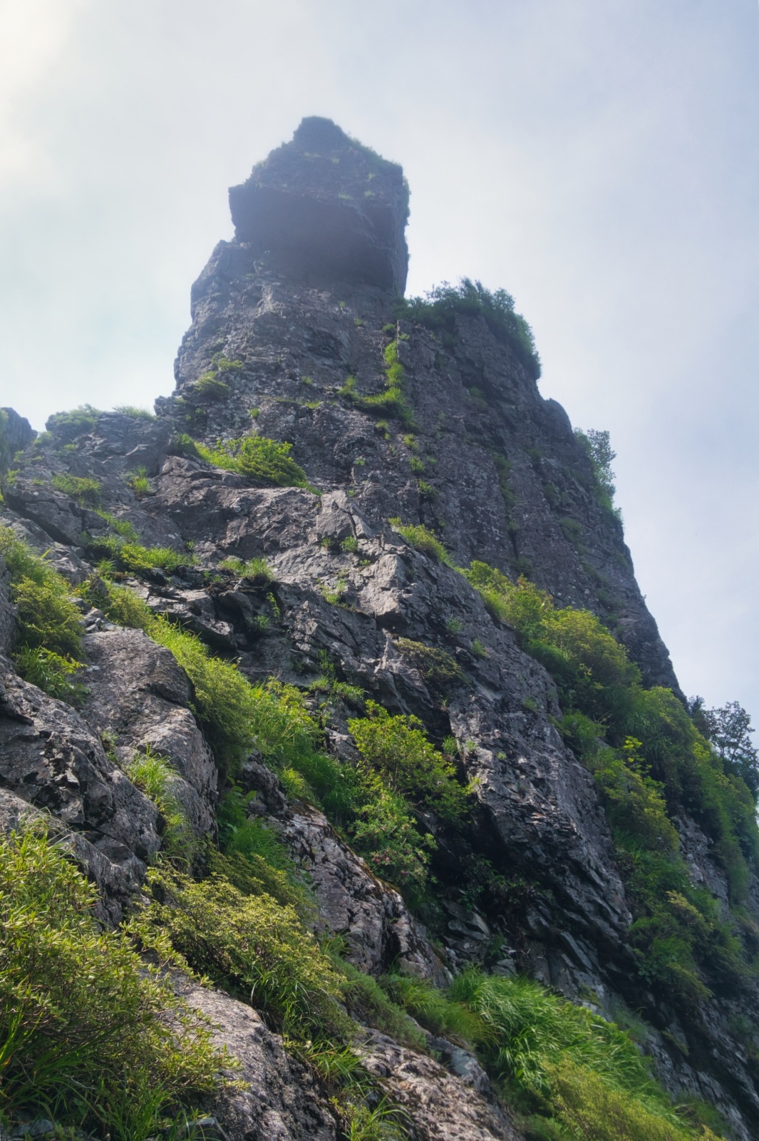
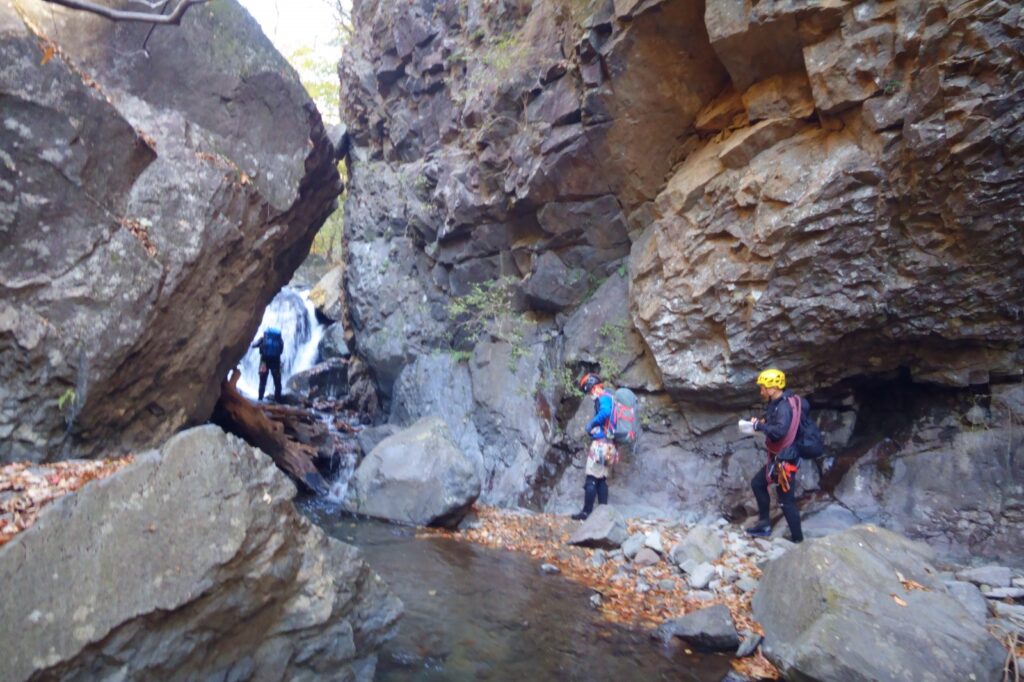
Small waterfalls appeared one after another. Most stood only two to three meters high, presenting no technical difficulties. However, today’s purpose was not simply to climb waterfalls. We were here to learn safety management techniques through practical application.
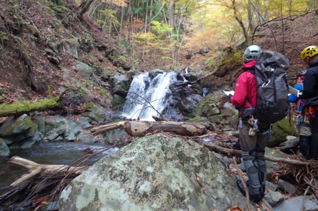
The instructor provided careful guidance: anchor placement, ropework, and positioning for supervising participants. How to ensure safety when leading groups into streams. During breaks, we also studied reading water flow diagrams and drawing ascent maps. Reading terrain from contour lines on topographic maps, predicting waterfall locations—practical techniques that cannot be learned from textbooks were honed in this ravine.
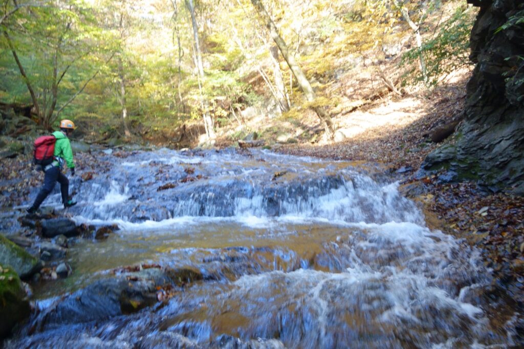
The name (smooth slabs) were beautiful. Water flowed over polished rock surfaces as we carefully progressed, testing our grip on the wet stone. These slabs were one of Usuigawa Right Fork’s main attractions.
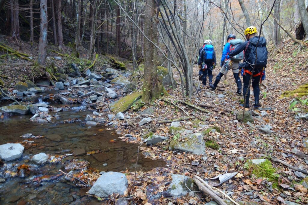
As we gained elevation, the stream character gradually changed. Yet we encountered no thick brush. Like yesterday’s Yakyusawa, late autumn in Western Joshu offered streams relatively free of vegetation and comfortable climbing. We also had no concerns about leeches—a blessing unique to this season.

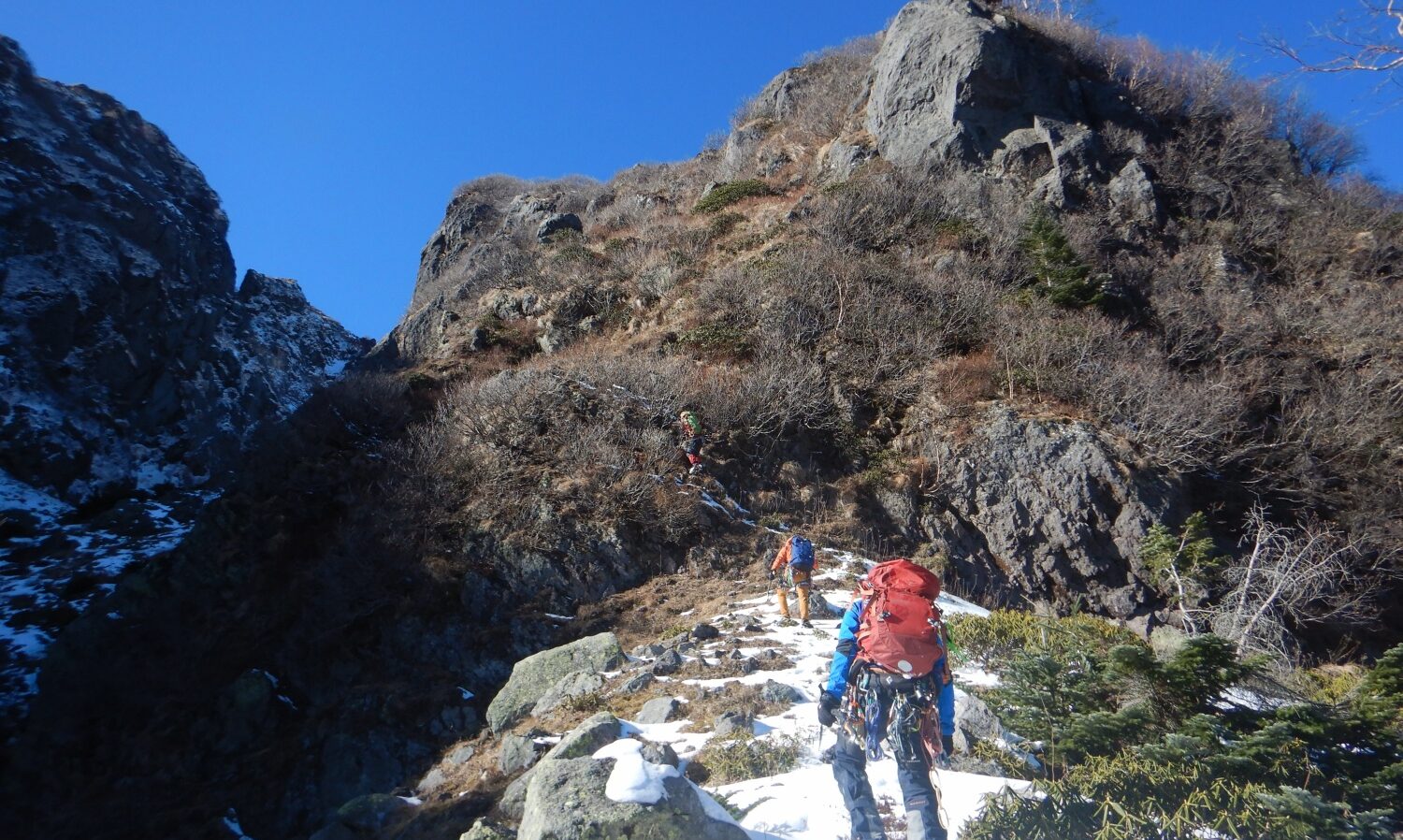
By early afternoon, we continued our ascent. Passing small waterfalls, climbing slabs, and working through occasional boulder fields (goro). All participants were experienced mountaineers, creating an atmosphere of mutual learning and skill exchange. Though this was a training course, a relaxed mood prevailed.
The water’s coldness became more pronounced as we progressed upstream. Yet as long as we kept moving, we didn’t feel cold. Rather, immersion in the frigid water seemed to sharpen our senses.
The exit proved more comfortable than expected. We had braced ourselves for bushwhacking (yabukogi), but it wasn’t necessary. We climbed the open slope and eventually reached the ridgeline.
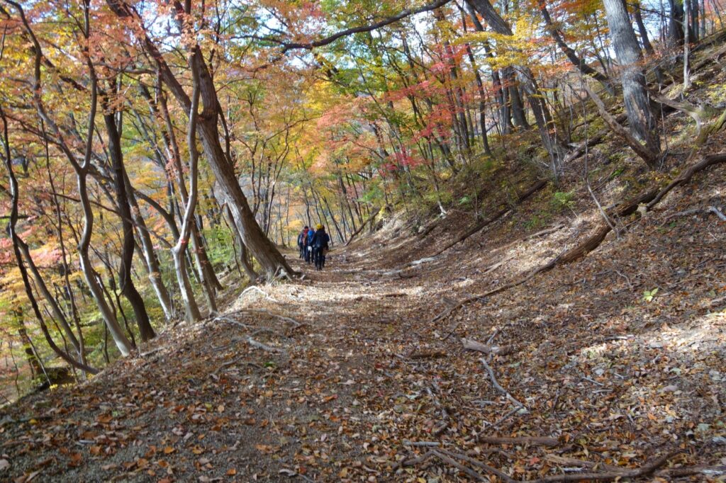
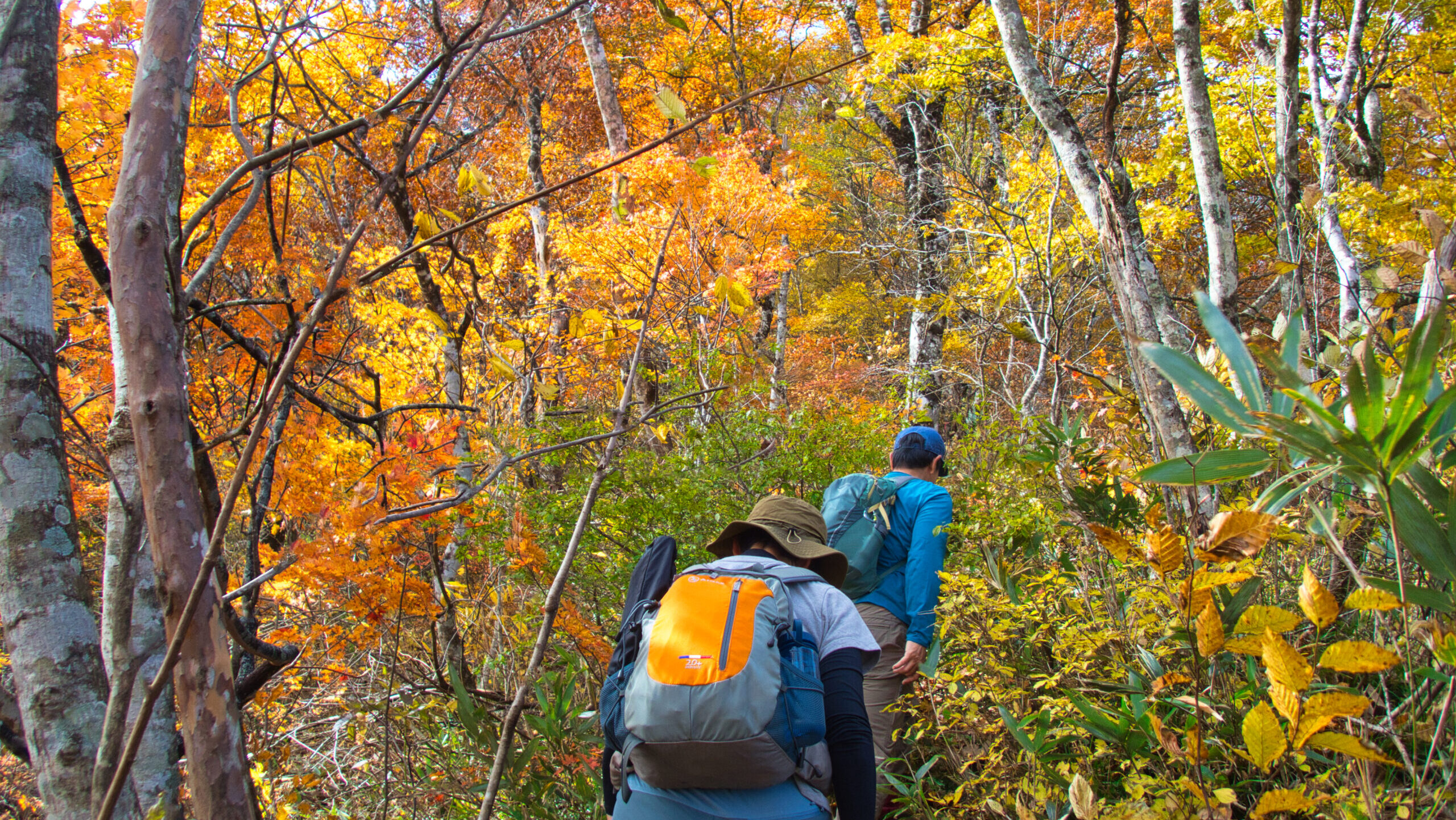
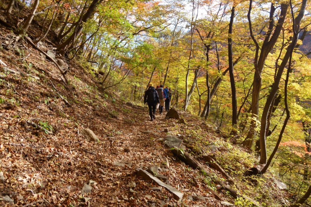
For our descent, we followed the old Nakasendo trail. This historic road, once traveled by many wayfarers, still bears strong traces of the past. Explanatory signs line the route, conveying scenes from bygone days. Horse-head Kannon statues, trail markers, stone Buddhas—observing these relics made us forget the fatigue of descent.
Walking this historic trail, I reflected on the two-day training course. Yakyusawa’s columnar jointed cliffs and autumn colors, Usuigawa’s bright slabs and small waterfalls. We had ascended two contrasting streams and savored the charm of each. Most importantly, we had learned safety management techniques for stream climbing through hands-on practice.
After descending the old Nakasendo trail, Megane Bridge came back into view. Unlike the morning, it was now bathed in evening light, dyed in orange tones. The Meiji-era structure standing quietly evoked the passage of time.
We completed our two-day training course. We learned much in the two mountain regions of Ura-Myogi and Western Joshu: techniques, understanding of nature, and teamwork with companions. All of this will nourish our future mountain expeditions.
Though Usuigawa Honryu Right Fork presents no high technical difficulty, it serves as an ideal stream for learning sawanobori (Japanese stream climbing) fundamentals. The bright, open stream character, beautiful slabs, and historic descent route harmonize to provide a fulfilling day of mountaineering.
Leaving Megane Bridge behind, we head toward our next expedition. The learning never ends. The mountains continue to offer us new challenges and discoveries.
[LOG SUMMARY]