【Deep Dive Chronicle】Hirogawara-sawa Right Fork: Ice Climbing in South Yatsugatake
北村 智明
稜線ディープダイブ
In mid-September, we pivoted from Kita-dake Buttress due to severe weather and headed to Suginomorisawa Hidarimata, a tributary of the Omonogawa River system in Yakunaigawa. This stream was chosen by our leader S’s intuition. For me, it was a second ascent, though my memories of the first were vague—just scattered impressions of small waterfalls, minor gorges, deep pools, and smooth slabs. Only upon returning did I discover what a surprisingly fine stream this truly was.
目次
We had abandoned Kita-dake Buttress about three days earlier. After checking the weather forecast, our leader S proposed Suginomorisawa Hidarimata as an alternative. It was his gut feeling. I knew this stream—I had climbed it once before with a large group—but honestly, my memory was hazy. This time we would be just three. I would get to experience it anew.
On the day, we drove in two vehicles. We left one at the descent point at Omoridaira and took the other to the entry point. A characteristic of Sugane’s streams is that you enter by passing beside residential houses. Each time, I’m struck by the curious juxtaposition of these gorges opening up right beside people’s homes.
Suginomorisawa Hidarimata is a tributary of Yakunaigawa in the Omonogawa River system, ascending to Mizusawamori at 1,018 meters elevation. It’s graded as Grade 2 (based on Japanese Alpine Club/local standard). One of this stream’s attractions is its virtually zero approach time.
Considering it was mid-September, we didn’t bring fishing gear this time. The water level appeared slightly elevated, perhaps due to rain the previous day.
We entered the stream shortly before 7:00 AM.
The stream was better than I remembered.
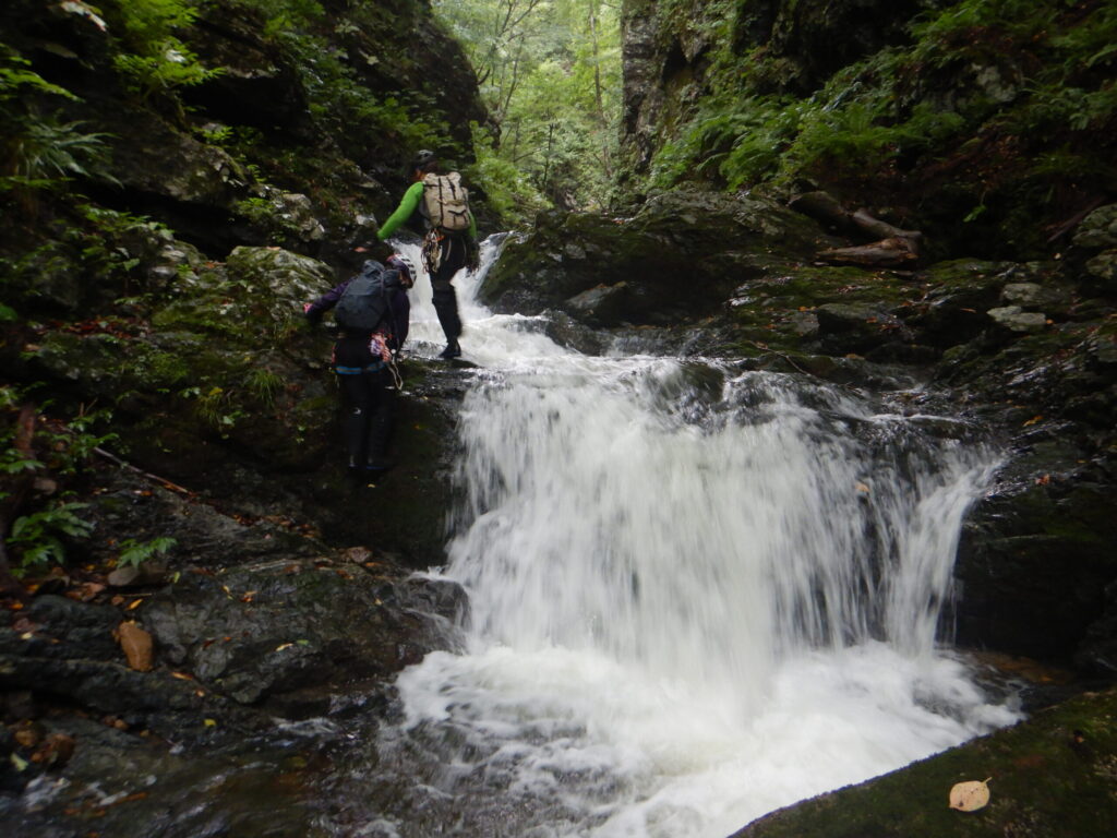
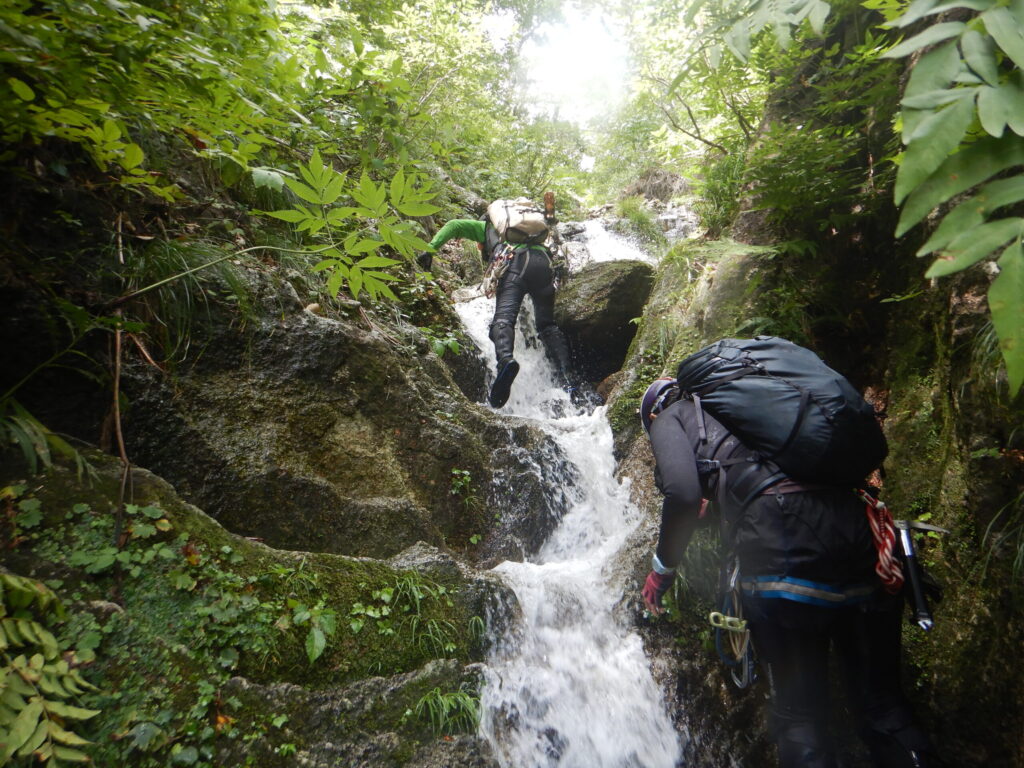
A small waterfall would appear, and once we climbed it, a minor gorge would open before us. Then smooth slabs would continue, leading us to the next fall. This pleasing rhythm was the essence of Suginomorisawa Hidarimata. Why hadn’t I noticed this charm the first time? Perhaps the congestion of a large group had obscured the stream’s true character.
Every waterfall could be climbed directly, with no obvious crux sections. Yet the varied stream character kept us engaged, propelling us forward. The three-person team size felt ideal. S led, reading the route, while the other S and I followed behind. Our movement was fluid.
We spotted decent fish populations in the pools. Though we hadn’t brought fishing tackle, we could confirm the stream was rich with Iwana (Japanese char).
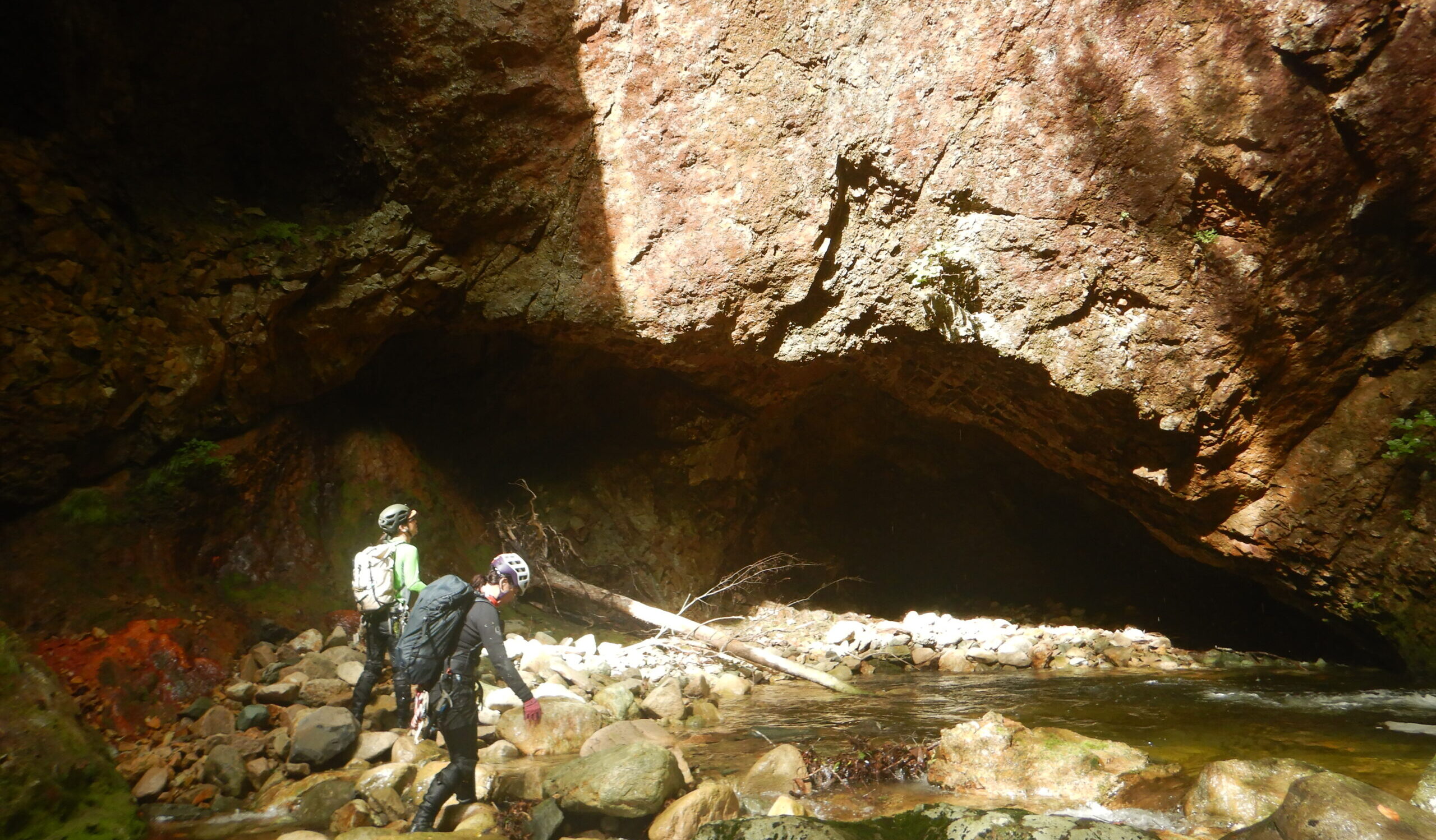
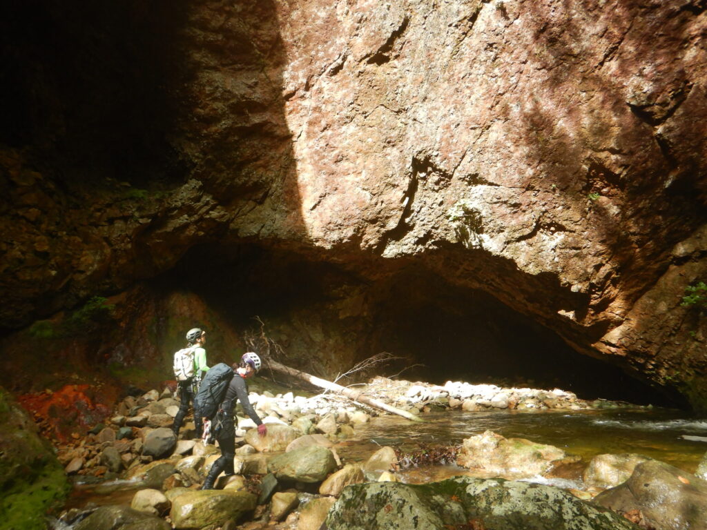
Around 10:00 AM, a cave appeared. Water flow had carved through the bedrock, creating deep darkness. The surrounding rock had a reddish tinge, clearly different in composition from other sections. Perhaps it was iron-rich strata. We paused at the cave entrance, contemplating its mysterious presence.
Entering the gorge, we encountered a deep pool waiting for us.
We would have to swim to reach the start of the climb. The water temperature wasn’t particularly cold—it was mid-September water. I went first, diving in and swimming to the take-off point. The two S’s followed. There was no reason to hesitate.
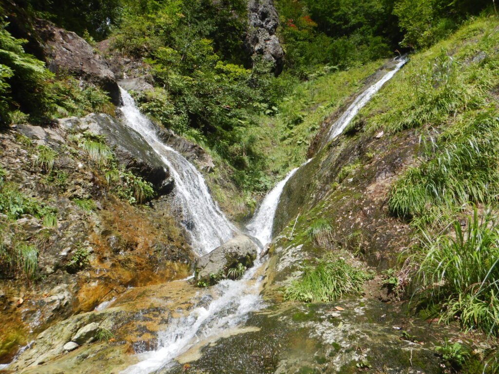
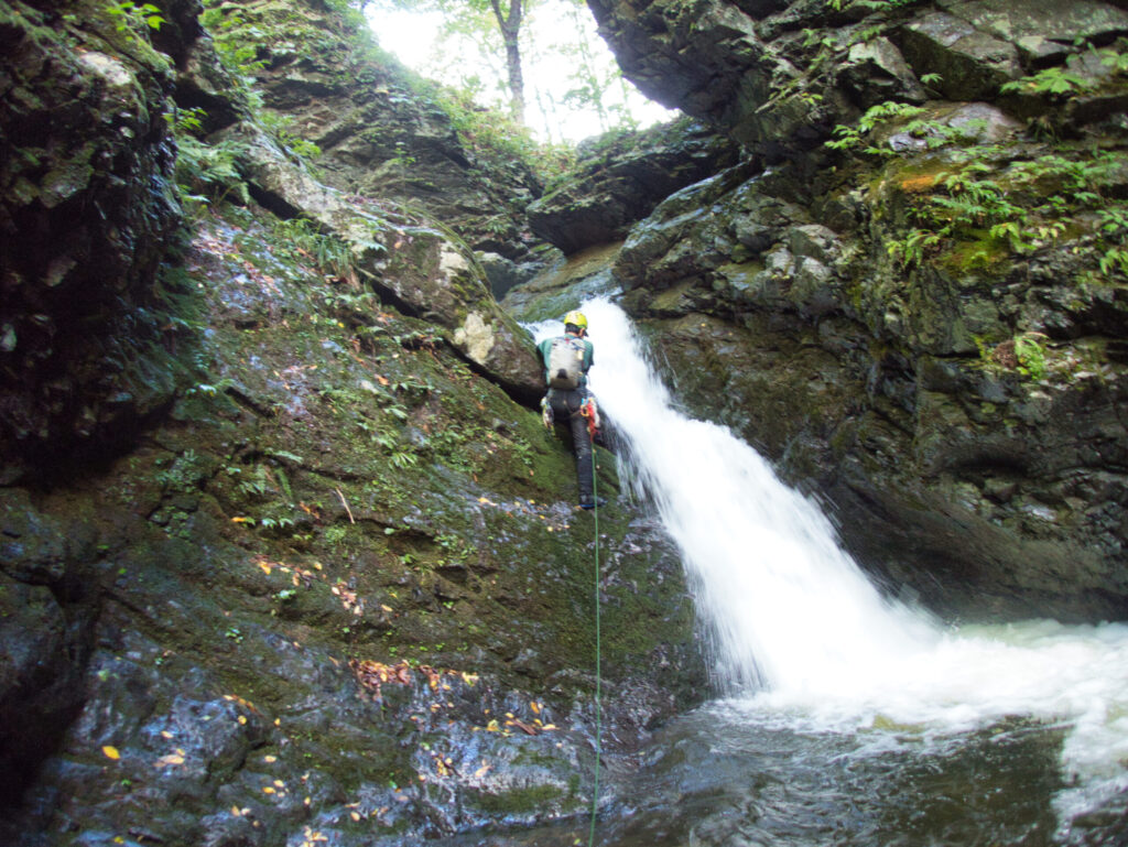
Gaining more elevation, Ryōmon Falls (literally “twin gates,” named for its two waterfall tiers that resemble a pair of gates) came into view.
Including the lower tier, this waterfall must be seventy meters—the largest in this stream. We had been concerned about yesterday’s rain, but the water volume wasn’t as high as we’d feared. Leader S started up the left wall, carefully selecting wet holds while traversing across the fall’s face toward the right.
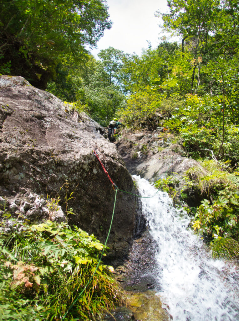
Crossing the waterfall, getting soaked was unavoidable. The current pounded our bodies, drenching us completely. Still, our footing remained solid, and we felt no danger. As a precaution, we placed a piton for an intermediate anchor—simply a safeguard against potential slips.
By the time I followed, the route was clear. My rubber-soled shoes gripped the wet rock as I gained height step by step. The waterfall’s roar filled my ears. Cold spray struck my face. When we cleared Ryōmon Falls, we felt a quiet satisfaction.
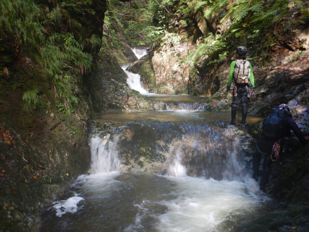
After Ryōmon Falls, the stream showed a gentler face once more.
Smooth slabs continued with scattered small waterfalls. The rhythm matched the earlier section, though the gradient gradually eased. The surrounding forest was deep, with autumn still barely evident. Yet occasionally the breeze carried the cold air of changing seasons.
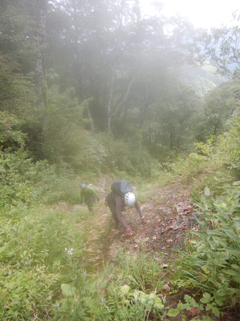
Just before 1:00 PM, we turned further left from Suginomorisawa Hidarimata and began the final ascent to Mizusawamori. We’d expected bushwhacking, but surprisingly encountered walkable slopes. Eventually we merged with a hiking trail, and at 1:52 PM we stood atop Mizusawamori.
1,018 meters elevation. Not a high mountain by any measure. Yet for us on this day, this summit held sufficient value. Any lingering regret about Kita-dake Buttress had completely vanished.
We descended via the Ōmori Course trail. At 2:17 PM, we arrived at Omoridaira. Our parked vehicle was waiting.
Looking back, it was a day guided by leader S’s intuition. The pleasure of climbing every waterfall, the exquisite balance of small falls, gorges, and smooth slabs, the swimming in deep pools—my memories from the first time had been vague, but revisiting allowed me to truly appreciate this stream’s genuine quality. It was a surprisingly fulfilling ascent.
Sometimes when plans don’t proceed as intended, the outcome can be even better. With these thoughts, I settled into the car seat.
[LOG SUMMARY]