【Deep Dive Chronicle】Mt. Iwaki-san — First Snow, Elegance, and Inner Reflections
北村 智明
稜線ディープダイブ
Rain had been falling on Arafune-yama (Mt. Arafune) since morning. Alone, I ascended the right fork of Aizawa-gawa (Aizawa River), a stream carved deep into the heart of one of Japan’s rare table mountains. Small but endlessly varied waterfalls. A fog-wrapped forest held in perfect silence. This is the record of a sawanobori (Japanese stream climbing) day-trip in early summer.
目次
I left Fukushima before dawn. Heading west along the Kanetsu Expressway, the ridgelines of the Joshinetsu highlands emerged from the morning haze as the car rolled into the town of Shimonita. Arafune-yama straddles the border of Gunma and Nagano Prefectures and is one of the very few table mountains in Japan. Elevation: 1,423 meters. Its flat silhouette tells a geological story — a hard layer of lava that outlasted the erosion of the softer strata below. Though it did not make Kyuya Fukada’s celebrated Nihon Hyakumeizan (One Hundred Mountains of Japan), it appears in Motoo Iwasaki’s Shin Nihon Hyakumeizan (New One Hundred Mountains of Japan), making it a mountain of distinct character. At the rim of its summit plateau stands Tomoiwa — a sheer cliff face exceeding 200 meters in height.
In 2009, manga artist Yoshito Usui — creator of the beloved series Crayon Shin-chan — lost his life on this mountain, an accident that brought the severity of Tomoiwa’s exposure back into the public consciousness. More than a decade has passed since then, yet the mountain receives us still, unchanged.
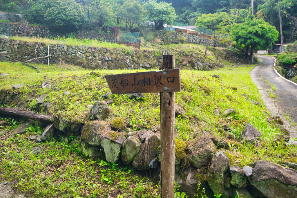
I pulled into the Aizawa Trailhead just after 10:00 AM — late, because I had been waiting for the rain to ease. In a light drizzle, I sorted my stream gear. Rope, harness, slings. Today’s objectives: complete the ascent of the right fork of Aizawa-gawa, and scout the winter ice climbing route known as “Shōten no Hyōchū” (Ascending Icicle).
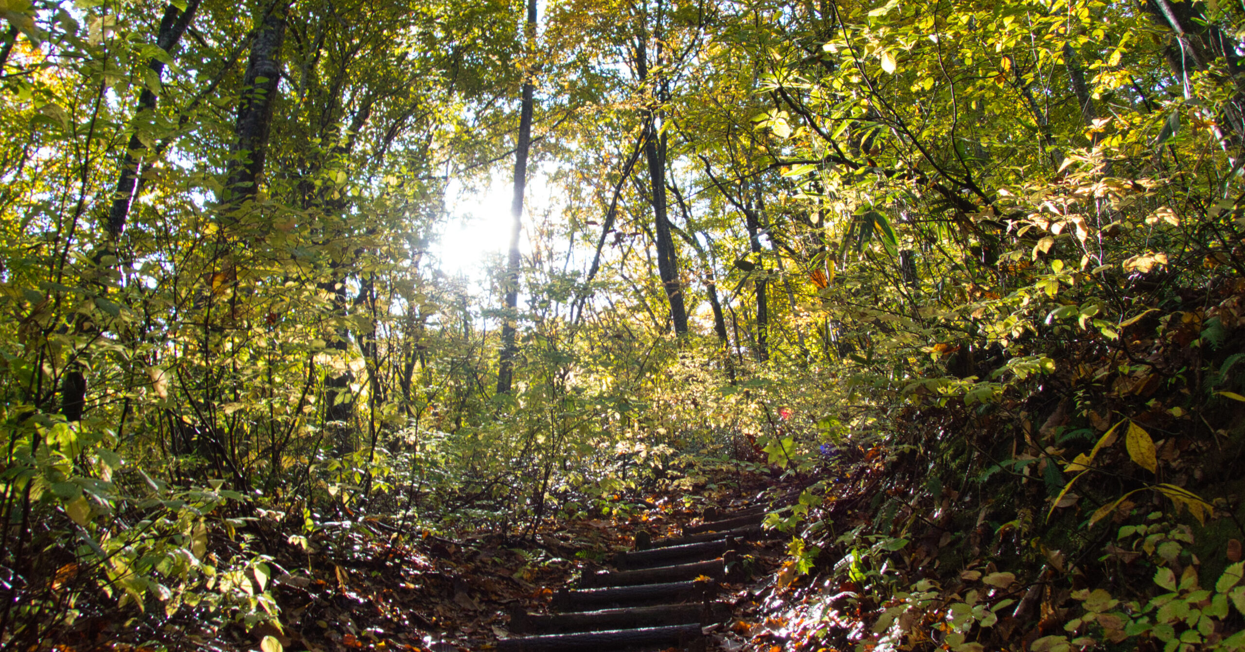
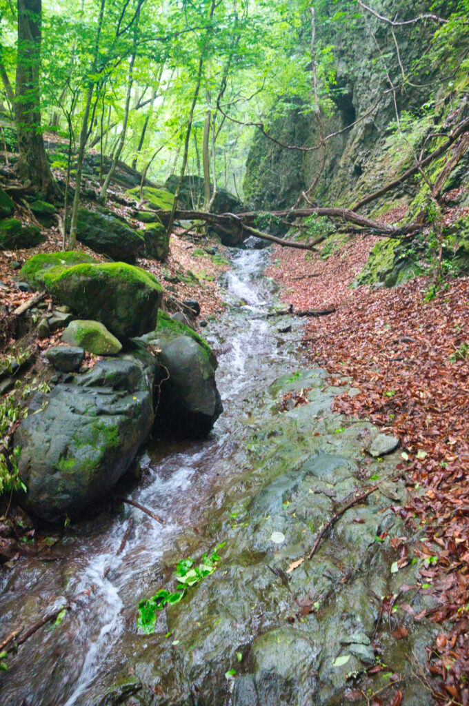
After bowing to the stone shrine of Nakanomiya, I stepped into the forest. Mist drifted between the trees; visibility was no more than fifty meters. The ground underfoot was thick with fallen leaves, wet and treacherous. Before long, the sound of the stream reached me.
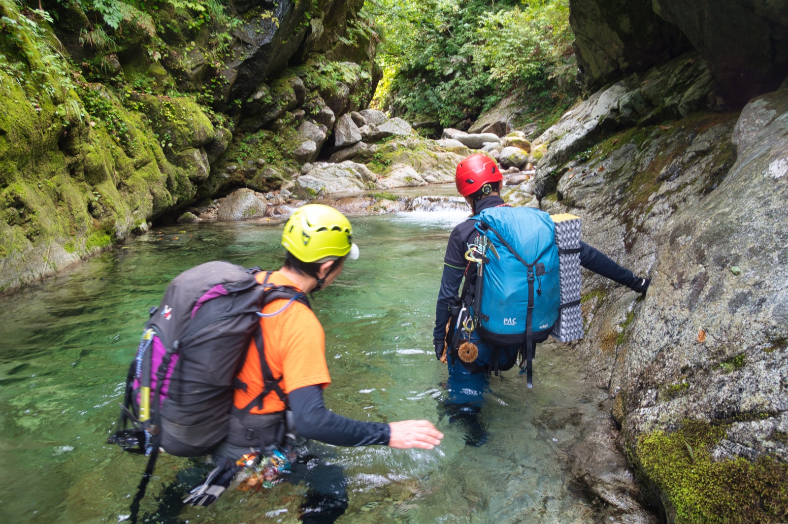
I entered the water at the 420-meter elevation mark. Water levels were normal — despite rain through the night, there was no sign of swelling. Confident it was safe, I changed into my stream climbing shoes and stepped into the current.
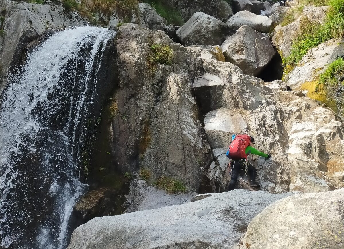
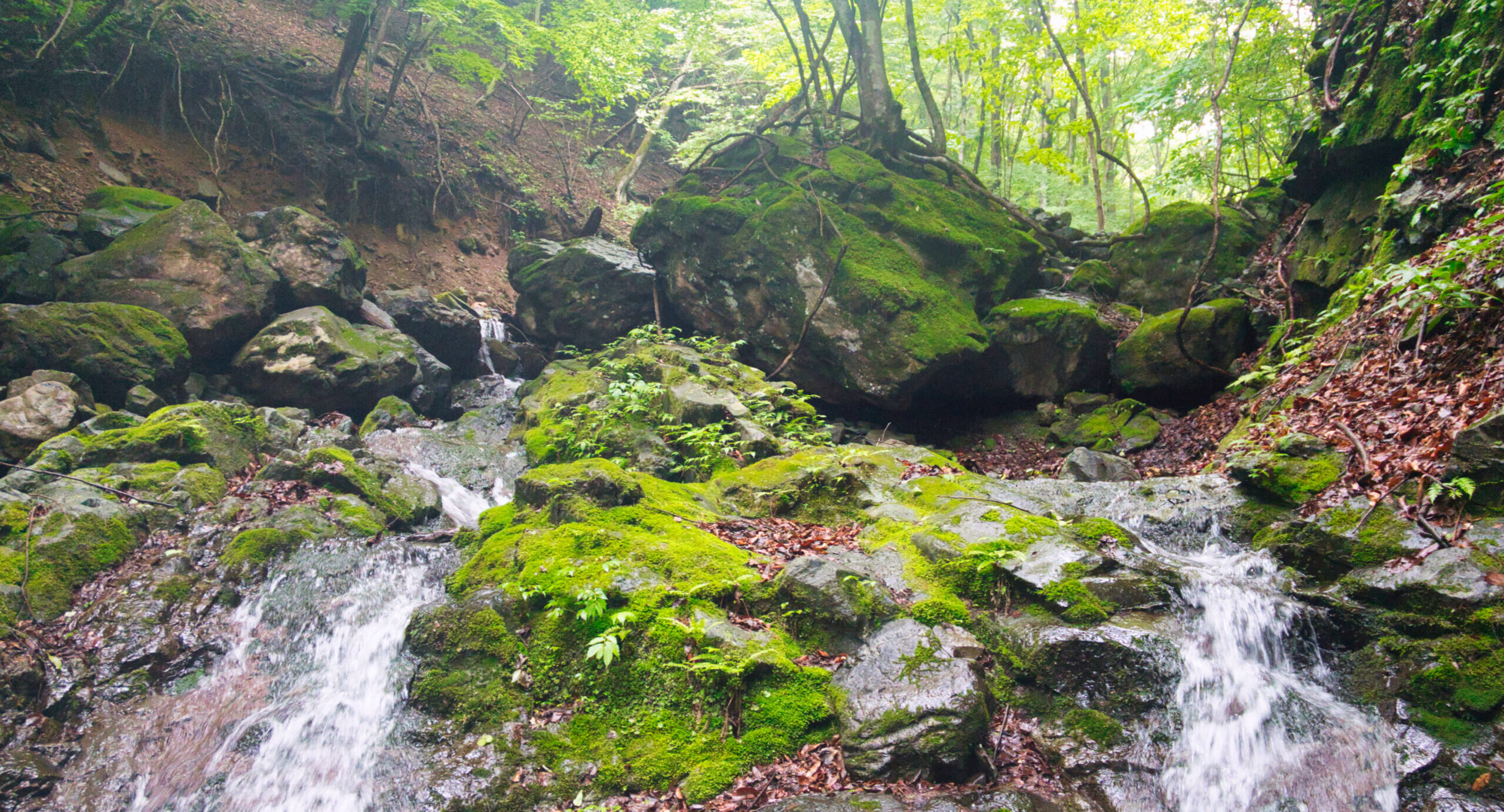
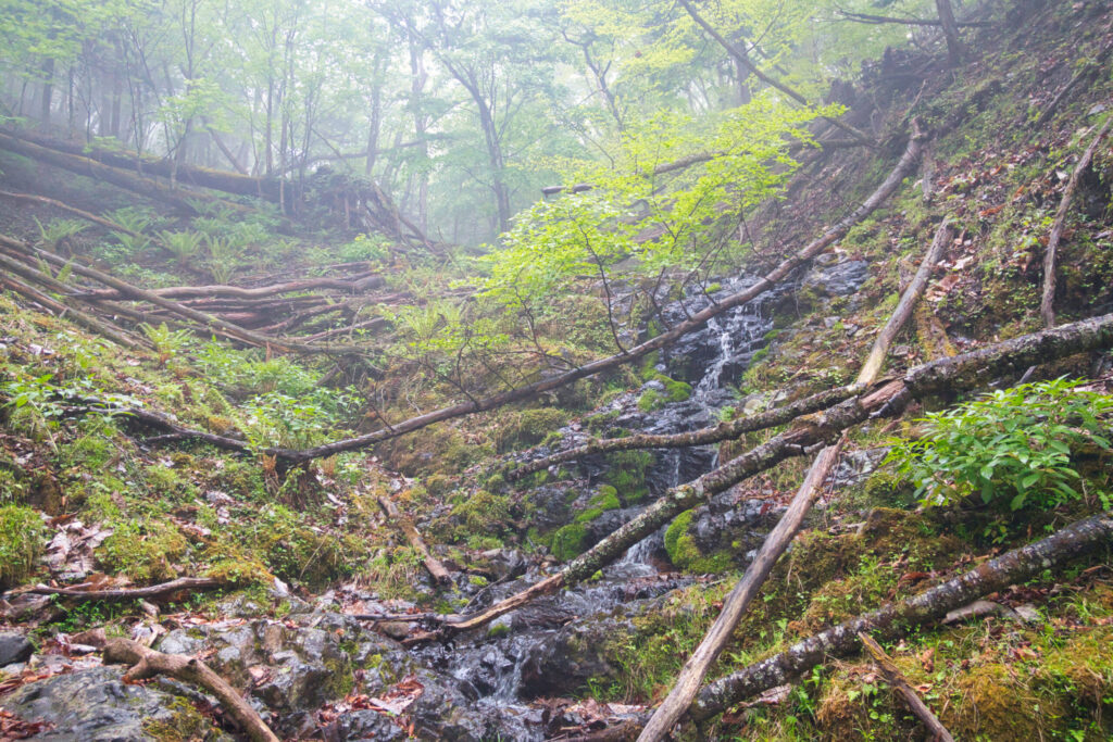
The ascent moved at a good pace. Two- and three-meter cascades appeared in quick succession. The rock here is primarily tuff, patched in places with moss. The wet surface demanded caution, but the holds were plentiful and the climbing never severe.
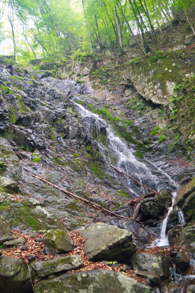
At 650 meters, a twin-stepped cascade appeared before me — and from here, waterfalls came one after another as the gorge began to assert itself.
Between 770 and 870 meters, smooth water-polished slabs (nametoko) made their appearance, alternating with short cascades in a pleasantly varied rhythm.
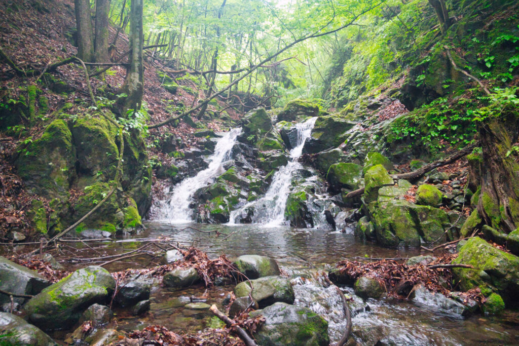
At 870 meters, a ten-meter vertical waterfall (choppuiwa) blocked the way. I bypassed it on the left via a high bypass (takamaki). The rock band at 920 meters was noted in older records as once having been a continuous waterfall sequence, but it has since been buried in sediment and reduced to an easy boulder field (goro). Picking my way carefully over the slick rocks and maintaining three points of contact at all times, I steadily gained elevation. Beyond this boulder band, the terrain entered what I consider the true crux of this stream.
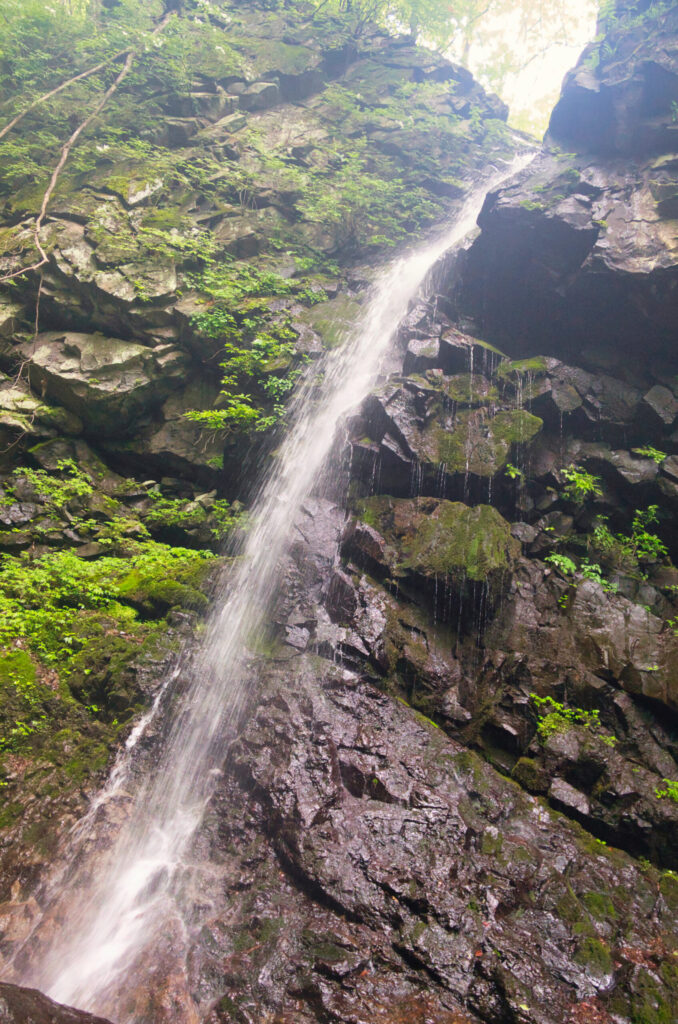
At 1,030 meters: a twelve-meter vertical waterfall. Climbing solo, I avoided the waterfall basin and processed it via a couloir (runze) bypass on the left bank. Then I stood before the moment I had been building toward — the 1,070-meter mark, and a seventeen-meter sloping waterfall that is the defining challenge of this route.
The angle was moderate, but the exposure was real. For a moment, I weighed whether to rope up alone. I made the calm decision to climb it free. Not from overconfidence — I kept my technique strict, held three points of contact throughout, and did not allow myself to rush.
The rock was more stable than it looked, but I steered clear of the mossy sections and selected only certain holds. Cold sweat traced a line down my back. I kept my hands moving. Steadily, meter by meter, I climbed.
When I pulled over the top, I felt the tension I had been holding release all at once.
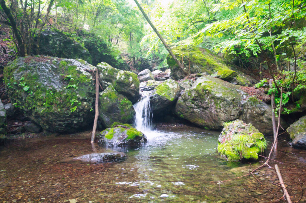
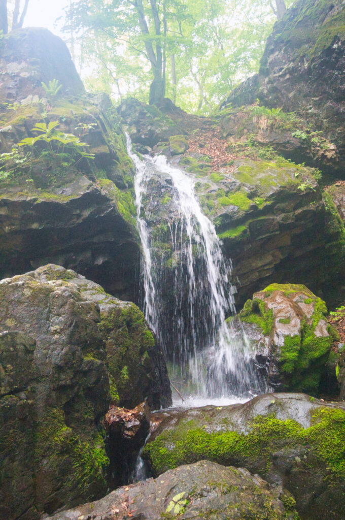
Above the crux, a succession of smaller cascades remained — including a five-meter overhanging waterfall (hangdaki) — each cleared in turn. At 1,210 meters, a five-meter flume-shaped fall (toishō no taki) poured forward as if being pushed from behind. Once past it, the stream gradient began to relent.
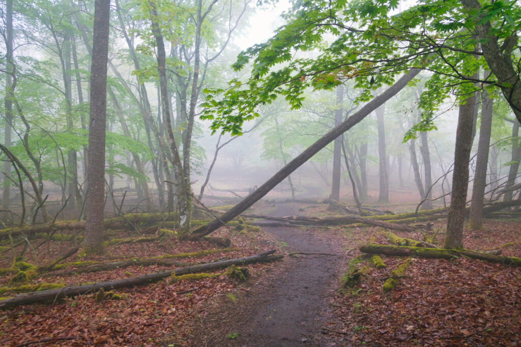
Beyond 1,340 meters, the water disappeared entirely and the surrounding vegetation shifted into beech forest (buna-rin). The mist deepened; the trees rose from a white veil. The scene recalled a sumi-e ink painting. The broadleaf woodland — beech (buna) and Mongolian oak (mizunara) dominant — radiated a living stillness that settled over everything.
I followed the dry streambed upward toward the ridgeline. The headwall approach required no bushwhacking (yabukogi) to speak of, and the gradient was comfortable throughout. Then, scrambling up a final steep pitch, the world opened. Before me stretched the summit plateau leading to Kyōzuka-yama — the highest point of Arafune-yama.
The perfectly flat tableland at the top of the stream is a sight unlike anything else in Japan’s mountains. It felt like wandering into an immense, formal garden — a complete release from every tension accumulated in the gorge below.
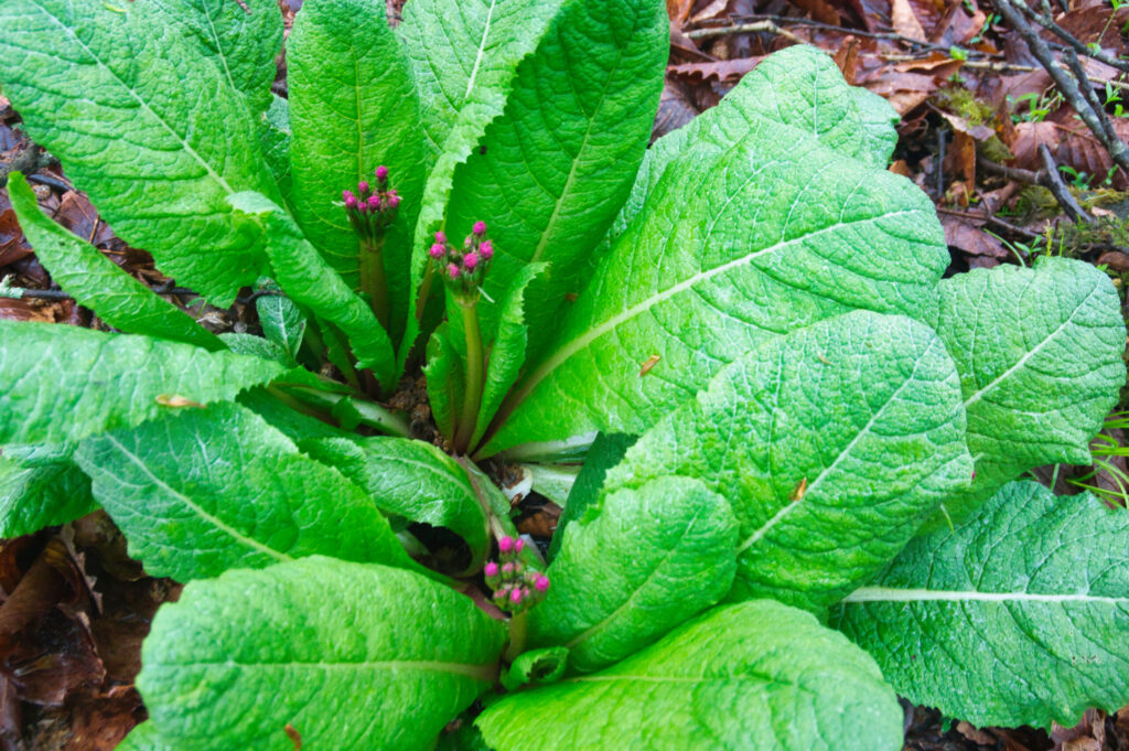
Near the summit monument grows a colony of Japanese primrose (Kurinso / Primula japonica). At this time of year they were still in bud, their latent vitality palpable in the misty flatness of the plateau.
The view I had hoped for — the full panorama of the table mountain — was lost to fog. A disappointment, but that is the nature of mountains.
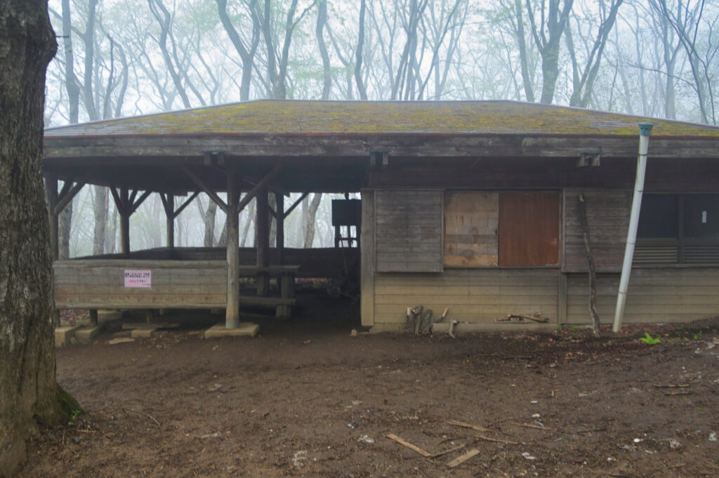
After a short rest at the emergency shelter, I turned downhill. The trail unrolled steadily beneath my feet. Fatigue settled into my legs, but I kept the pace even.
At 3:50 PM, I returned to the Aizawa Trailhead. Total time: five hours and thirty-six minutes — longer than usual, as I had stopped frequently to sketch notes for the route diagram.
To clear the cold and wet from my body, I stopped at Arafune-no-Yu, a hot spring ten minutes down the road. Soaking in the outdoor bath, looking out at the green mountain flanks, I let my mind return to the stream I had just climbed. As the warmth spread through me from the inside out, quiet relief rose in its wake — relief that the day had ended safely.
Arafune-yama’s stream is small, but varied and full of character. On a day of soft rain, it held a silence of its own, and the beauty of a fog-filled forest. The view from the table mountain will keep for another time. The mountain is not going anywhere.
[LOG SUMMARY]