【Deep Dive Chronicle】Mt. Mitsuishi-yama — Autumn in the Rain-Shrouded Tohoku
北村 智明
稜線ディープダイブ
With the deep rumble of Naeba shaking the air at our backs, we set off toward a different kind of stage — Sasaana-zawa, in the Tanigawa Range. This is a natural colosseum where water and rock thunder in concert. The opening act was marred by a costly mistake — sleeping in — followed by the unwelcome noise of leeches targeting our legs. But when we finally stood before the 120-meter great slab fall (Ō-name-taki), the main stage, our adrenaline hit its peak. This is a record of 15 hours and 44 minutes of non-stop improvisation — a midsummer stream climbing live bootleg, where silence and screaming cross paths.
目次
The night before, our party of five pitched tents near the trailhead. We had traveled roughly 200 kilometers from Fukushima to the Tanigawa Range — a long drive, but one that carried the particular electricity of a genuine expedition. There was no room for complacency, however. We needed to leave at a precise time the next morning to shuttle a vehicle to the exit trailhead.
And yet, when morning came, the member responsible for the shuttle failed to wake on schedule. An hour was lost before we had even begun. To start a climb demanding careful judgment already running behind — the anxiety was suffocating. Still, there was nothing to do but move: calmly, steadily, one step at a time.
It was around this time that Fuji Rock Festival ’24 was underway at Naeba Ski Resort in Yuzawa, Niigata Prefecture. Running from July 26 to 28, the three-day festival draws music lovers from across Japan and beyond. The final night was to feature Noel Gallagher’s High Flying Birds — the ex-Oasis frontman headlining for tens of thousands. While we moved quietly into the mountains’ depths, an entirely different kind of heat swirled at the foot of these same peaks. Two worlds: one pulling people toward each other, one pulling people toward the hills. The same time, the same region, two entirely different passions intersecting.
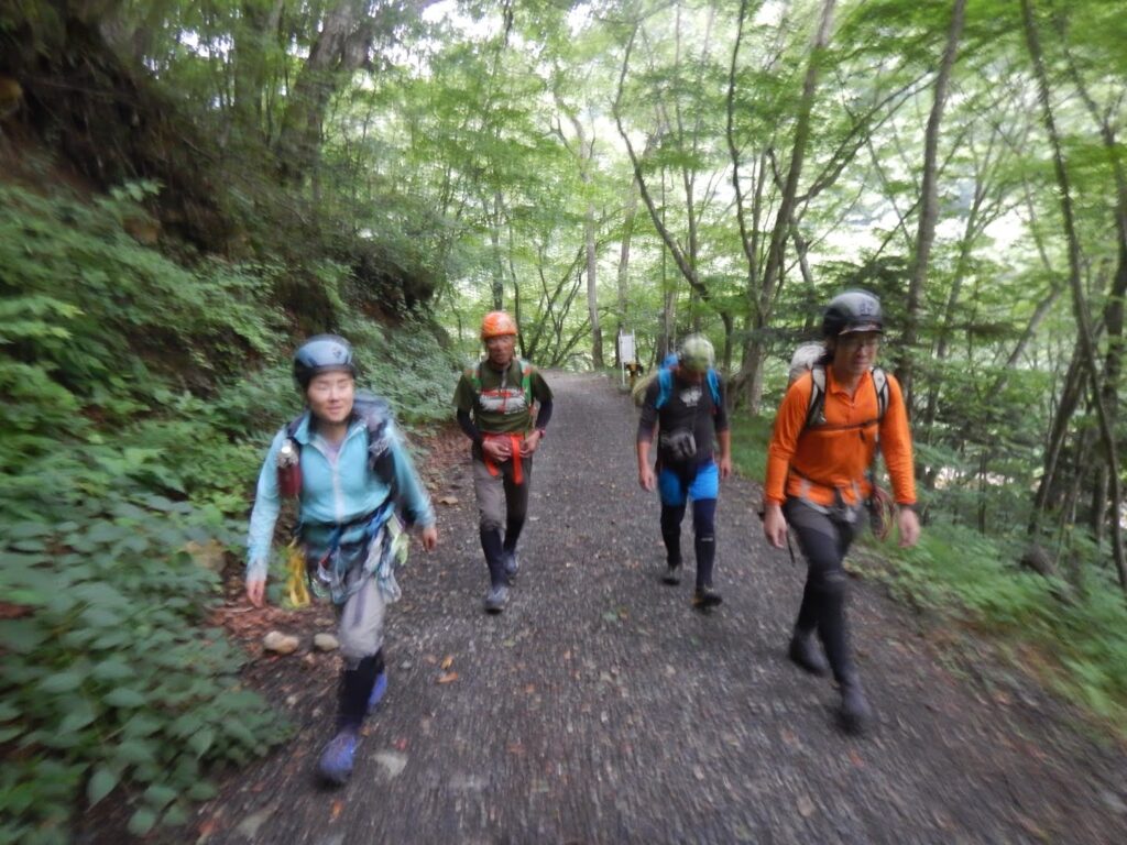
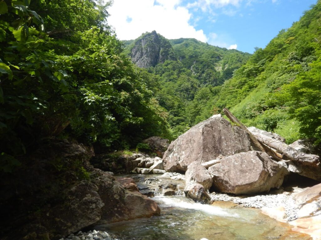
Departing from Kawafuru Onsen, we crossed Akaya-gawa Bridge and pressed on along Akaya Forest Road. At 8:14 AM, we reached the road’s end and prepared to enter the main stream of Sasaana-zawa. Mt. Taira-ppyō-yama (1,984m), at the western fringe of the Tanigawa Range, is known as one of Japan’s “100 Flower Mountains,” its broad ridgeline dotted with alpine plant communities — a gentle, welcoming mountain on its face. Chishima-zasa bamboo grass ripples in the summer breeze; the ridge basks in warm sunlight.
But the valley Sasaana-zawa carves deep into its southern flank is anything but gentle. Successive large falls, slime-coated rock walls, sustained technical climbing — these are the hallmarks of a meikei (a renowned gorge). Behind the mountain’s easy exterior hides a valley of uncompromising severity. We were about to step into its depths.
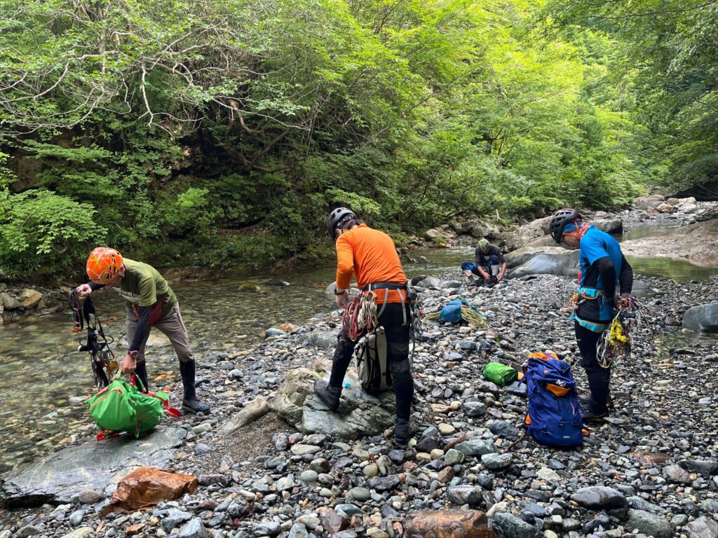
As we geared up to enter the stream, something felt off at our feet. Leeches. By the time we noticed, several had already latched onto our lower legs, blood welling up beneath them. Unpleasant — unavoidable. This, too, is the initiation rite of the Akaya-gawa watershed. It took all five of us working together nearly thirty minutes to remove them one by one. The trial had already begun before we set foot in the water.
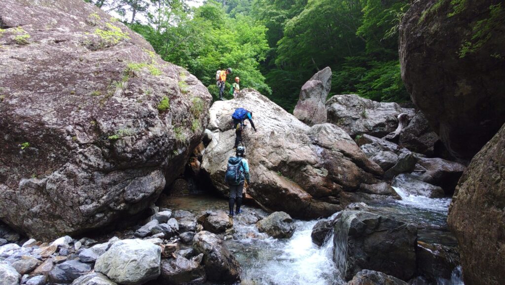
The early section is Goro (boulder field) strewn with massive rocks — an unbroken succession of clambering over, Maki (climbing around an obstacle), and hauling ourselves up stone after stone. Repetitive, even monotonous. But within that monotony lives the gorge’s own particular rhythm: the sensation of grabbing cold rock, the silence broken by rushing water, the chill seeping up through the soles. All five senses sharpen.
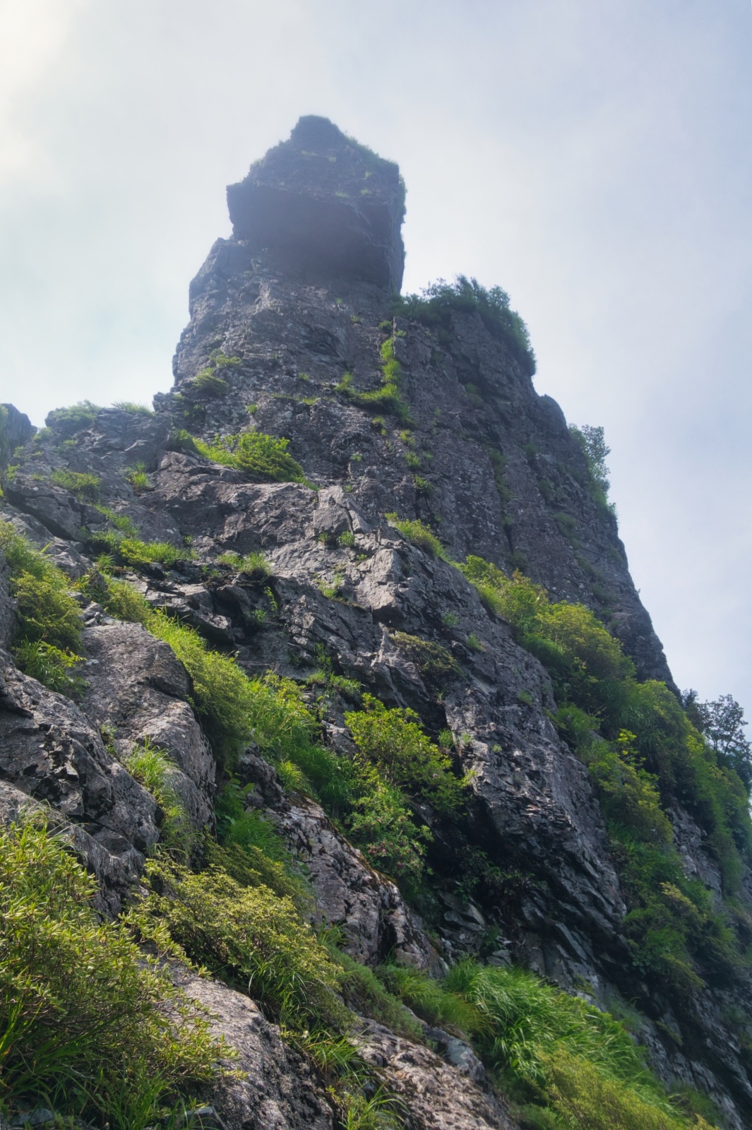
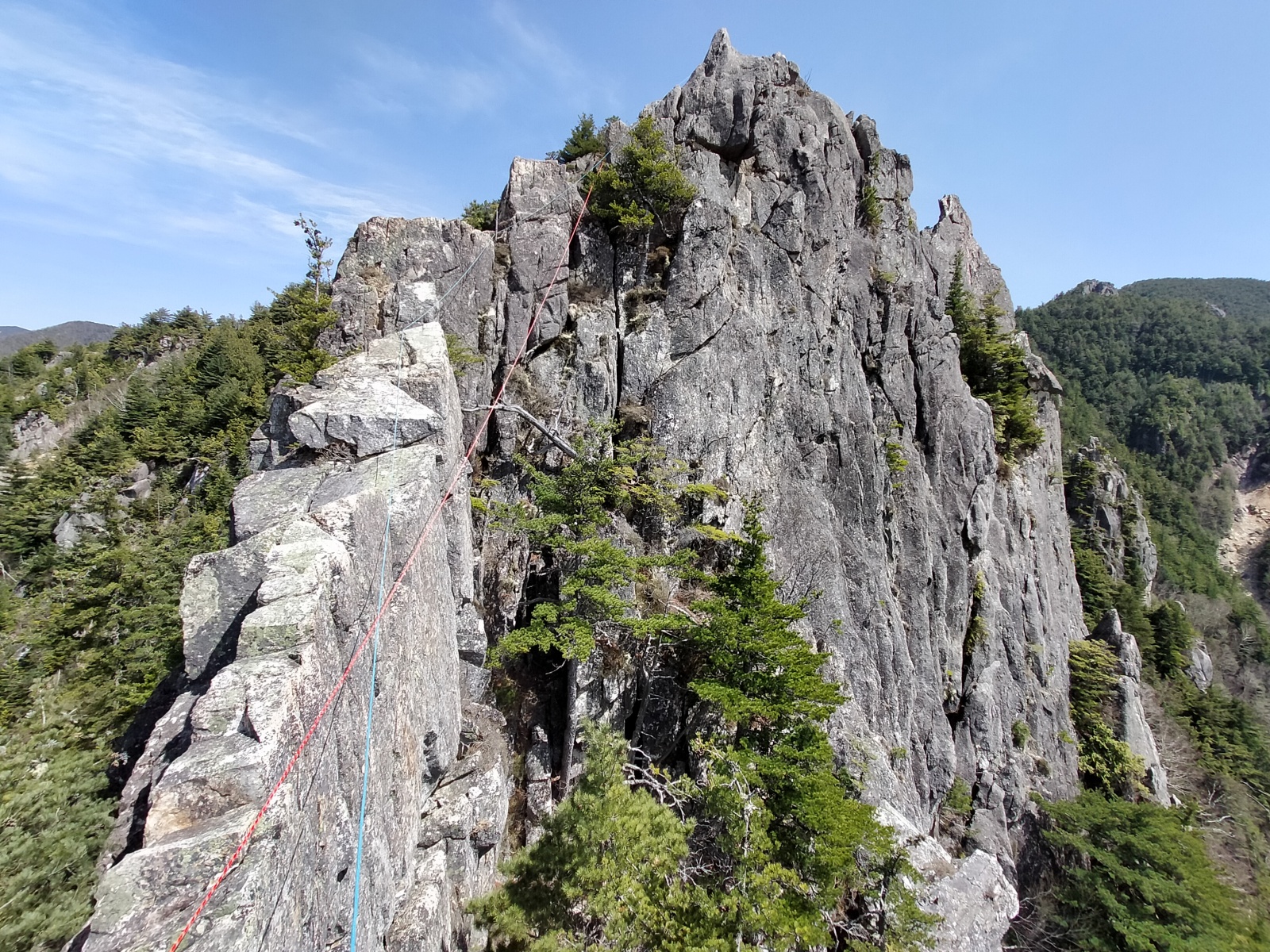
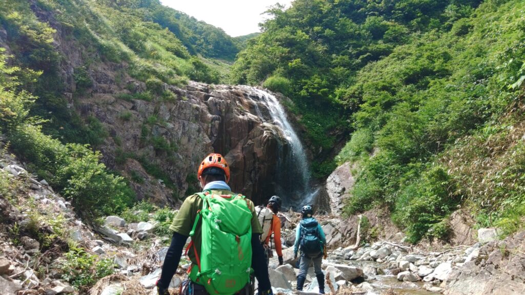
As the black rock towers of Kurogane-ganpō came into view, the canyon character brightened. The walls fell back, and light began to reach the valley floor. This is where Sasaana-zawa reveals its true character.
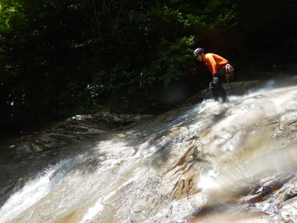
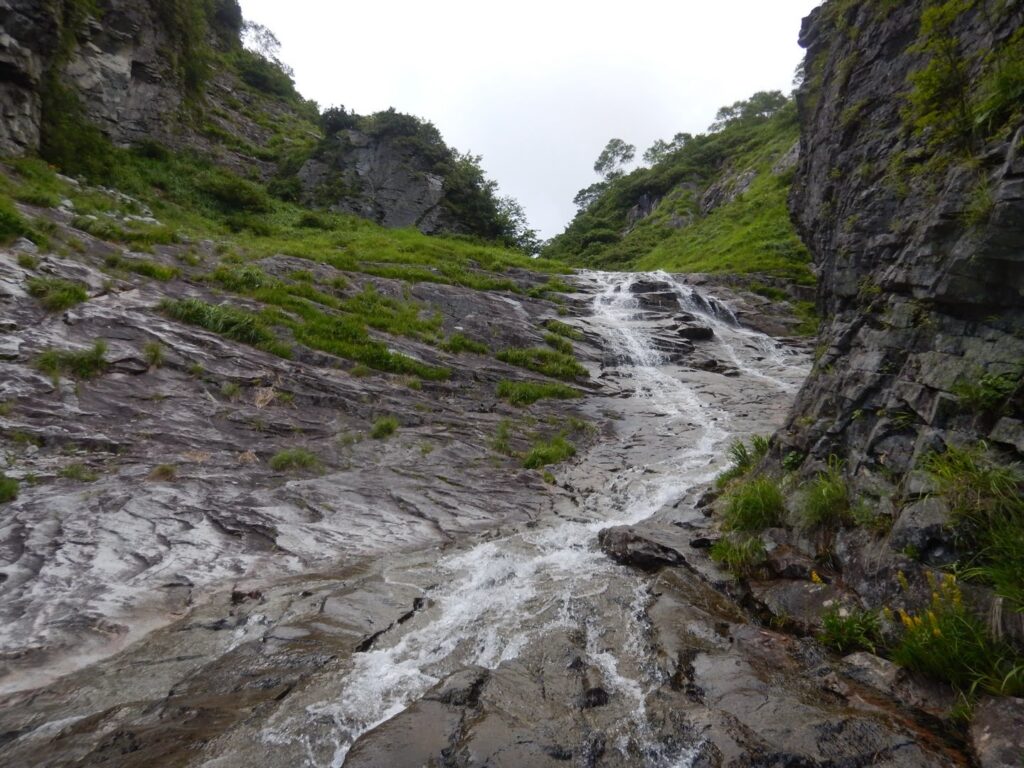
Name (water-polished slabs) stretched before us like natural waterslides, thin sheets of water flowing over smooth, sculpted rock — a section to be savored. The water in late July was, contrary to expectation, not brutally cold; dipping a hand in, one felt a pleasant coolness, nothing more. Hakusan-kozakura (Primula cuneifolia var. hakusanensis) bloomed in white clusters from crevices in the rock, celebrating summer at its peak. The gorge in summer is a world of green, water, and flowers.
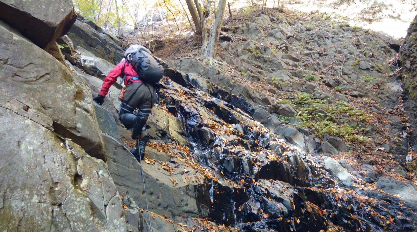
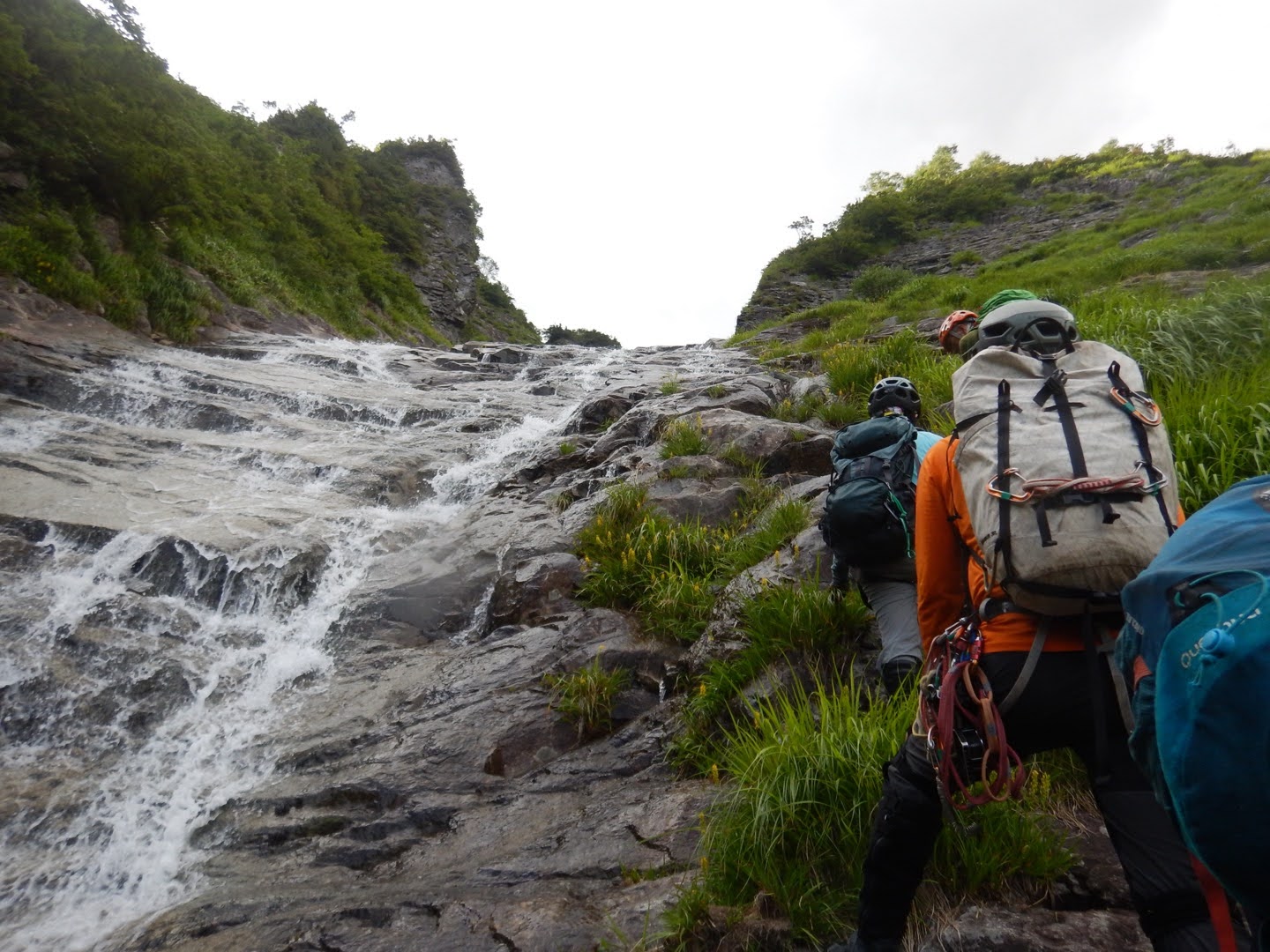
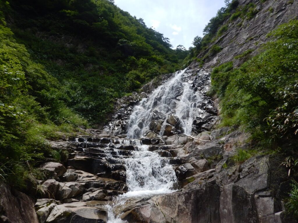
But the respite was brief. A two-tier, 30-meter waterfall stood before us. I looked up at the waterline — the rock glistened, thick with Numeri (slime-coated rock). This proved to be the section that gave us the most trouble on the entire route. I caught S’s eye. No words were needed. We both understood: take it carefully.
We first engaged the right wall. T led, climbing the slime-coated rock face with deliberate precision, eventually clearing the two-tier 30-meter fall and pulling through to the top via the right wall.
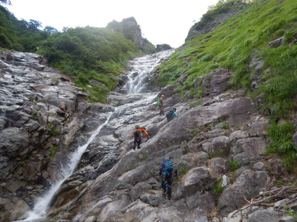
But the real trials lay ahead. A 10-meter fall bypassed via a Runze (couloir) on the right, then a 4-meter stepped section, then a 10-meter fall climbed from the left of the waterline. Fighting the uncertainty underfoot, searching carefully for each hold, my fingertips reading the texture of the rock — here? No. A bit higher. The slime tried to slide my feet out from under me. One step at a time. The climbing became a battle of concentration.
“You good?” T called over. “No problem,” I answered. In those brief words, there is trust. No rushing. My own pace, steady. That is the only road to safety.
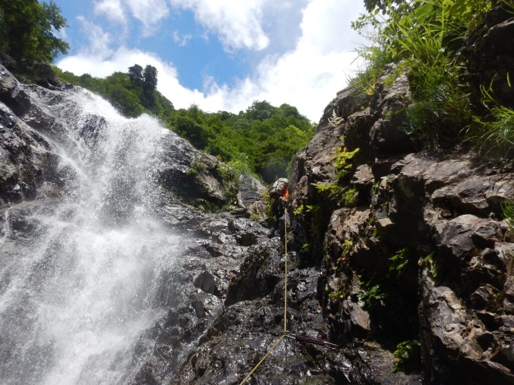
The falls kept coming. Ten meters, seven meters, 20 meters via the left wall, four meters, then 50 meters via the right wall — one massive fall after another. This was no longer mere upstream travel. We had entered terrain that demanded genuine climbing technique.
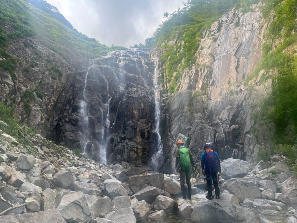
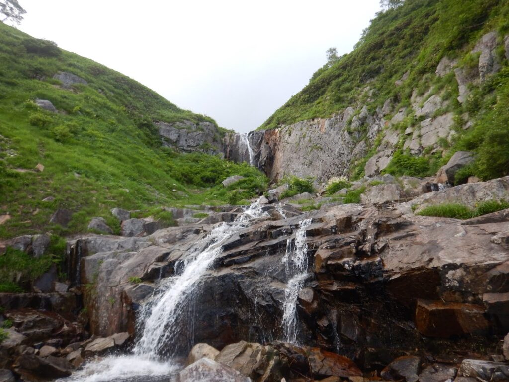
And then came the centerpiece: the great slab fall, 120 meters. Looking up, a white wall of water soared toward the sky — like an enormous bolt of white cloth dropped from the heavens. We engaged from the right of the waterline at the base. Spray battered our faces. Partway up, we traversed left. The rock was nearly vertical, holds sparse. How much energy we burned getting through this section, I couldn’t say. But turning back was never an option. We kept climbing. One step, then another, steadily gaining height. There was nothing else to do.
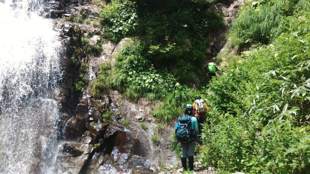
Even after the succession of great falls, the gorge gave us no rest. Twenty meters, seven meters, six meters, four meters, then a final 10-meter fall bypassed on the right bank — we processed each one in turn. Counting had ceased to be meaningful. All that remained was the work: clear each obstacle, one by one.
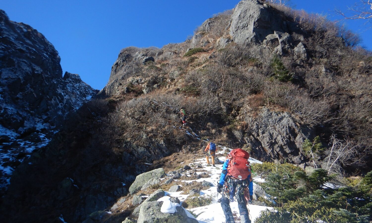
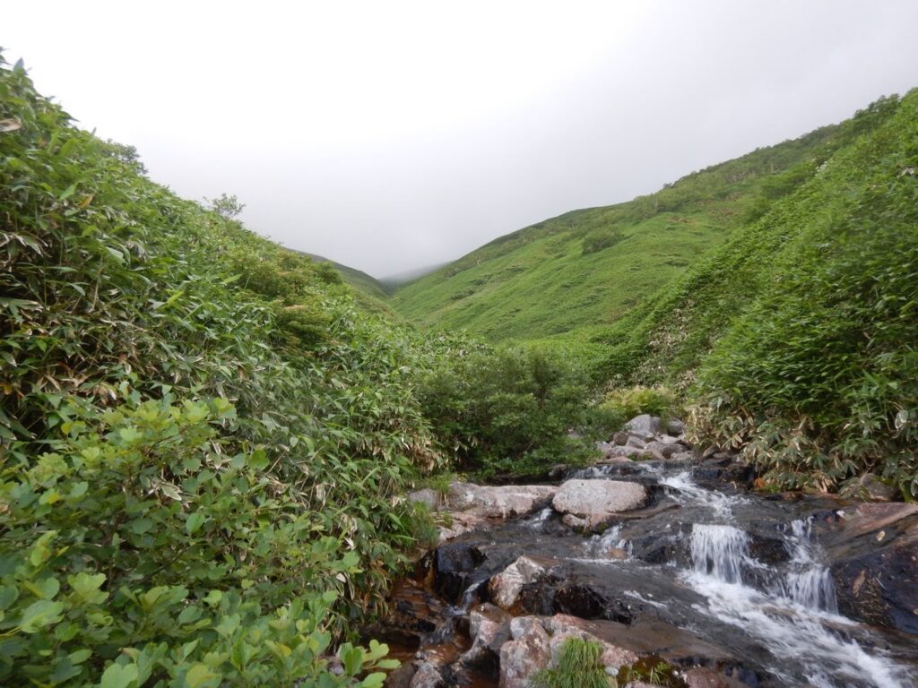
The headwall exit brought us up to the southern ridgeline of Mt. Taira-ppyō-yama. The instant we crossed the tree line, the world transformed. An open landscape of wind-rippled Chishima-zasa. Wide sky. A through-breeze. The sense of liberation that follows a long climb is something that never grows old — released from the enclosed world of the gorge, lungs filling with the free air of the ridge.
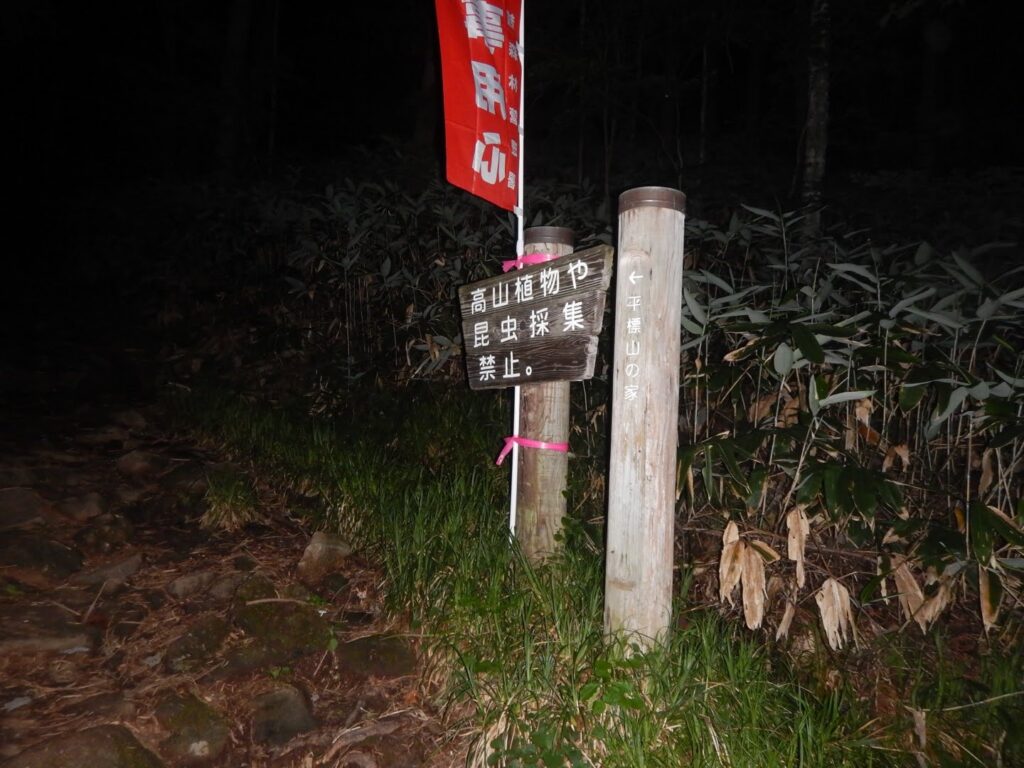
But there was no time for relief. It was already past 8:00 PM. The sky had begun to dim. By the time we rejoined the trail, headlamps were necessary. We descended through Taira-ppyō-yama-no-ie toward Hiramotoshin-dō Trailhead. Fatigue pressed heavily on every limb. Even so, we could not stop moving.
Should we push harder and accept some risk, or maintain caution and prioritize safety even at the cost of time? The answer was never in doubt. Safety first. Rushing invites stumbling and route-finding errors. Trusting our headlamps, we descended one careful step at a time. Haste is the enemy.
We passed Iwana-zawa Forest Road Gate and Taira-ppyō-yama Trailhead Bus Stop, arriving at the Taira-ppyō-yama Trailhead parking area at 10:10 PM. Total elapsed time: 15 hours and 44 minutes, including just 49 minutes of rest. We had been moving, almost without pause, for an entire day.

At the parking area, presumably Fuji Rock attendees — even well into the night — milled about in numbers. Car doors opening and closing, laughter, the faint echo of music carried on the air. Tomorrow was the festival’s final day. Noel Gallagher would take the stage before tens of thousands. A festival of music and a stream climbing ascent. Same moment, same region, each in pursuit of a different heat. Their frenzy and our quiet battle. Neither is more righteous than the other. People simply seek, each in their own way, a life fully lived.
We set up tents in the same spot as the night before and settled into our second night of camping. The relentless succession of great falls, the ever-present challenge of slime-coated rock — the qualities that define a Tanigawa Range classic. A day of midsummer stream climbing, completed.
[LOG SUMMARY]
[GPS Data Usage Notice]
The GPS data published in this article is a record of our specific trip on that day. Please note the following: