【Deep Dive Chronicle】Sukkan-zawa & Sakura-zawa: Ascending the Azure Stream in September
北村 智明
稜線ディープダイブ
A midsummer ascent of Kitanomata-zawa on the Kakkonda River, deep in the Hachimantai highlands. We climbed one of Japan’s storied “100 Best Gorges,” traversed the Oshiromori wetlands, and descended the Akedōri-zawa in a two-day circuit — two days dense with gorges, fishing, alpine marshes, and the quiet pleasure of a gentler stream. A July chronicle of sawanobori (Japanese stream climbing) at its most elemental.
We left Miyagi the evening before. Driving north from Sendai along the Tōhoku Expressway toward Hachimantai, we ran into an unexpected obstacle: the tunnel just before our destination was closed for nighttime construction. There was nothing for it but to pitch tents on the roadside and turn in at 2:00 AM.
Late July had brought record-breaking rains to northern Tōhoku. Landslides had been reported in Akita. There was genuine uncertainty about whether our plans would survive the weather. But the forecast called for clear skies, and we pressed on — cautiously.
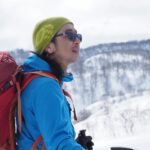
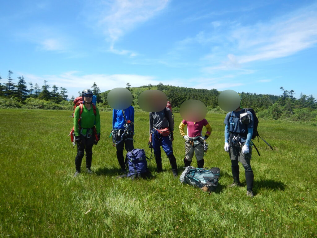
At six the next morning, we were up. Our team was six: S, S, O, K, and Y, plus myself. I dropped the others at the gate and drove alone to the parking area at Takinoue Onsen.
Kitanomata-zawa on the Kakkonda River has its headwaters in the Hachimantai massif of Iwate Prefecture. Listed among Japan’s 100 Best Gorges, it is known for its generous water volume and bright, open gorge character — a classic stream climbing objective with a long history. Takinomata-zawa, an adjacent stream, was once more popular, but a prolonged closure due to volcanic activity regulations in the Heisei era shifted attention to Kitanomata-zawa, and the stream’s reputation has only grown since.
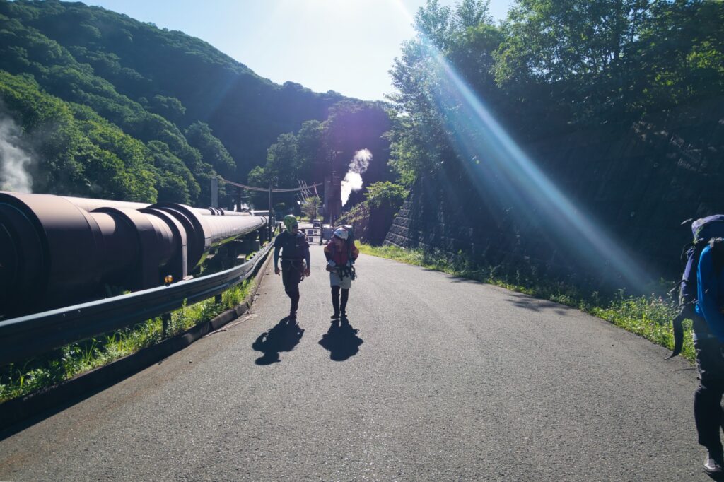
The Kakkonda Geothermal Power Plant serves as the trailhead. We followed the paved forest road, crossed a check dam, and spotted a pink trail marker. Following the faint path, we entered the stream.
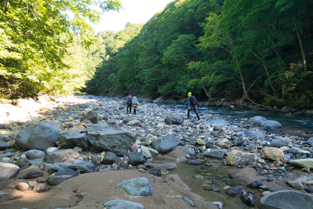
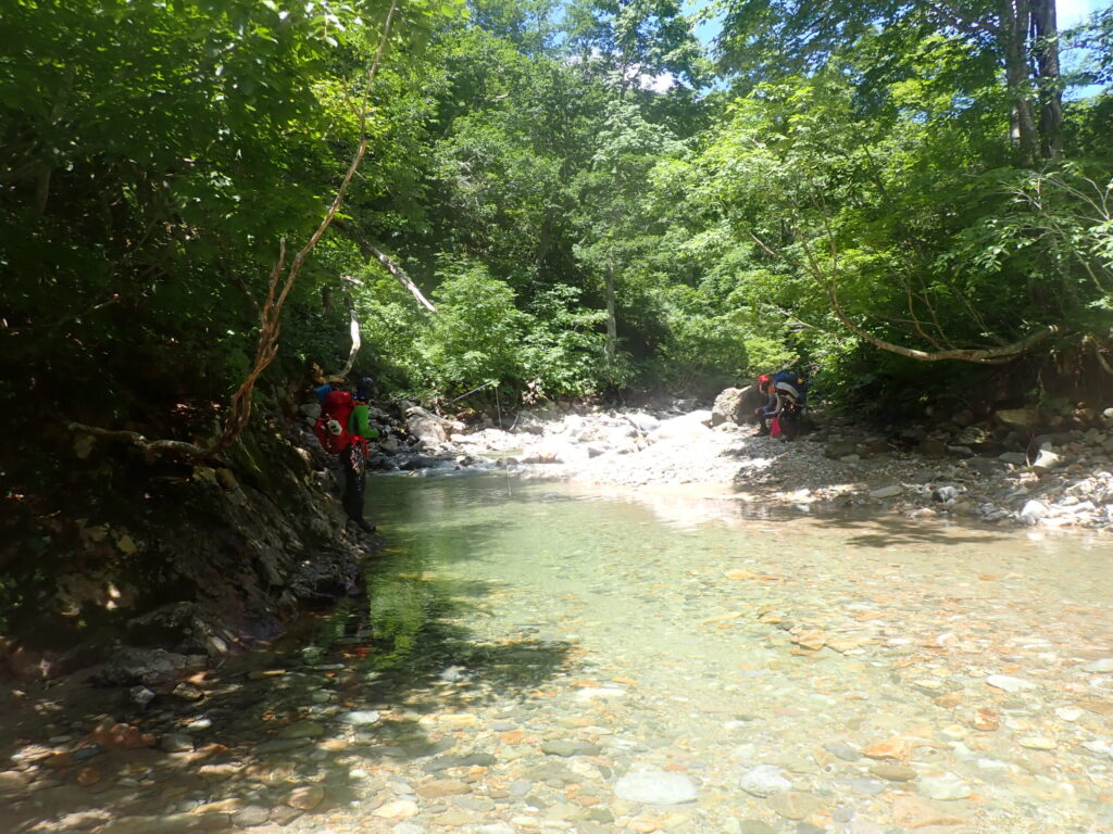
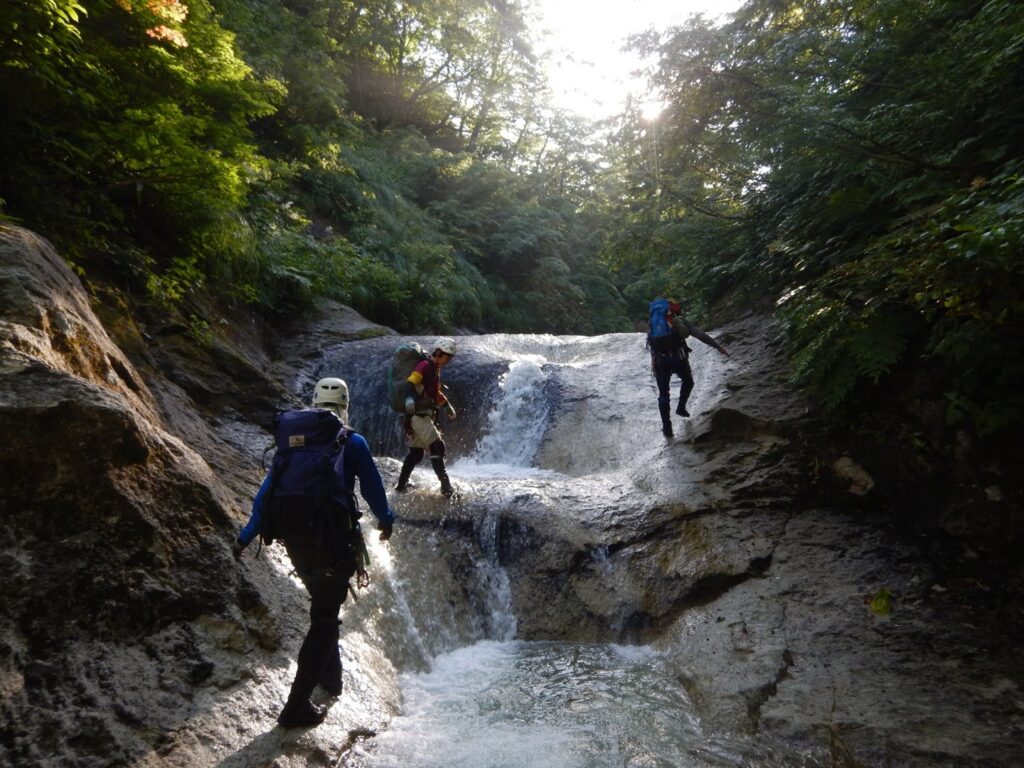
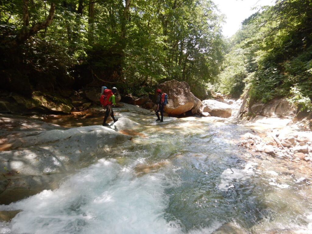
The water was powerful. It hadn’t rained in some days, yet the volume was formidable. We crossed and recrossed the current, each footstep deliberate on the slippery rock. Cold water wrapped around our ankles. The sound of the river filled the valley; the smell of wet earth rose from the stone. On both banks, the forest ran deep — dense Buna (Japanese beech) and Mizunara (Japanese oak), their summer green throwing shadow across the streambed.
We moved through boulder fields (goro), crossed again, and kept walking. Repetitive, yes — but this is the essential grammar of stream climbing. We read the rock with the soles of our feet and found our rhythm.
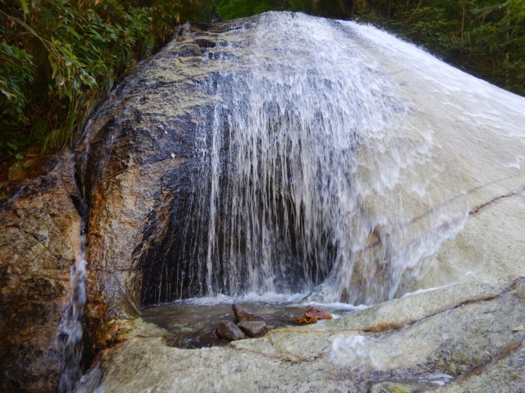
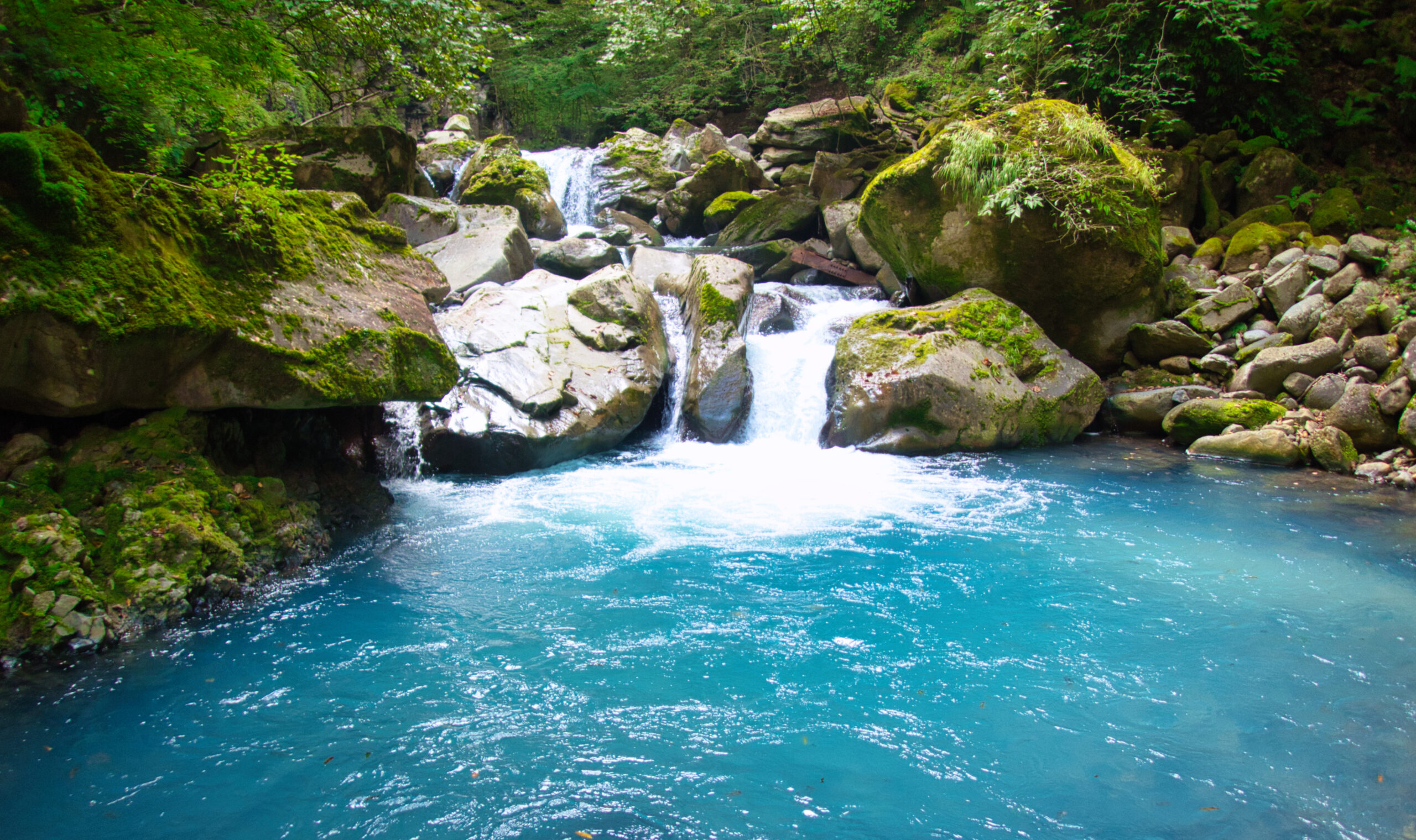
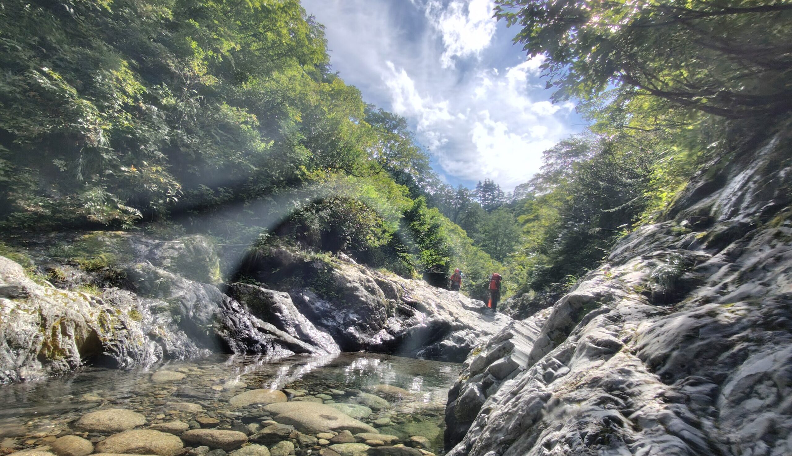
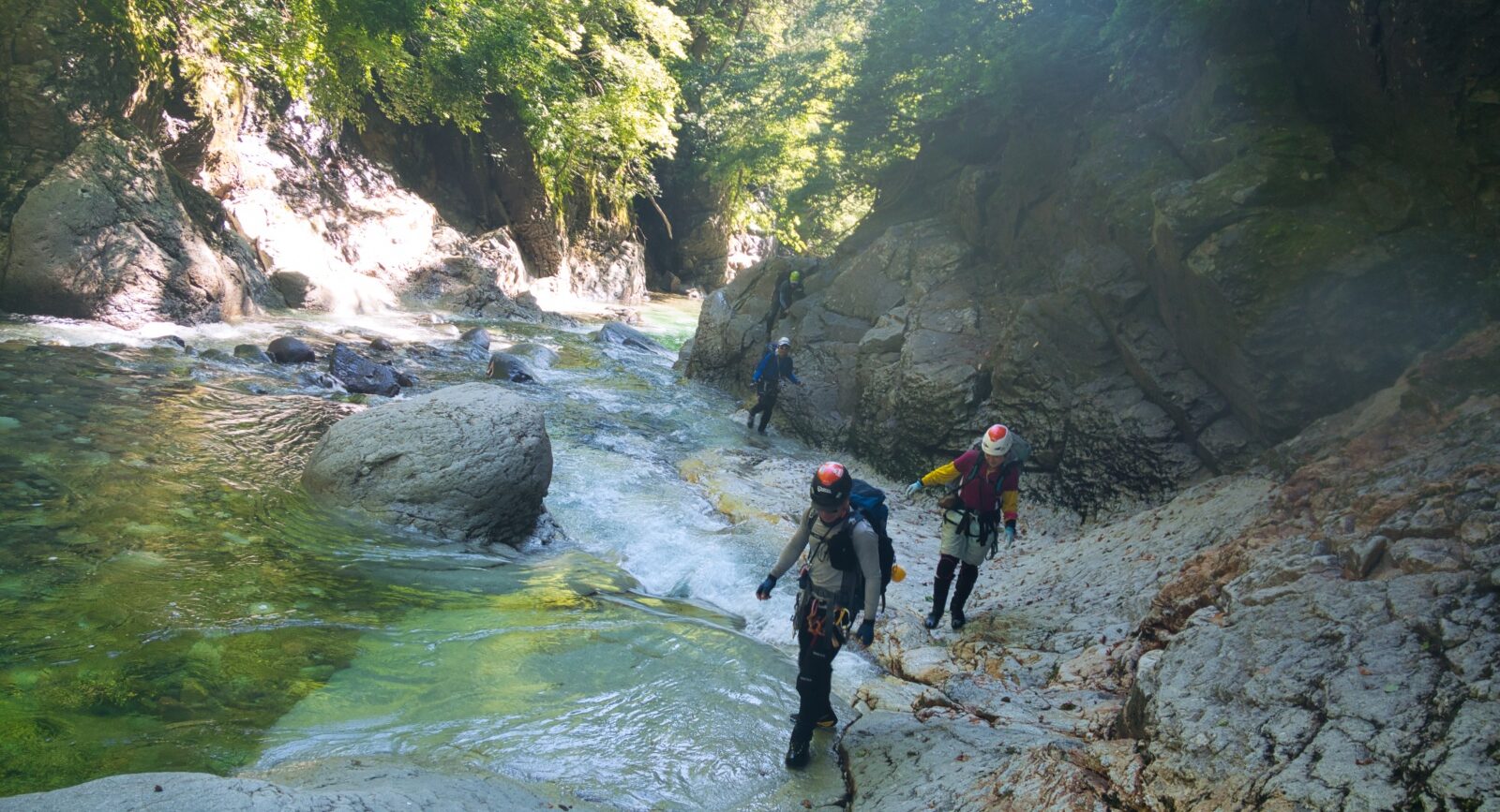
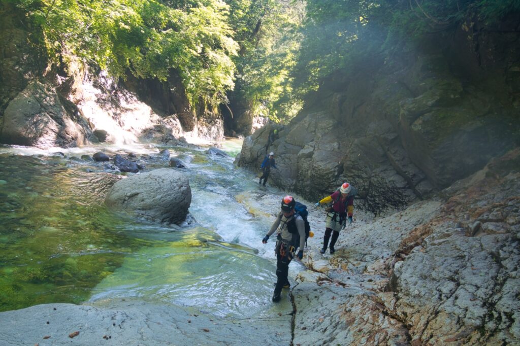
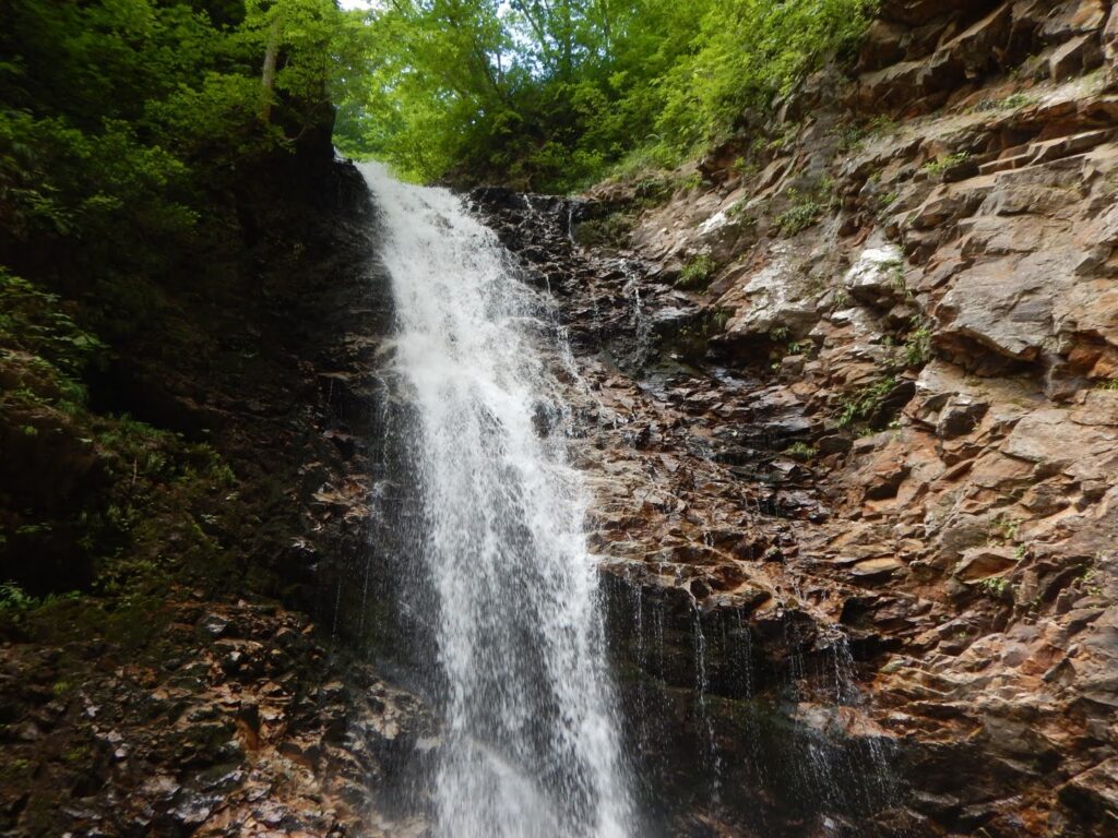
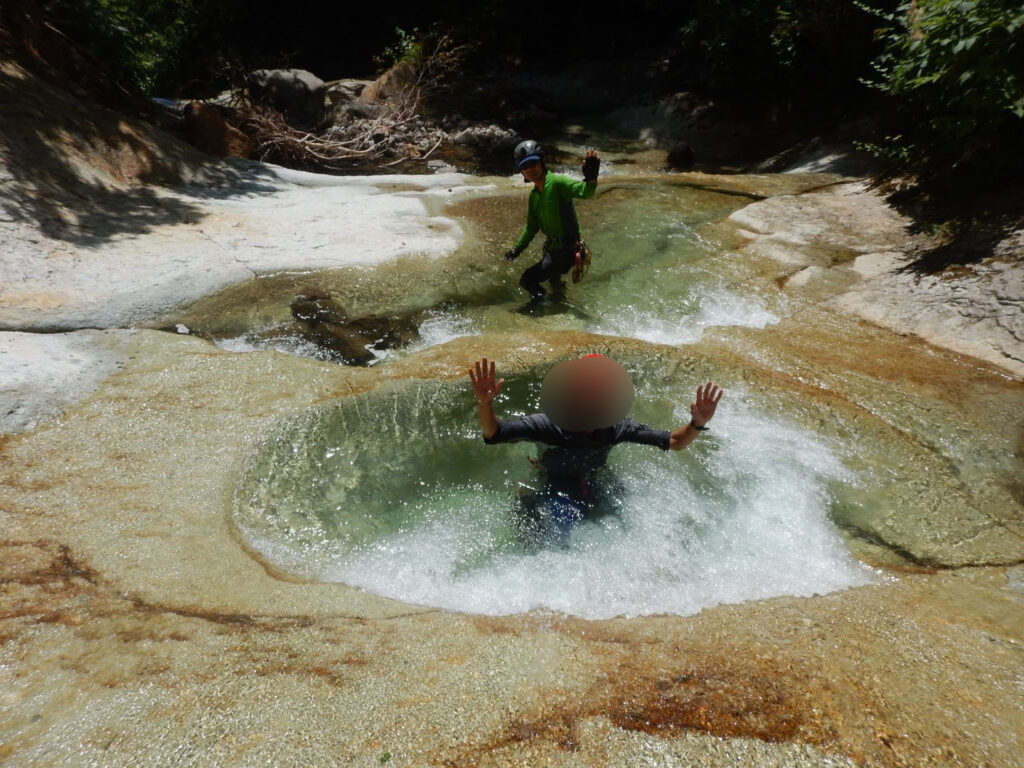
Past the confluence (futamata) with Akedōri-zawa, a waterfall appeared: the Dokuro-taki, or “Skull Falls.” The name is grim; the falls are not. Light poured in, mist whitened the air, and the sound of water against rock was enormous. Beyond it, we entered the gorge (gōrju) known as Ohako.
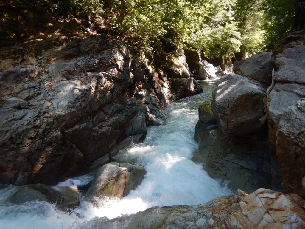
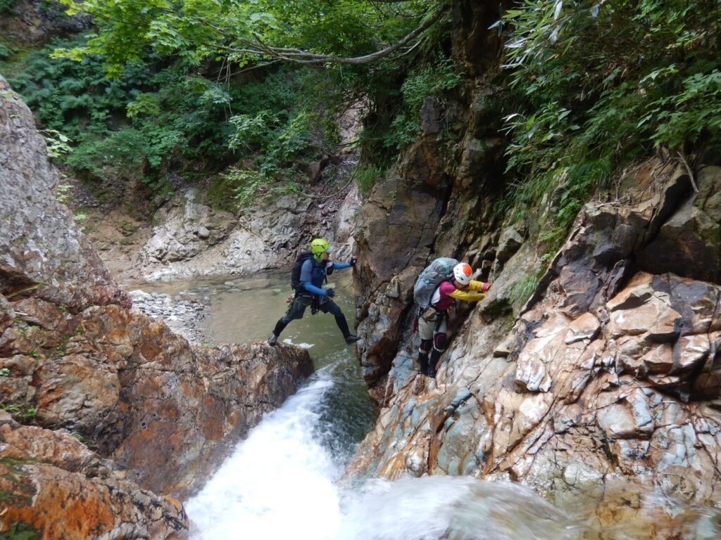
A bright gorge. The walls rose high on either side, yet the canyon floor was well-lit. With water this high, a slip meant being swept away — this section had seen a fatal accident in the past. We moved single file, checking each other’s footing, placing each step with full attention. The rock was slick. If you went in, you would not stop. The anxiety was real. But turning back was not.
At the confluence with Oishi-sawa, we saw a single tent pitched on the bank. Here the water volume halved — the two tributaries divided what had been the main current. The flow eased, slightly.
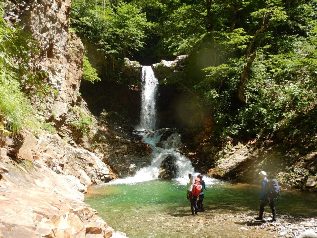
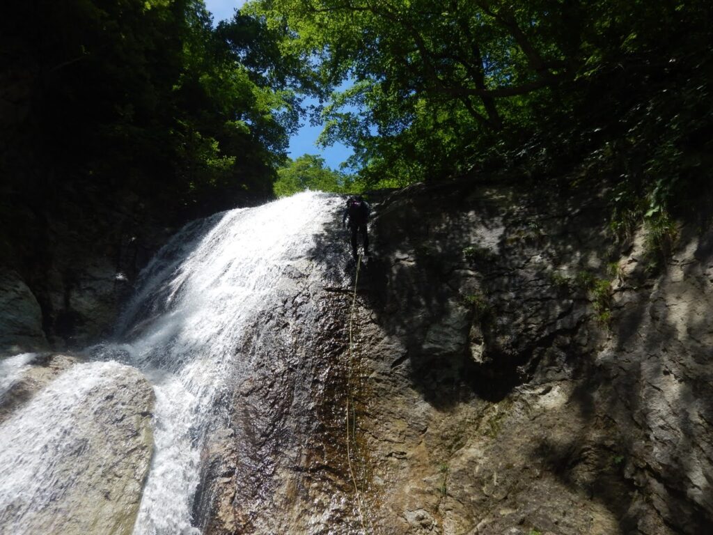
At the base of Kakkonda O-taki — the great waterfall — we encountered a local fly fisherman. His Iwate dialect was warm and unhurried. “There are fish in that pool,” he told us. We’d seen no fish sign until now; above, it seemed, the prospects improved. With his blessing, we bypassed the falls via a maki (bypass) compactly up the left bank, gaining height carefully with the roar of the cascade at our backs.
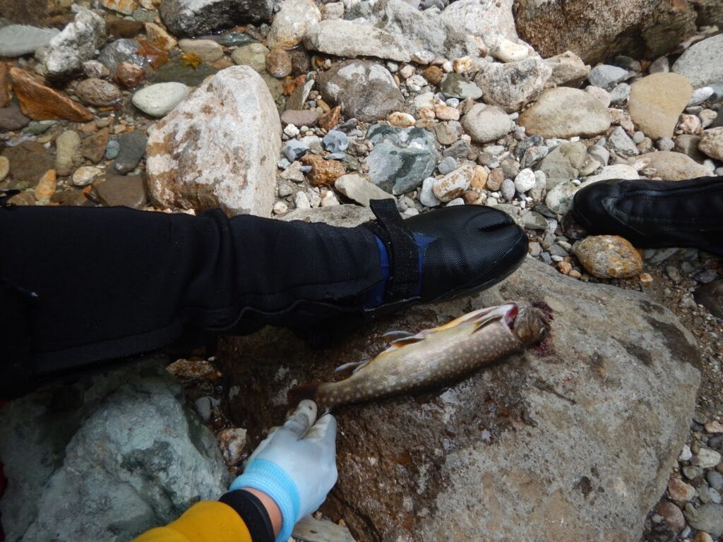
Above the great waterfall, we entered the middle reaches — and the fishing began. There were few large plunge pools (kama), but even in the gentler riffles and calm sections, the fish were present. Small ones, mostly. Y and I were tasked with catching dinner for six, and we fished hard.
I worked a lure; Y alternated between bait and tenkara fly fishing. My weapon of choice was a D-Contact 50 in chart yamame coloring. I’d lost my spinner earlier in the day — a painful setback — but the minnow drew strikes.
Cast by cast, I read the water: the surface tension, the shadow beneath an undercut bank, the seam where the current slowed. I retrieved the lure through likely-looking lies. On one cast, a firm take. The rod tip loaded. I played the fish up carefully: an Iwana (Japanese char, Salvelinus leucomaenis) of about twenty centimeters, silver flanks catching the light as it broke the surface.
Y pulled fish after fish with his bait rig. His tenkara rod described elegant arcs. Fishing while climbing a stream — this, too, is part of what makes sawanobori what it is.
In the end, we had six fish between us. The largest measured twenty-five centimeters — a good one. We had done our part for the evening meal.
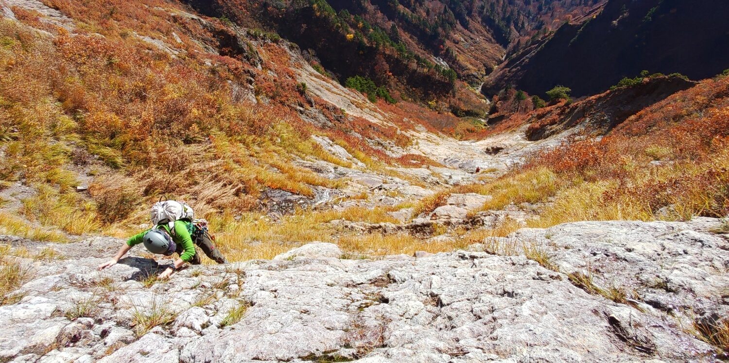
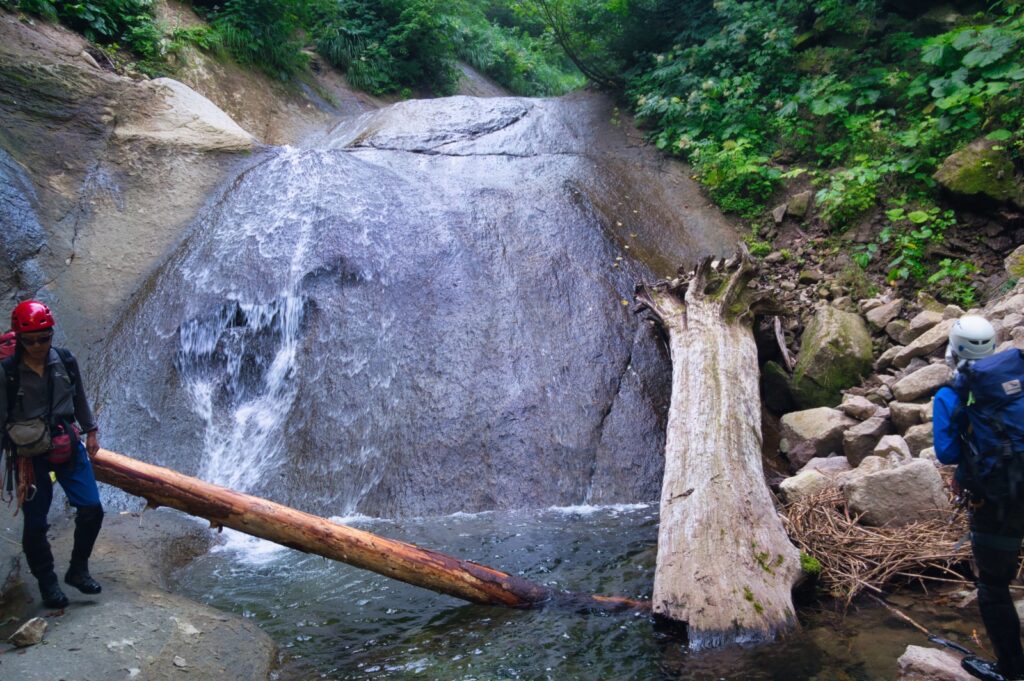
Past 2:00 PM, we reached a fifteen-meter waterfall. The route along the suisen (waterline) on the right looked potentially climbable, but we opted for a bypass (maki) via a small ridge on the right bank. It was serious terrain. The footing was unstable, the holds unreliable. We gripped the brush, shifted our weight with care; dead leaves skidded underfoot. A misstep at this height would mean a fall. We moved one at a time, each person established before the next followed. No one relaxed until the last climber was through.
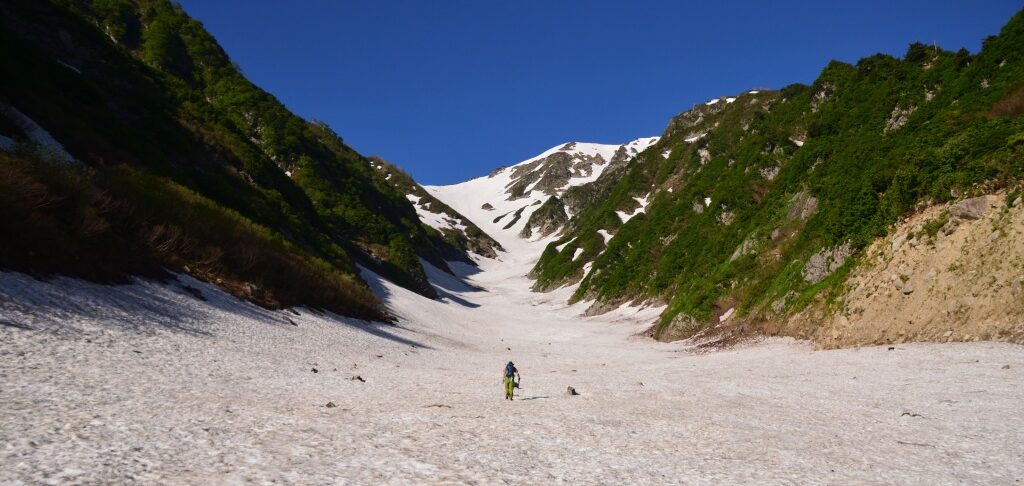
Above the falls at Takinomata-sawa confluence, the stream gentled again. Water volume dropped further; the ascent became easier. The vegetation around us shifted with the elevation.
At around 920 meters, on a flat section of the right bank where the contour lines eased, we found a bivy site. Modest — no mountain hut could envy it — but wide enough for six to lie down.
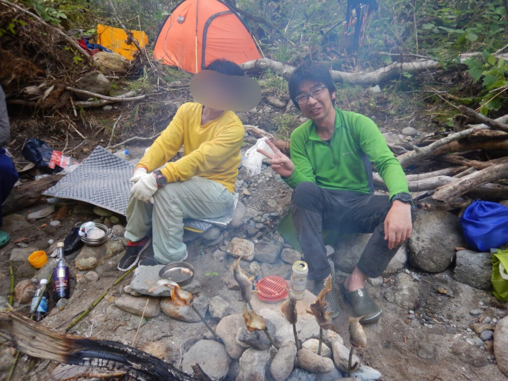
As evening came, we built a fire. We threaded the Iwana on skewers and grilled them with salt. Tending the flames, we talked through the day’s climbing. Half-asleep from the previous night’s short rest, the warmth of the fire and the smell of crisping fish skin were enough. The char was perfect: skin crackling, flesh tender. The taste of something caught and cooked in the mountains is its own category.
The valley bottom cooled rapidly. The fire’s shadows danced on the rock walls.
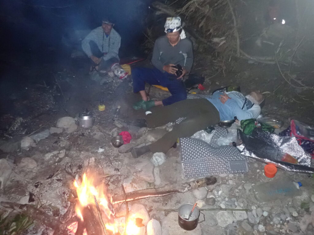
At 10:00 PM, we slept. Above us, the full breadth of the Milky Way was visible. In the city, this sky doesn’t exist.
Day two. We started at 7:00 AM, following the right fork (migi-mata). The route description in Japan’s 62 Classic Gorges was sparse on detail, but the terrain held more waterfalls than the guide suggested. We climbed each in turn — none higher than about five meters, but none to be taken lightly. Water volume had dropped, yet the rocks remained slick with moss and numeri (slimy coating on rocks).
We climbed water-polished slabs (nametaki) and pushed through small gorges. At every fork, I checked the topo. Right, and right again. The ridgeline was ahead.
Near the headwaters, the stream dissolved into dense, winding scrub. When the water ran out entirely, I decided it was better to ignore the creek channel and push directly uphill. For a stretch we fought through bushwhacking (yabukogi) — branches across the face, the ground invisible underfoot, bamboo grass (sasa) dense enough to require real effort with each step. But we were gaining elevation. Not far now.
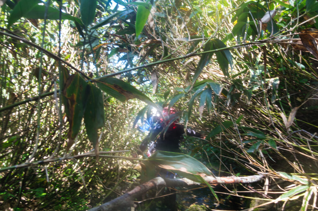
And then, without warning — the brush parted, and the world opened.
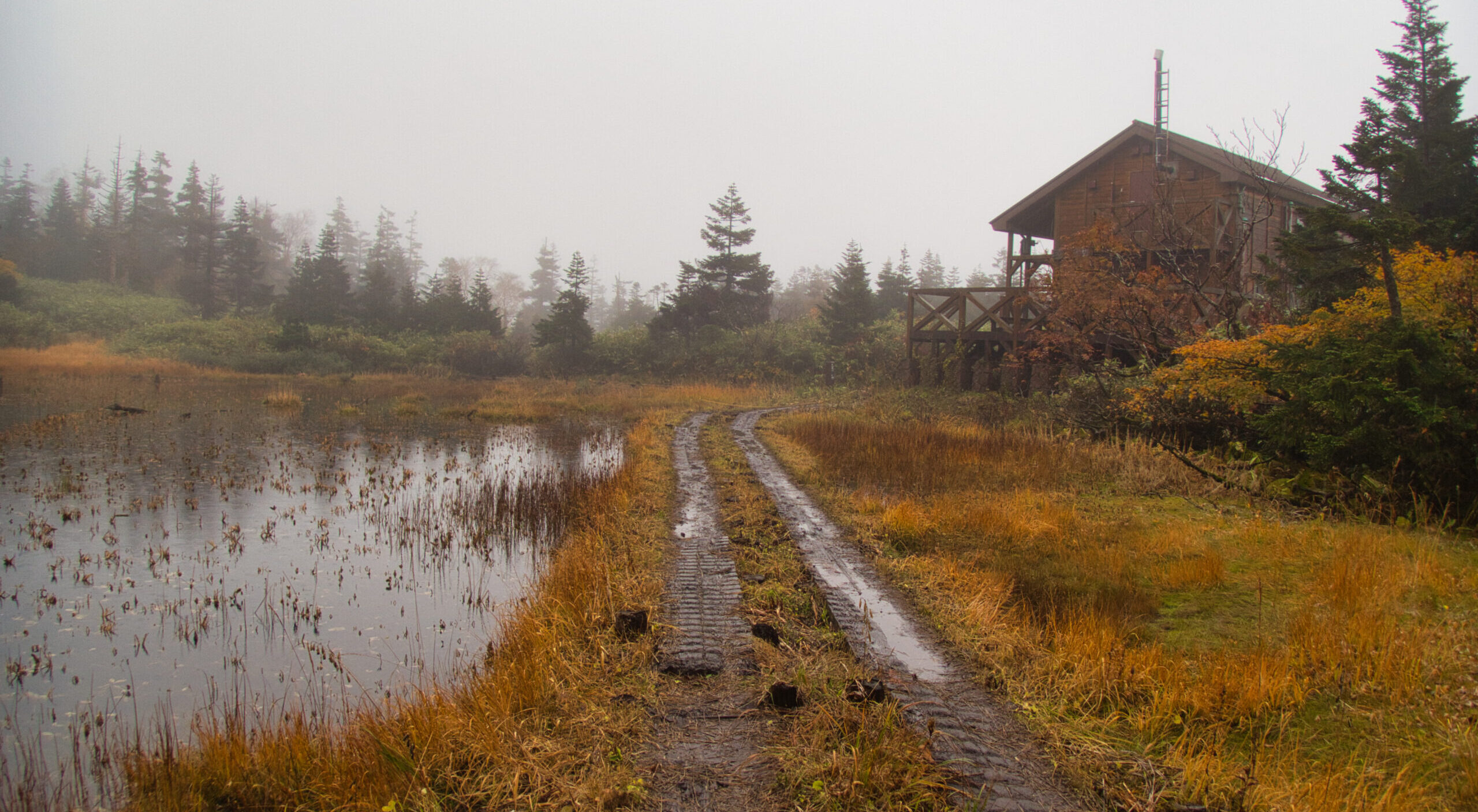
The Oshiromori wetlands. Not boggy underfoot, but a relatively dry highland marsh, receiving us like an enormous green carpet after the valley we’d crawled up from. Wetland sedges and grasses moved in the wind. We sat, ate, breathed. A breeze crossed the open ground. The struggles of the climb felt, in an instant, repaid. Blue sky overhead; the ridgeline of Hachimantai visible in the distance. Silence, holding everything.
After a full rest, we began the descent. Our route: Akedōri-zawa.
The descent started through more scrub. After about thirty minutes the brush thinned and water reappeared — Akedōri-zawa, beginning as a trickle and growing steadily as we descended.
True to its name — “Bright-passage Stream” — Akedōri-zawa was luminous. Sunlight scattered off the moving water. Moss-covered rock, a gentle current, the green of overhanging trees. The flow slid over stone the way water moves over smooth porcelain. Everything here was soft, unhurried. The contrast with Kitanomata-zawa’s muscular force from the day before was remarkable — the same mountain range, two entirely different personalities.
We rappelled (kensui-kakō / abseiling) three times down small waterfalls, each around ten meters, each straightforward and pleasant. One person at a time, the rope set, the anchor clean.
Where a side stream joined, we merged back into the main current. Volume increased. Spotting an old wooden bridge, we climbed out to the left bank and hit the forest road. About an hour of walking brought us back to the Kakkonda Geothermal Power Plant. 3:00 PM. Down.
After descending, we drove to Takinoue Onsen Takikan. Seven hundred yen, and into the bath. Two days of sweat and effort dissolved into the water. Through the window, the Kakkonda River was visible — the same stream we had been walking just a few hours before.
Gorge. Fishing. High bypass. Bivouac. Campfire. Bushwhacking. Wetlands. Two days that held everything sawanobori can be. The gentle current of the Kakkonda flows on in memory.
LOG SUMMARY