【Deep Dive Chronicle】Kaba-san — The Mountain of Tengu, A Winter Pilgrimage
北村 智明
稜線ディープダイブ
In mid-August, I set out alone for the main stream of the Uonogawa in Oku-Shiga. A tributary of the Nakatsu River in the Shinano River watershed, this stream is renowned among sawanobori (Japanese stream climbing) enthusiasts for its successive gorges and abundant fish. I drove from Fukushima to Lake Nozoriko, then threw myself into a grueling approach and three days of upstream travel. This is the record of that journey.
目次
I pulled into the parking area at the Nozoriko viewpoint and visitor center in the early hours of August 12th. Prefectural staff were on-site promoting the Kenkyō Ridgeline Trail, and I informed them of my intended entry into the mountains. The day before, Japan had begun releasing treated water from the Fukushima Daiichi Nuclear Power Plant into the sea — the world outside churning with controversy, while the mountains stood as unchanged as ever.
I crossed Jizōtōge (Jizō Pass) and headed toward Mt. Nishi-Okura. The trail was swallowed by brush, and I lost my line more than once. The summer heat showed no mercy — I came perilously close to heat exhaustion, gulping water and resting for fifteen minutes. Calling for rescue before even entering the stream would have been unthinkable.
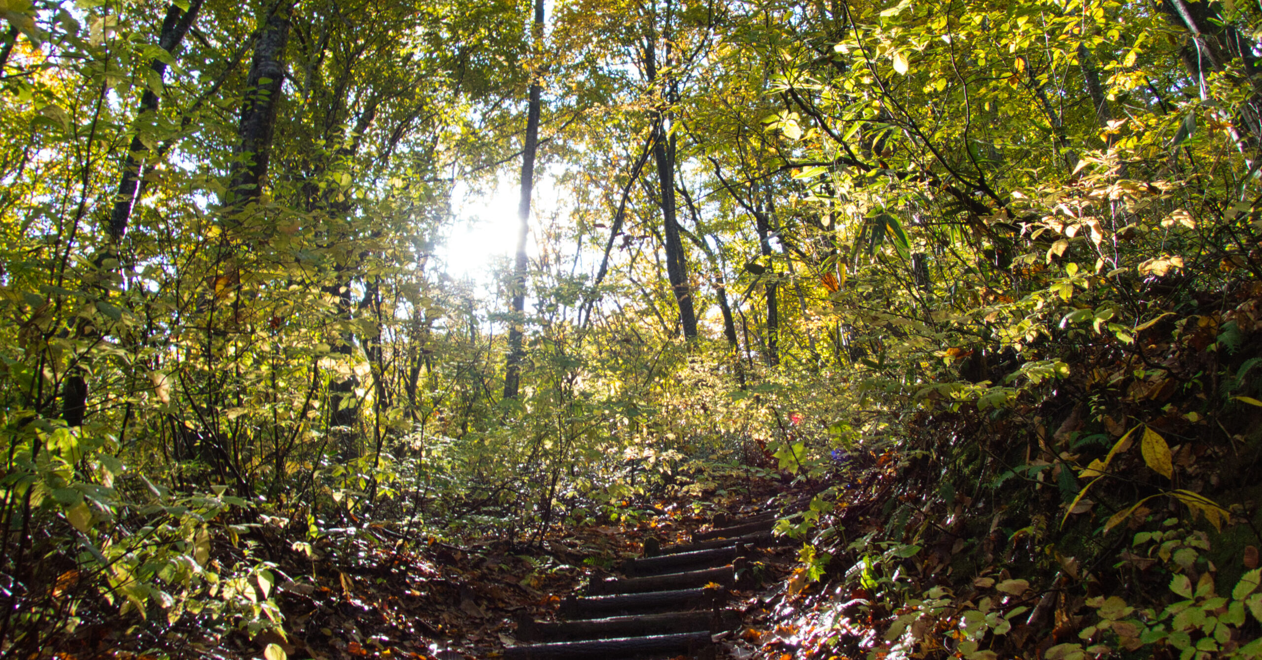
The descent opened into a pleasant trail. I pushed through the brush from the ruins of what appeared to be a small hut and entered the stream. I could have continued to the dam, but this felt like the right entry point.
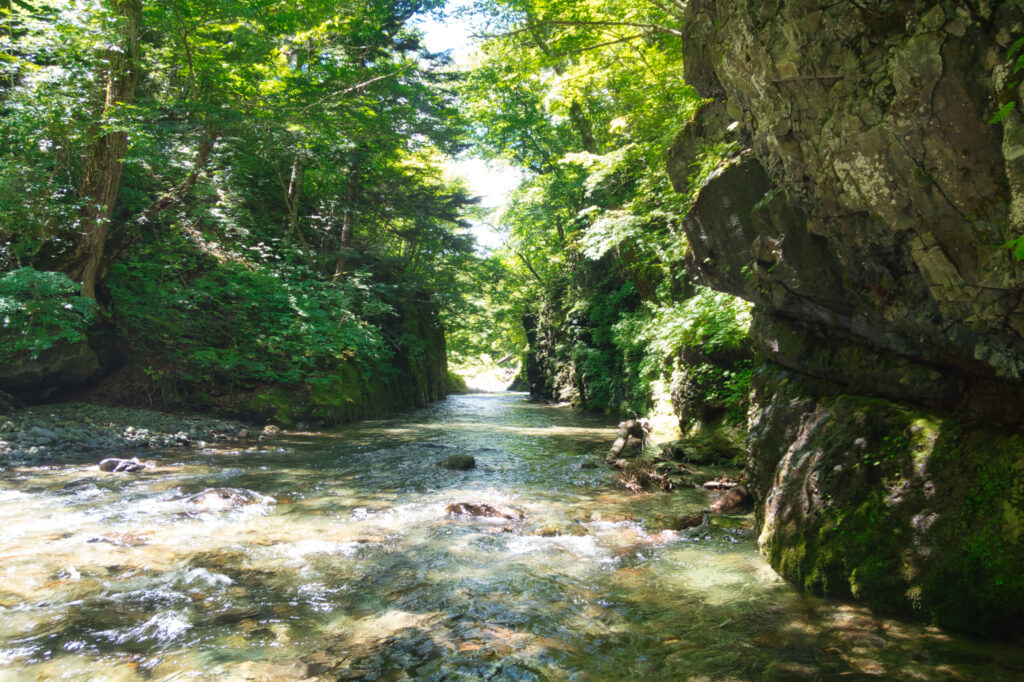
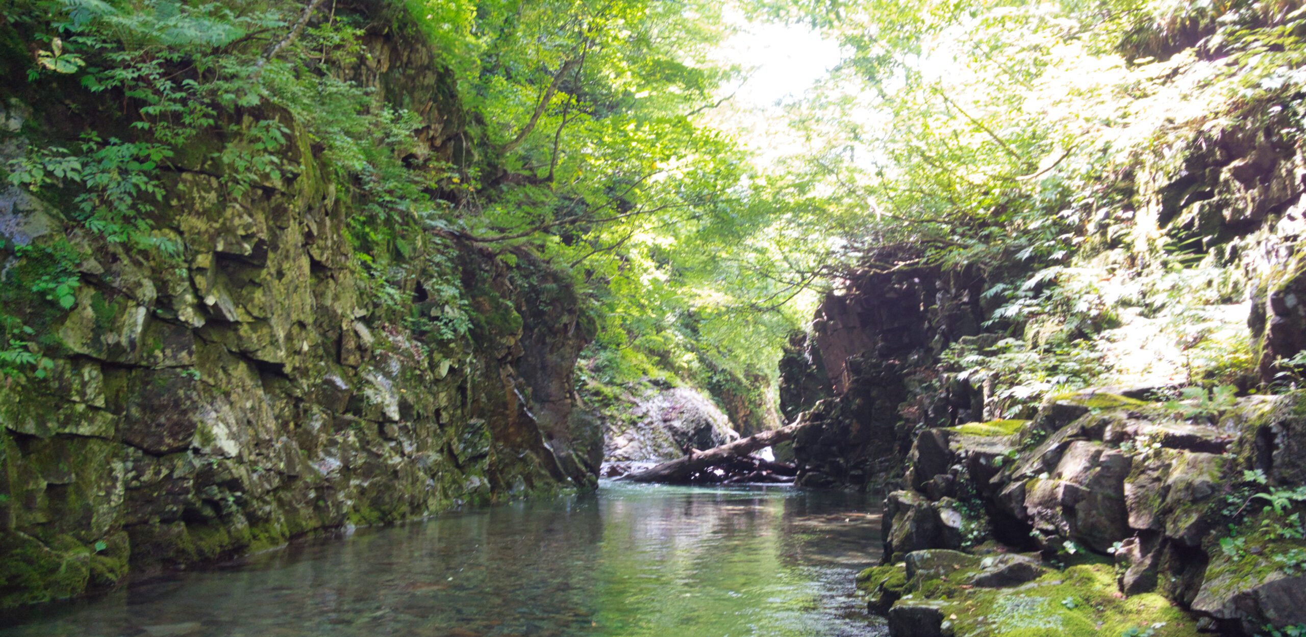
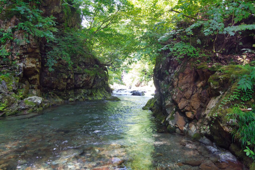
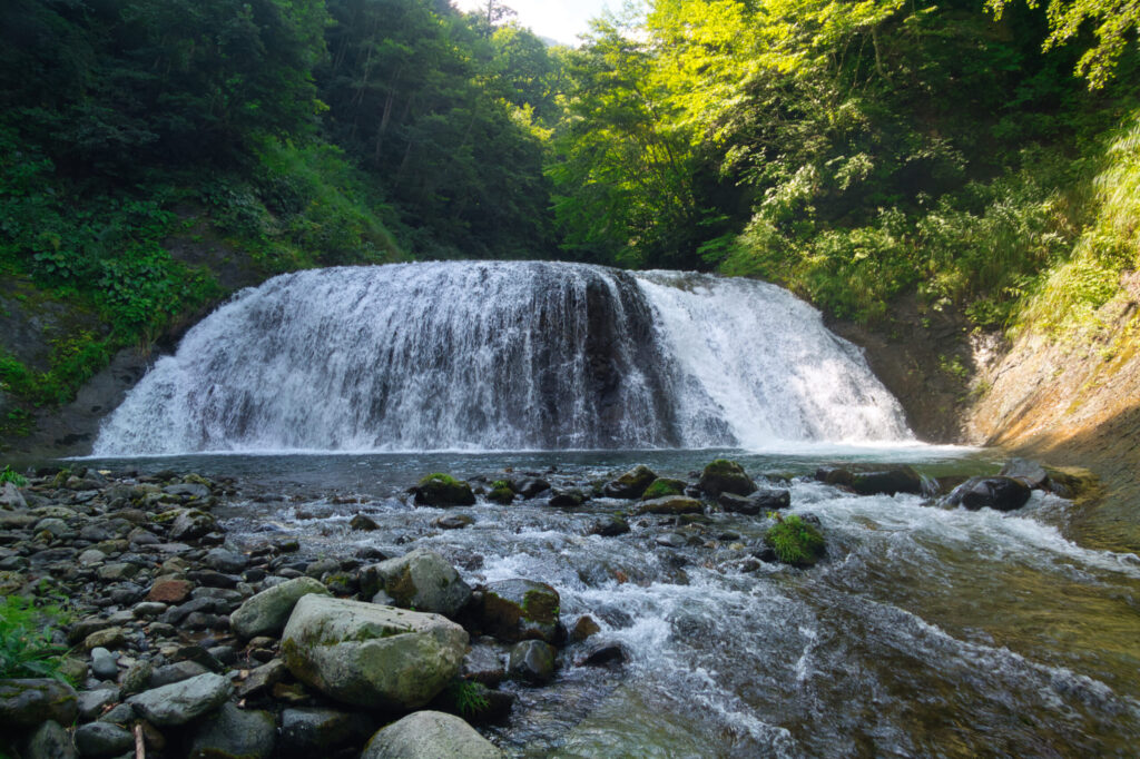
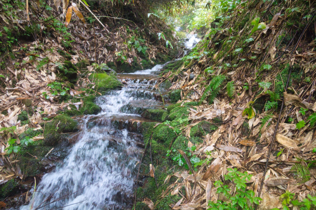
The river was substantial — not quite the volume I had encountered recently at the Kuzunetagawa, but demanding enough that every crossing required careful judgment. The gorges came in quick succession: Katsurakamachi, Hakobuchi, Fudōkoide. I waded through pools with water up to my navel, barely keeping my feet, in sections where a party might face a major Takamaki (high bypass) or be forced to retreat entirely. There was a great deal of Hetsuri (traversing along the walls), and the heavy pack bit into my shoulders.
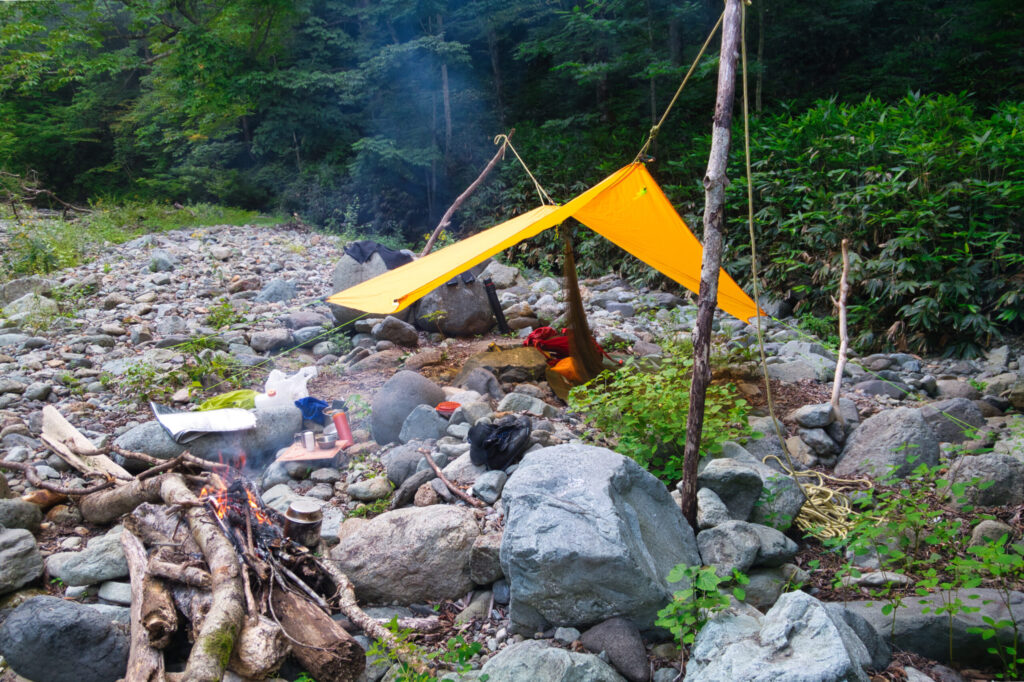
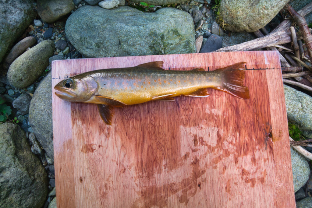
Once clear of the gorge, I broke out my fishing rod. The Iwana (Japanese char) were biting with almost reckless enthusiasm — lures and flies seemed nearly unnecessary. Fishing my way upstream through a broad, graveled section, with the hour turning favorable, I set up a bivouac at around 1,150 meters elevation. My “luxury hotel” for the night was a modest sleeping spot in the open. I prepared a bowl of Iwana tartare over rice and savored the raw fish — the undeniable privilege of the stream climber.
The second day began with riverbed walking. Before long, Kagitorizen appeared — a deep plunge pool (kama) followed by a sequence of smooth-slab waterfalls (namedaki). Wide, with considerable volume, they were genuinely impressive falls. A party travelling light might have found some of these climbable, but for me, alone and heavily burdened, a bypass (maki) was the only option.
Iwasugozen, Suribachizen, Heritorizen — I bypassed them one after another from the left bank. Every plunge pool held fish. I released the small ones and kept only the large. The water around the boulders was deep, and the Iwana were wary.
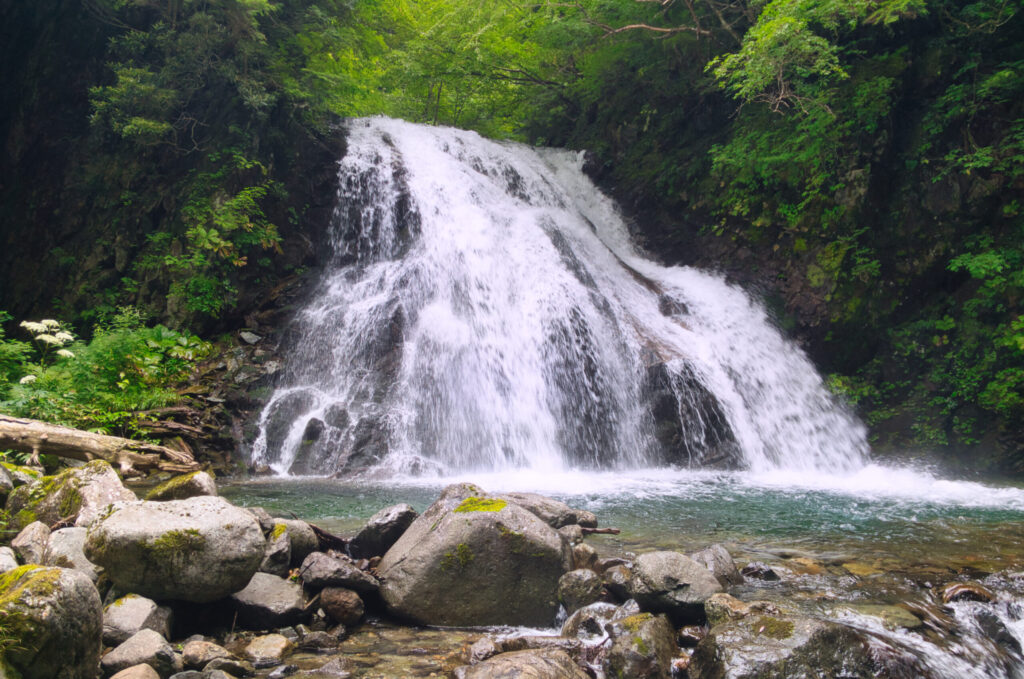
Then came Shōkurō-ōtaki, the great waterfall. The left margin of the water line looked potentially climbable, but I took a large Takamaki (high bypass) from the broken scree on the left bank instead, climbing well above the obstacle to reach safe ground. Beyond lay a massive Goro (boulder field) — the rocks so enormous I couldn’t follow the water line at all. I stumbled around, losing time to the labyrinth of stone.
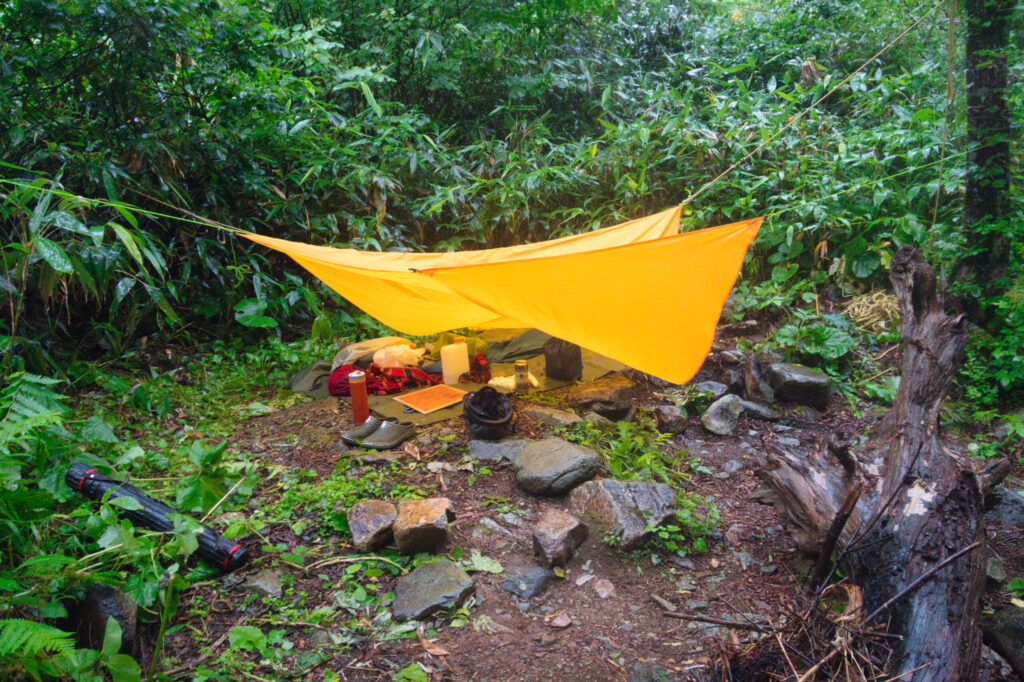
By past three in the afternoon I was hunting for a bivouac site, finding nothing suitable. I finally arrived around 4:30 PM at a spot approximately one kilometer below the confluence of Minami-no-sawa, at 1,620 meters elevation. I gathered firewood and struck a flame to warm my soaked body — and at that moment, the sky opened into a torrential downpour. The disappointment was crushing. I cooked on my gas stove instead. Anxious about the rising water level, sleep came slowly. Only a bowl of grilled Iwana over rice offered any consolation.
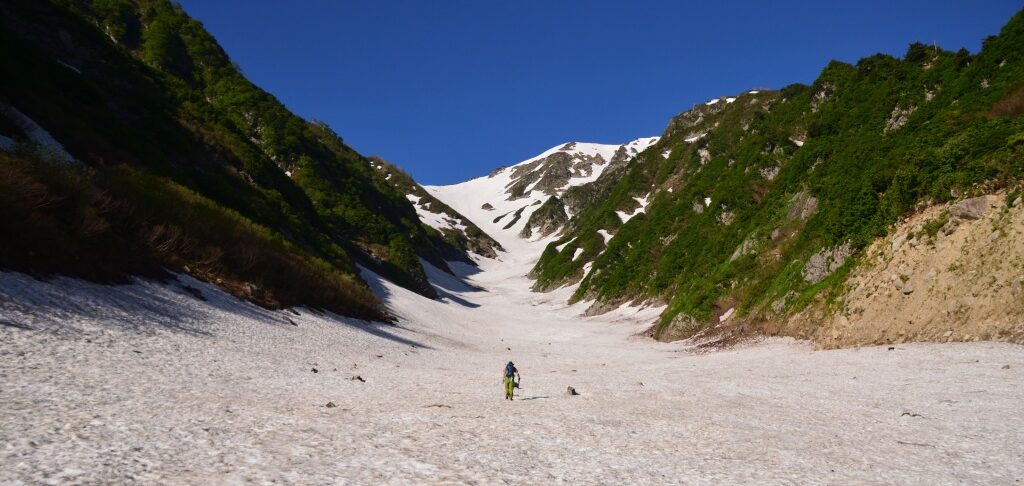
Day three arrived in rain — expected. A typhoon was approaching. The water had risen somewhat, but forward progress was possible. I cleared several more waterfalls and reached the confluence of Minami-no-sawa (Southern Stream). Here the flow divided one-to-one; the volume halved, and the character shifted from river to stream.
Fish were present as far as the first falls of Minami-no-sawa. I picked my way up a succession of two- and three-meter cascades. Even at the deepest points, the water reached only knee-height. Still, I had to gain nearly 2,000 meters of elevation through a combination of small waterfalls and Yabukogi (bushwhacking).
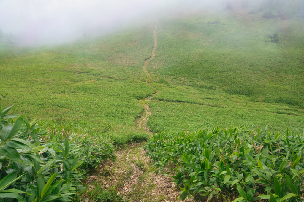
I reached the very first drop of the Uonogawa — the headwaters. Above it, only brush. The bushwhacking here bore the traces of a popular route: a faint track threaded through the thick bamboo grass, making the passage easier than expected. When I broke onto the ridgeline, a violent storm met me head-on. Visibility was nil. The trail was reclaimed by vegetation, but a trodden line remained. From around the Danzawa-no-kashira area, the brush had been cut back, but the fallen sasa lay heaped on the ground — less a trail than a slide. I wished I had skis.
Both the ascent and descent were steep and muddy. I fell more times than I care to count. Despite the cold of the storm, I consumed two liters of water. Had the weather been fine, the heat alone would have been genuinely dangerous. I had skipped breakfast and departed an hour ahead of schedule, yet arrived at Nozoriko an hour and a half behind plan.
The wind was too fierce to change clothes in the open. I used the restroom at the Nozoriko viewpoint and visitor center to get changed.
The Uonogawa main stream. Gorge after gorge, waterfall after waterfall, fish at every turn. After a brutal approach and a descent through a typhoon, I emerged from three days richer in ways that are hard to articulate. The beauty of the stream itself goes without saying. To say you could complete this ascent with nothing but a bag of rice might be an exaggeration — but the Iwana were, without question, plentiful.
The deep generosity of Oku-Shiga — I felt it with every inch of my body.
[LOG SUMMARY]