【Deep Dive Chronicle】Mt. Akadake: Ascending the Crown of the Yatsugatake Range
北村 智明
稜線ディープダイブ


In early March, I headed for Mt. Akamido-dake, which stands at the northern end of the Asahi Range, squarely facing Mt. Gassan. Our original plan fell through, so we entered from the north side of the Gassan Daiichi Tunnel. What followed was a twelve-hour backcountry ski tour over one gentle summit after another, from a blue-sky morning to a headlamp descent in the dusk. Mistletoe tangled in the brush, afternoon fog, and a snowfield sinking into darkness: this is a record of early spring on one of Japan’s classic backcountry ski routes.
We left Miyagi before dawn. Heading west on National Route 112, we drove into the folds of Mt. Gassan, the car alive with conversation. There were five of us, each having rearranged work to give this weekend to the mountains. Our minds were on snow and weather.
Mt. Akamido-dake (1,420m), at the northern end of the Asahi Range, is known as a classic backcountry ski route. The origin of its name is uncertain, but a local tale says a red temple hall (mido) once stood somewhere in these mountains, a name that echoes the old mountain worship of Mt. Gassan. Its appeal lies in gentle ridgelines, abundant snow, and an open descent running down from the summit.

The course we had originally planned was difficult to enter under the conditions. After talking it over among the five of us, we switched to an approach from the Gassan Daiichi Tunnel. The tunnel has two entrances, north and south, about three kilometers apart. For reasons I can’t quite explain, we chose the longer one: the north entrance.
It was hardly a rational decision. Three kilometers meant close to an hour of extra travel. But that is how mountain days go. Sometimes a choice that defies reason is what writes the story of the day. Perhaps the essence of the mountains lies somewhere in the irrational. With such thoughts, I stepped out of the car.

At 7:21 AM, we clipped into our skis and set off. The snowpack in early March was deep. I had heard that this winter brought record snowfall even to the Kantō region, and with snow continuing into March, it was said to be the snowiest season in twenty years. Mt. Gassan seemed to keep its old majesty: abundant snow filled the valleys and blanketed the slopes.

But the damp snow typical of this time of year soon got in our way. Snow balled up on our climbing skins, growing heavier with every step and steadily draining our strength. Sweat beaded on my forehead. It was March, yet the traces of winter were still strong.

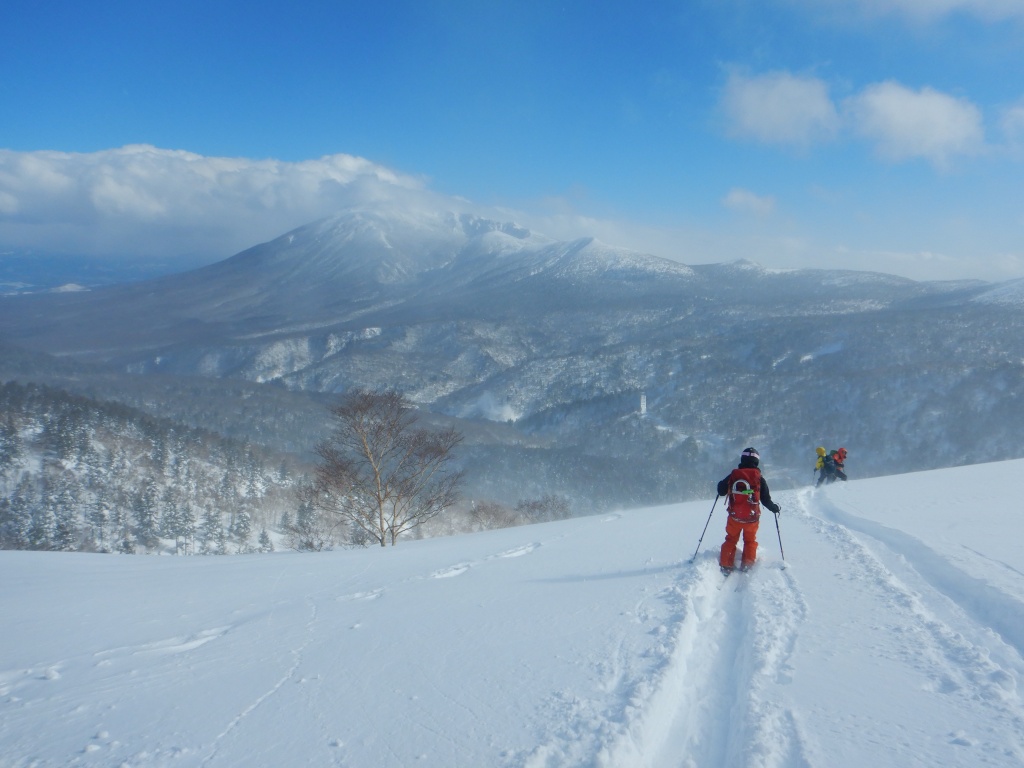
The morning was blessed with good weather. Blue sky opened overhead and the snow surface shone white. We passed through forest and climbed gentle slopes, and in the distance the form of Mt. Gassan came into view. Trees sheathed in rime ice glittered silver in the morning sun, standing with a stern dignity, as if frozen time itself had taken shape.
I suddenly remembered the voices in the news lamenting a warm winter and a shortage of snow. Climate change has long been a pressing concern, yet the Mt. Gassan before me boasted an overwhelming volume of snow, as if laughing at such human worries. No matter how precise our data and forecasts become, nature sometimes slips easily beyond our assumptions. Before this silver-white world, the yardsticks of human society felt far too frail.
Just after noon, we passed Nabemori, a gentle hill at 1,301m. From here, the ridge to Mt. Akamido-dake crosses a series of mild summits. Just as the contour lines on the topographic map drew soft curves, the terrain itself was undulating yet kind. Cross one hill and another appears. In this way we made our way across waves of snow.
Conversation among us was sparse. Each of us climbed silently at our own pace.
Past Kitazawa-yama, brush began to stand out, though never dense enough to block our way. We threaded between sparse shrubs, the sound of ski edges brushing branches ringing through the silence. It was then that I noticed how much mistletoe clung to the branches.
Yadorigi (Japanese mistletoe) lives on other trees, and in a winter-bare forest it has a presence all its own. Its yellow-green leaves form round clumps attached to the branches. Each time I looked up, another came into view, one after another, as if the whole forest were ruled by this hemiparasitic plant.

I had never seen so much mistletoe. I felt both the strength of life and something uncanny. Mistletoe depends on other trees, yet it photosynthesizes and lives on its own: a being on the border between independence and dependence. That way of existing stirred something philosophical in me.
In the afternoon, the weather turned. The blue sky gradually clouded over with fog, and visibility whitened and blurred. A view from the summit seemed unlikely. Still, we could not stop.

The primeval beech forest, smoldering in fog, had the profound serenity of a sumi-e ink painting I had wandered into. The outlines of the trees blurred and depth perception faded. Relying on the figure of my companion ahead, I kept climbing on skins in silence.

We crossed these great waves of snow one by one. The ridge draws a gentle arc and, from afar, looks like a calm ocean. But step onto it and countless subtle undulations appear, waves made by nature itself. Following the backs of those waves, sometimes sinking into the troughs between them, we aimed for the one tall crest.
At 2:30 PM, we finally stood on the summit of Mt. Akamido-dake. But the joy was brief. Fog flowing in from the west began to wrap around us. The climb back up to Mt. Ishimido-dake became the crux of the day.
Reaching Mt. Ishimido-dake took nearly another hour. Fatigue piled up and our steps grew heavy. Again and again, I scraped the snow from my skins.

At 4:22 PM, we arrived at the summit of Mt. Ishimido-dake. We were well behind schedule, and sunset was near. Even so, the relief of reaching our goal was real. All five of us stood on the summit. The long climb was finally over.
By the time we began the descent, the sun was already sinking. Even in March, dark comes early. A glance at my watch showed it was past 5:30 PM. By the time we reached Yadorigi-no-oka (Mistletoe Hill), the dense mistletoe zone between Mt. Akamido-dake and Mt. Ishimido-dake, it had grown dim.
Impatience crossed my mind, but haste is the enemy. I read the route carefully. Calling out to my companions, I skied down the slope, feeling the edges bite into the snow. There was still some visibility, but the darkness deepened by the moment.
Behind that impatience, however, a trap was waiting. It happened as we passed near Yadorigi-no-oka. The snow surface, which had looked flat, suddenly gave way beneath my feet.
“Ah!”
With a voiceless cry, my field of vision dropped a level. A hidden crevasse (a void beneath the snow), about one meter deep. A cavity concealed under the snow had swallowed one of my legs. I had landed awkwardly, and my skis were jammed into the snow at an unnatural angle, leaving me unable to free myself. Cold sweat ran down my back.
My companions rushed over at once. With clear instructions and a strong pull, they got me out and no harm was done. But if I had been alone… The thought brought home once more the fearsome nature of this mountain, and of winter mountains in general. The mountains never allow a moment’s lapse.
The mountain sank completely into darkness. We skied on by headlamp. The reach of the light was limited, and I could not tell what the slope beyond looked like. Over a snow surface whose bumps I could not see, I felt my way carefully with my skis.
Descending in darkness is a wholly different sensation from daytime. With sight taken away, hearing and touch sharpen. The scrape of edges on snow, the wind brushing my cheek, the subtle undulations transmitted through the soles of my feet: I relied on them all as I made my way down.
One step at a time, surely. If one of us fell, a search would be difficult. The five of us kept our distance, checking each other’s lights. In the dark, a companion’s headlamp was a reassurance.
At last we entered the forest, and soon the forest road came into view. Our headlamps lit up a road sign. The snowfield, sinking into dusk, began to glow with the cold blue-white sheen of sapphire.
At 7:27 PM, we arrived safely at the Ogoshigawa Bridge parking area on National Route 112. It had been a long day of more than twelve hours. With everyone confirmed safe, a deep relief wrapped around me. Fatigue flooded in all at once, but it was a pleasant kind of tiredness.
Back at the cars, we stowed our skis and looked back over the day together. Reflections and laughter rang out in the dark. Moments like these are the real pleasure of the mountains.
The overwhelming snow of the Gassan region, the gentle ridges rolling like an open sea, and those strange yet sturdy colonies of mistletoe. A day that began under blue sky had dissolved into dusk, and at the end, only the stars and our headlamps lit the world.
Morning light and night’s darkness. Those twelve hours, in which I took in both extremes with my whole body, went beyond a mere record. They were etched sharply and warmly into a deep place in my soul.
A rerouted plan that refused to go my way, sudden fog, and a darkness that could not be escaped. Only those who accept all of it and carve the snow one step at a time can find, in the cold air after the descent, a sense of fulfillment too deep for words.
If I looked back at the ridge receding behind us, even our ski tracks would have vanished into the dark by now. But inside me, those silver-white waves still roll in and out, quietly.
LOG SUMMARY
Map of the route “【Deep Dive Chronicle】Mt. Akamido-dake & Mt. Ishimido-dake Backcountry Ski: Twelve Hours Through the Mistletoe Forest”: 22,067 m, 1,267 m of climbing and 1,413 m of descent, elevation between 603 m and 1,443 m, time 12:06:41. It starts at 38.52433, 139.94972 and ends at 38.48126, 139.99198 (latitude, longitude).
GPS Data Disclaimer
The GPS data published in this article is a record of the day only. Please note the following:
Backcountry skiing is a world of personal responsibility. Put safety first, and enjoy the mountains.