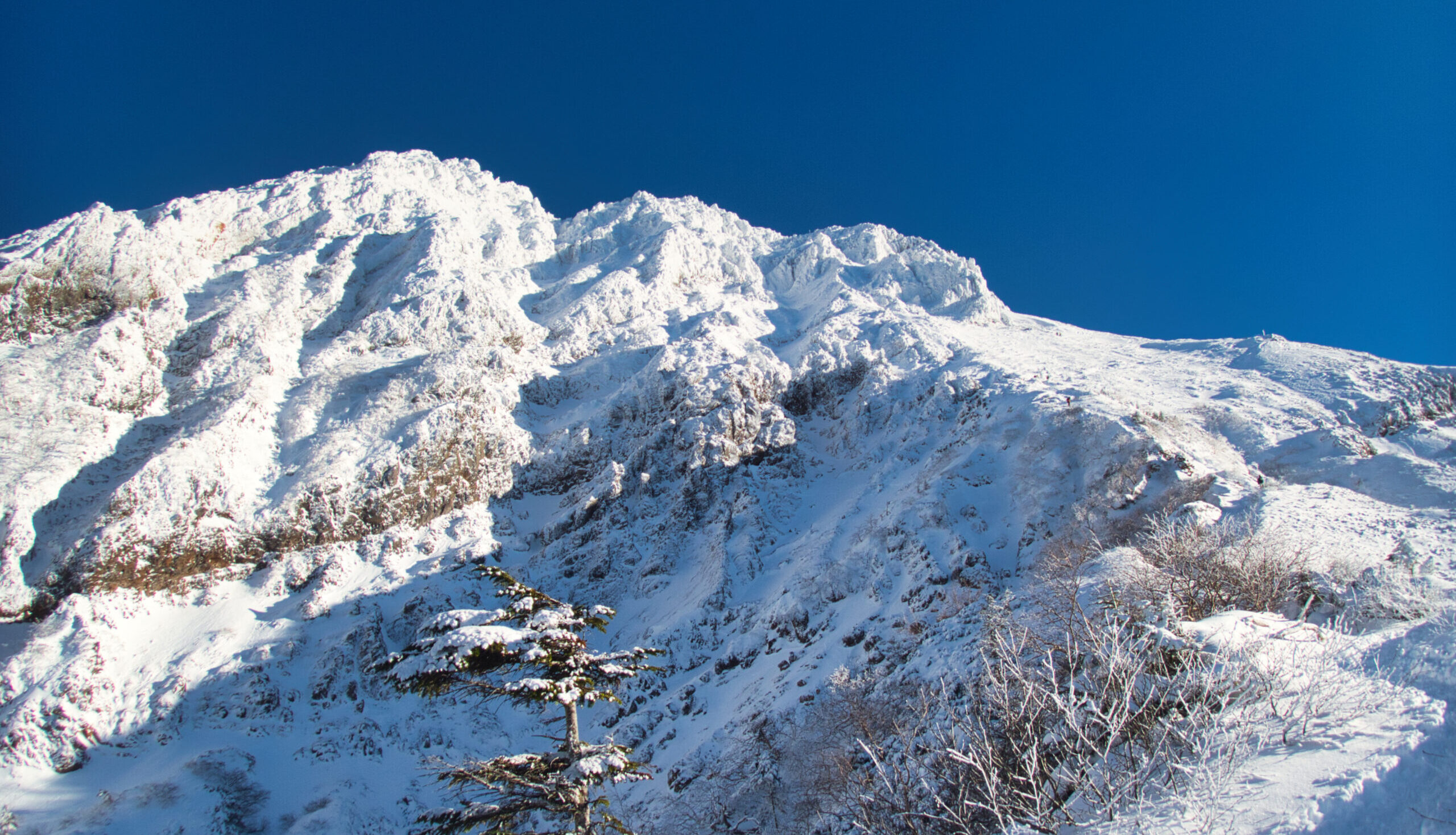
【Deep Dive Chronicle】Nikko-Shiranesan East Ridge — Tracing a Rock Ridge in Early Winter
北村 智明
稜線ディープダイブ


On the last day of a three-day holiday weekend, strong winds swept across Japan and shut many mountains to climbers. I drove south from Fukushima across the Kanto Plain toward Mt. Tsukuba-san. Its twin peaks, rising 877 meters, stood quietly in the winter sun: Mt. Nantai-san to the west, Mt. Nyotai-san to the east. This is a mountain that has drawn worshippers since ancient times, and its ridgeline is now busy with hikers. What follows is a record of a January outing.
From Fukushima I took the Ban-etsu Expressway and the Tohoku Expressway, then headed south on the Joban Expressway. The weekend’s strong winds had closed off mountains across the country. One planned outing after another had to be shelved, and on the morning of the final day of the long weekend, K, my partner for the day, suggested Mt. Tsukuba-san. It was modest in elevation and relatively sheltered from the wind, so we judged it a safe choice.
As we entered Tsukuba City, the twin peaks appeared abruptly in the middle of the Kanto Plain, conspicuous even from a distance. The light was dry and bright, a world apart from the deep-snow mountains of Fukushima.
Mt. Tsukuba-san. 877 meters. It is by no means a high mountain, but standing alone above the plain, it has a distinctive presence. With Mt. Nantai-san (871m) as its western peak and Mt. Nyotai-san (877m) as its eastern peak, the mountain has been an object of worship since ancient times. It is praised in the Manyoshu, Japan’s oldest poetry anthology, and is known as a famous mountain of Hitachi Province. Kyuya Fukada also included it among the 100 Famous Japanese Mountains (Nihon Hyakumeizan).
At 9:58 AM, I parked at a private lot near Tsukuba-san Bairin (Tsukuba Plum Grove). At this time of year the plum buds were still tightly closed. There were already many hikers on the road from the parking lot toward Tsukuba-san Shrine. It was the last day of the three-day weekend, and I was a little surprised to see so many people. It spoke to the mountain’s enduring popularity.

We passed through the torii gate of Tsukuba-san Shrine. The approach to the main hall is well maintained and lined with stone steps. In the precinct, the sales pitch of the Gama no Abura-uri (toad-oil sellers) rang out: “Sa, sa, otachiai” (“Step right up, gather round”). This traditional performance dates back to the Edo period, and many worshippers had stopped to listen to the practiced patter. It was fascinating to see such popular culture rooted in an atmosphere so solemn with the history of mountain worship.

We entered the mountain from the Shirakumobashi Trailhead. The trail was dry, with no snow or ice, which made for easy walking for mid-January. The air turned cool as we stepped into the trees. The wind was cold, but sunlight slanting through the forest was pleasant. We climbed through woods where evergreen broadleaf and deciduous trees mingle. The trail is well maintained and route-finding is not a concern, but many sections have protruding rocks and tree roots, so careful footing is necessary.
The Shirakumobashi Course leads from the Tsukuba-san Shrine side up to Mt. Nyotai-san. Compared with the Miyukigahara Course, which starts from Miyawaki Station (the cable car’s lower terminal), it is said to offer a more varied trail. Past Mukaeba Junction, we steadily gained elevation.

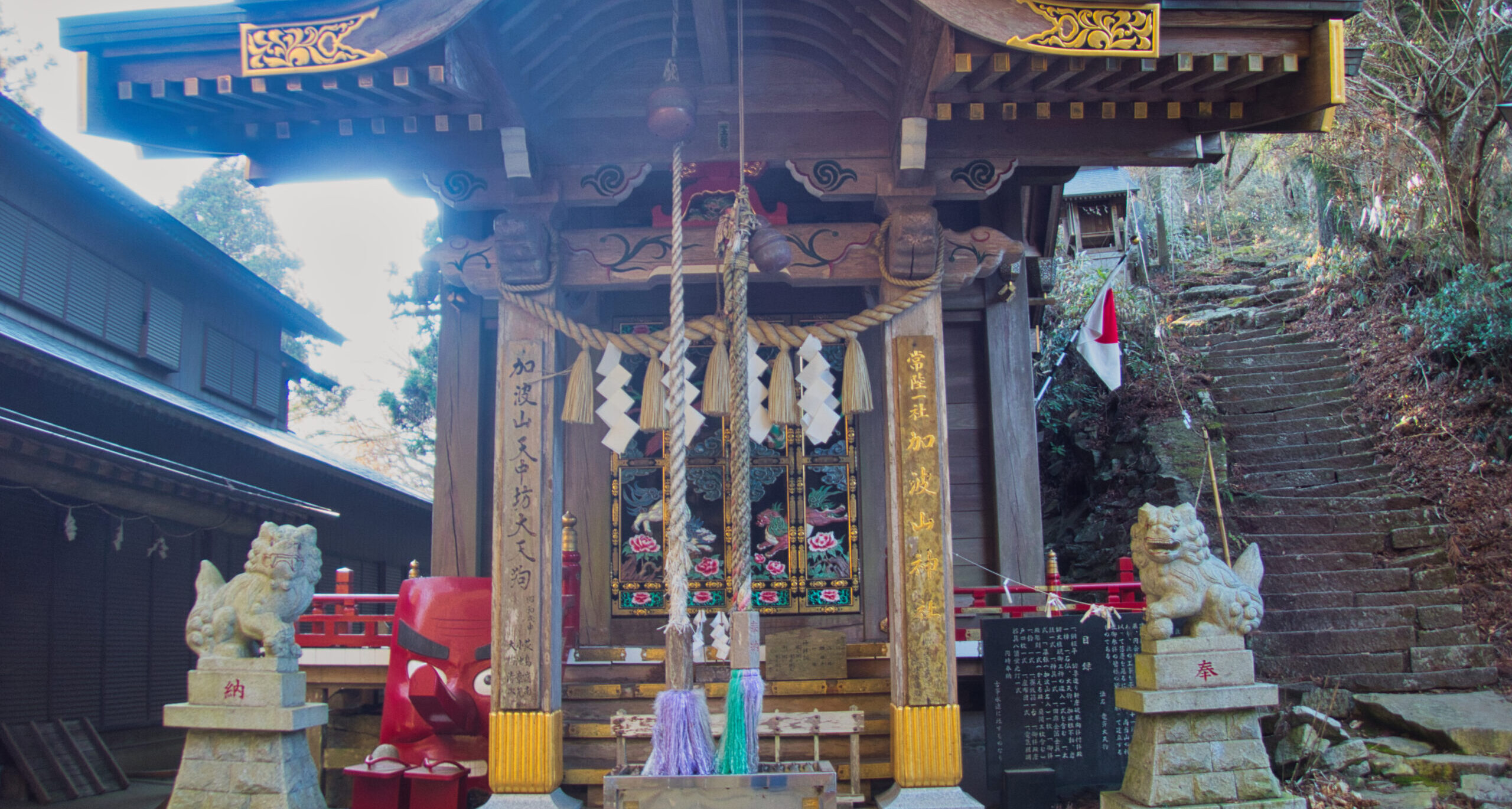
At 11:46 AM we reached Shirohebi Benten. A small shrine stands among the rocks, a sign that this has long been a place of worship. From here on, boulders become prominent. Huge granite blocks are scattered everywhere, a geological signature of Tsukuba-san. Plutonic rock that once lay buried beneath the strata forming the Kanto Plain has been exposed by uplift and erosion, or so it is said. It is evidence of magma that formed 60 million years ago and slowly surfaced over the ages.
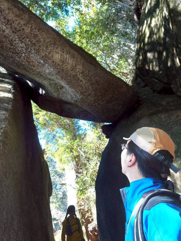
We passed a rest area called Benkei Hut, a modern building in the style of a mountain hut. Farther on, we came to a spot called Benkei Nanamodori (roughly “Benkei’s Seven Retreats”). A huge rock juts out over the trail as if about to fall on us. The legend that even the mighty warrior-monk Benkei recoiled here makes perfect sense in front of this imposing mass. We ducked beneath the rock and moved on.
The stream of hikers never let up. I had expected holiday crowds, but not like this. People passed us and we passed others, each enjoying the mountain at their own pace. Families, groups of young people, solo hikers in middle age and beyond. Such variety speaks to the depth of this mountain.

At 12:22 PM we reached the summit of Mt. Nyotai-san. 877 meters, the highest point of Tsukuba-san. The summit is bare rock and the footing is somewhat unstable, so I took each step with care.

The view from the summit of Mt. Nyotai-san was superb. Blessed with a clear winter sky, we could see Mt. Fuji standing white in the distance. The entire Kanto Plain spread out below us, and the surface of Lake Kasumigaura glittered. The wind, however, was strong. On the summit, a cold gale pressed against us relentlessly. At that moment, my hat was blown off my head. I reached out on instinct but was too late. It danced through the air and tumbled down the rocks. Fortunately, a fellow hiker nearby picked it up. I thanked them, and the wind’s strength sank in all over again.
We set off toward Miyukigahara, leaving the summit and descending via Sekirei Chaya (a tea house). Just past the giant cedar known as Shiho-sugi, we emerged onto Miyukigahara.

Miyukigahara is a wide, flat area that holds the cable car’s Tsukuba-san Summit Station, the ropeway boarding station, and a row of tea houses. The clamor of tourists and hikers mingling stopped me in my tracks for a moment. Against the steep rock just below the summit, the contrast with this bustle made me tighten my focus once more.

In one corner I noticed a new café with a stylish exterior. Peering inside, I saw tenugui (Japanese cotton hand towels) and T-shirts in modern designs on display, refined goods themed on Tsukuba-san. Again I found it fascinating that this new culture had taken root in a place of traditional mountain worship.

Next, we headed for Mt. Nantai-san. At 1:53 PM we reached its summit at 871 meters, slightly lower than Nyotai-san. This summit is also bare rock, and it enshrines the inner shrine (okumiya) of the Tsukuba-san Shrine main hall.
We returned to Miyukigahara and had lunch there, resting our chilled bodies.
For the descent we chose the Miyukigahara Course, which follows the headwaters of the Minano-gawa. We took a short break at the Minano-gawa information board, then continued down. It was a gentle path through forest. At 3:50 PM we reached the azumaya (gazebo-style rest shelter) at Nakanochaya-ato, the site of the former Nakanochaya tea house. Miyawaki Station is close from here.

At 4:11 PM we were back at Tsukuba-san Shrine. The grounds were still crowded with worshippers. We pressed our hands together at the main hall and gave thanks for a safe descent. From a stall along the approach, I bought a cream-filled obanyaki (a hot griddle cake). It was warm, and its sweetness seeped into my chilled body. We passed the bus stop at the shrine entrance and made our way back to the parking lot, arriving at 4:22 PM. The outing took 6 hours 24 minutes of activity time.

Mt. Tsukuba-san is a renowned peak rising from the Kanto Plain. Its elevation is modest, but it has a long history of drawing worshippers and of being loved by many people. Its appeal is undiminished today. If anything, new culture layered onto the old seems to have added still more depth. Walking the mountain among so many other hikers on a clear winter day made for a fulfilling time.
LOG SUMMARY
The GPS data published with this article is a record of the day only. Please note the following: